
-
MODIS/Aqua Calibrated Radiances 250m 5-Min L1B Wide Swath Subset along CloudSat V002 (MAC02QS1) at GES DISC NGDA recent views
This is the wide-swath MODIS/Aqua subset along CloudSat field of view track. The goal of the wide-swath subset is to select and return MODIS data that are within +-100 km across... -
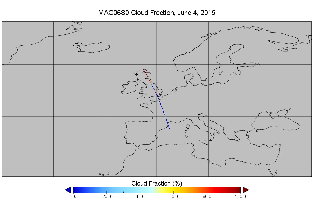
MODIS/Aqua Clouds 1km and 5km 5-Min L2 Narrow Swath Subset along CloudSat V002 (MAC06S0) at GES DISC NGDA recent views
This is the narrow-swath MODIS/Aqua subset along CloudSat field of view track. The goal of the narrow-swath subset is to select and return MODIS data that are within +-5 km... -
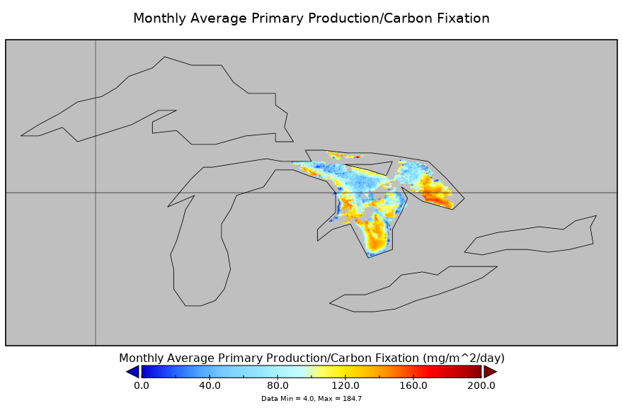
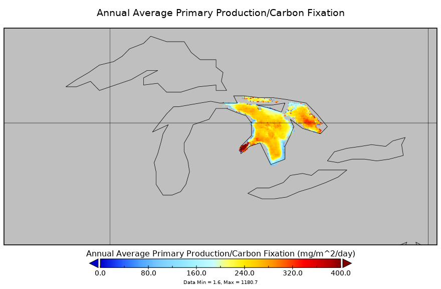
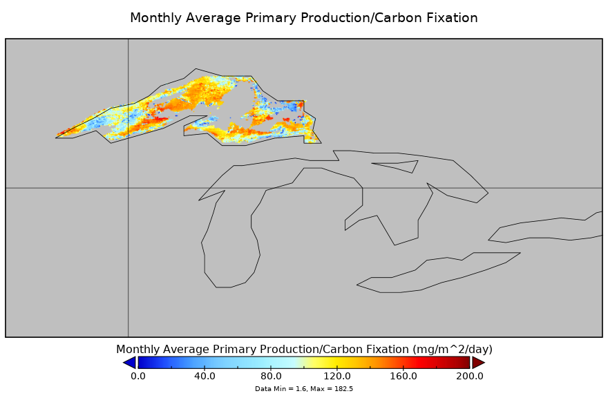
Carbon Monitoring System Lake Huron Primary Production Monthly V1 (CMSLakeHuronPPM) at GES DISC NGDA recent views
Monthly Average primary production/carbon fixation data for Lake Huron. The primary production data is derived using MODIS imagery with model data. The NASA Carbon Monitoring... -
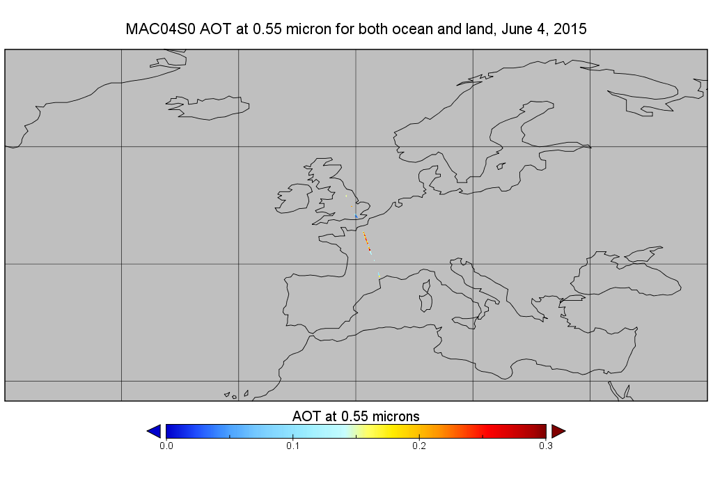
MODIS/Aqua Aerosol 10km 5-Min L2 Narrow Swath Subset along CloudSat V002 (MAC04S0) at GES DISC NGDA recent views
This is the narrow-swath MODIS/Aqua subset along CloudSat field of view track. The goal of the narrow-swath subset is to select and return MODIS data that are within +-5 km... -
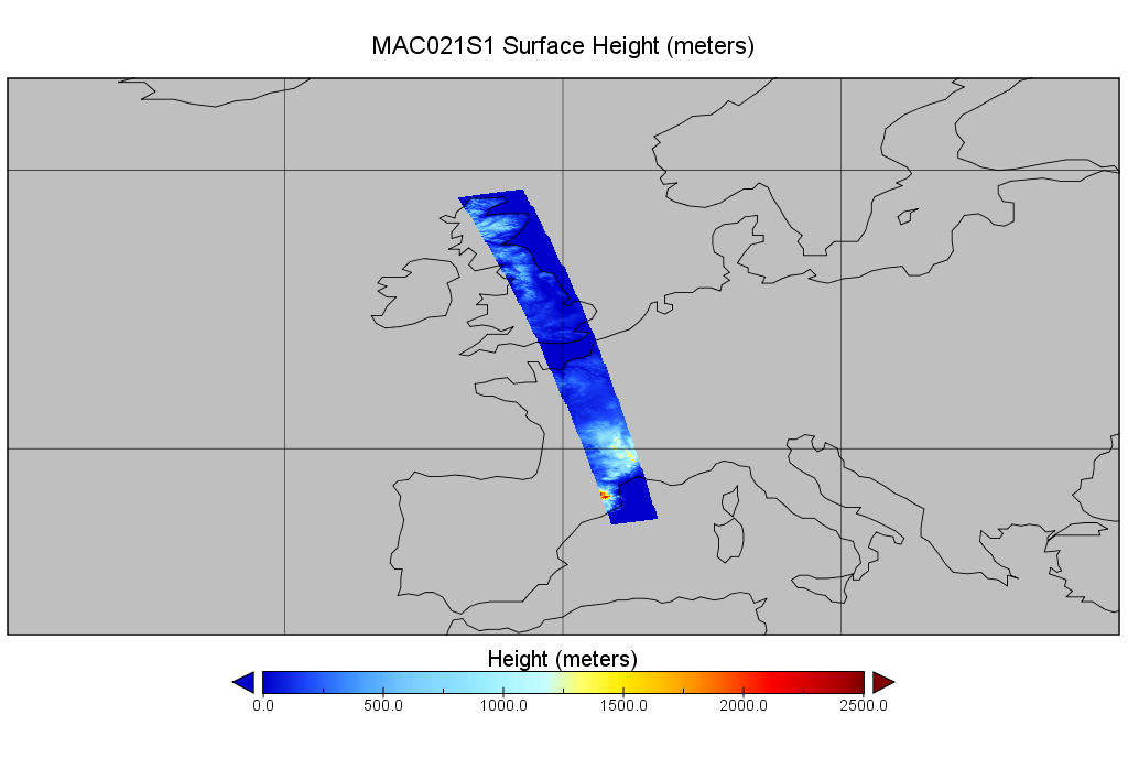
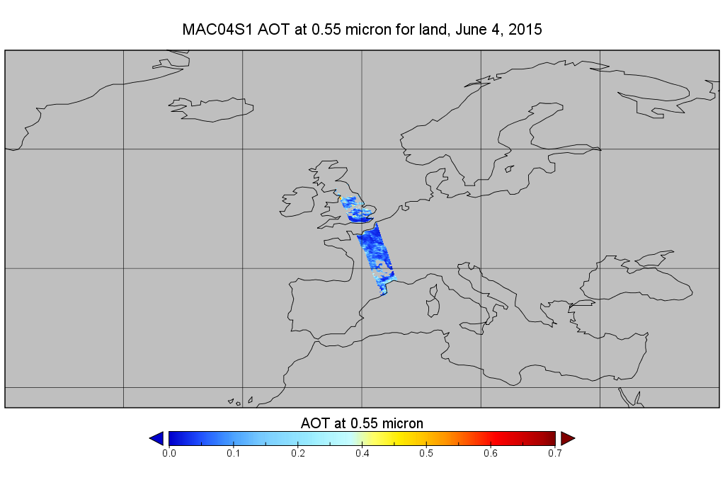
MODIS/Aqua Aerosol 10km 5-Min L2 Wide Swath Subset along CloudSat V002 (MAC04S1) at GES DISC NGDA recent views
This is the wide-swath MODIS/Aqua subset along CloudSat field of view track. The goal of the wide-swath subset is to select and return MODIS data that are within +-100 km across... -
OMI/Aura and MODIS/Aqua Merged Cloud Product 1-Orbit L2 Swath 13x24 km V003 (OMMYDCLD) at GES DISC NGDA recent views
The OMI/Aura and MODIS/Aqua Merged Cloud Product 1-Orbit L2 Swath 13x24 km (OMMYDCLD) is a Level-2 orbital product that combines cloud parameters retrieved by the Ozone Mapping... -
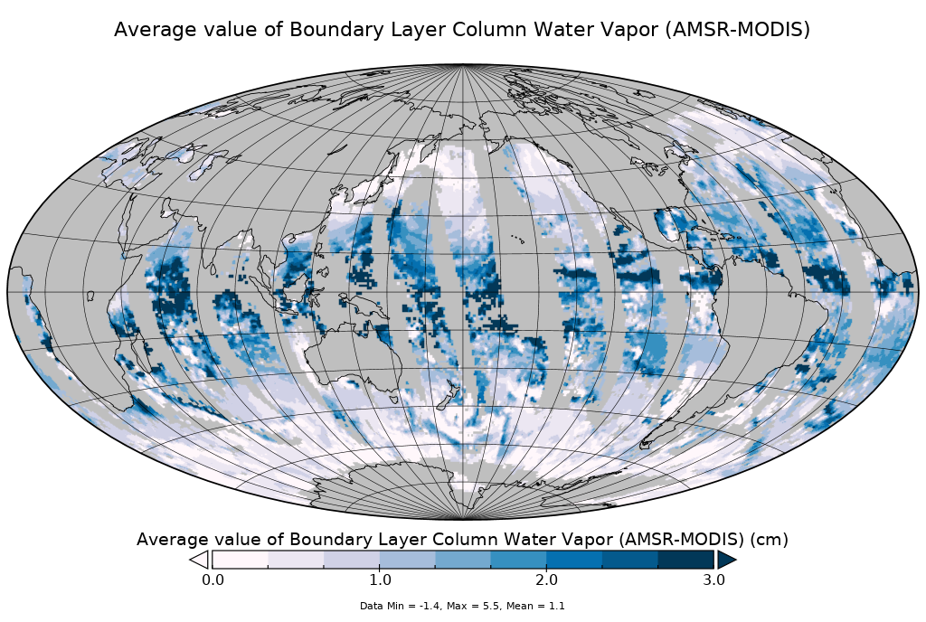
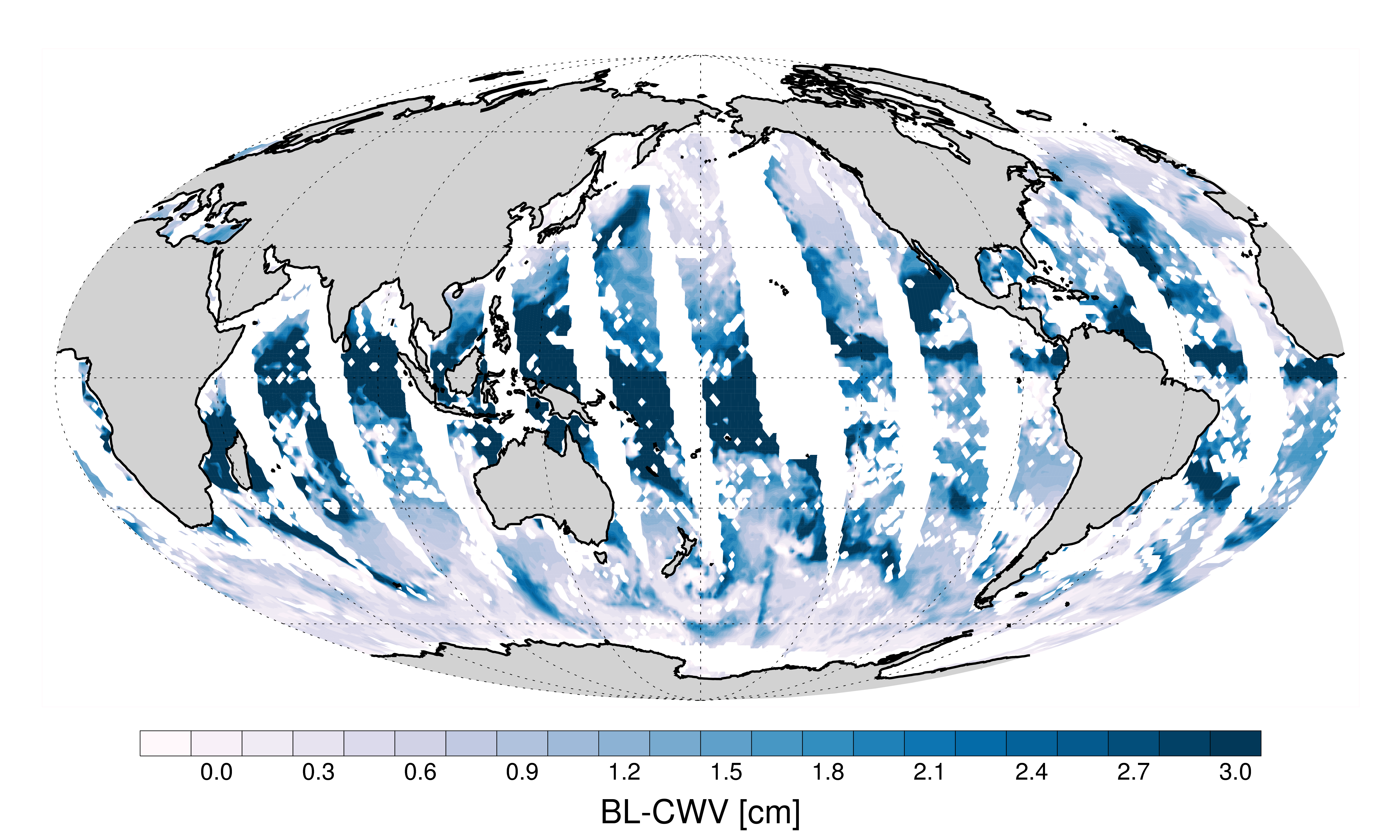
AMSR-MODIS Boundary Layer Water Vapor L3 Monthly 1 degree x 1 degree V1 (AMMBLWV) at GES DISC NGDA recent views
This data set provides an estimate the marine boundary layer water vapor beneath uniform cloud fields. Microwave radiometry from AMSR-E and AMSR-2 provides the total column... -
Carbon Monitoring System Lake Huron Primary Production Yearly V1 (CMSLakeHuronPPY) at GES DISC NGDA recent views
Yearly Average primary production/carbon fixation data for Lake Huron. The primary production data is derived using MODIS imagery with model data. The NASA Carbon Monitoring... -
MODIS/Aqua Monthly mean Night-Time Land Surface Temperature at 1x1 degree V005 (MYD11CM1N) at GES DISC NGDA recent views
The dataset contains global monthly night-time land surface temperature averaged within 1 by 1 degree grid cells. The source for the data is MODIS/Aqua MYD11C3 Collection 005... -
MODIS Aqua L2 chopped blocks (block size: 128 pixels x 128 pixels, daytime) V001 (MYD_L2_CB) at GES DISC NGDA recent views
This product is composed of a beta version for a product from the MODerate resolution Imaging Spectrometer (MODIS) on board the Aqua satellite. MODIS Aqua L2 chopped blocks (CB)... -
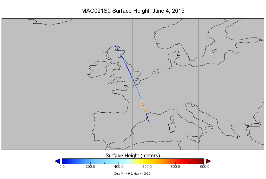
MODIS/Aqua Calibrated Radiances 250m 5-Min L1B Narrow Swath Subset along CloudSat V002 (MAC02QS0) at GES DISC NGDA recent views
This is the narrow-swath MODIS/Aqua subset along CloudSat field of view track. The goal of the narrow-swath subset is to select and return MODIS data that are within +-5 km... -
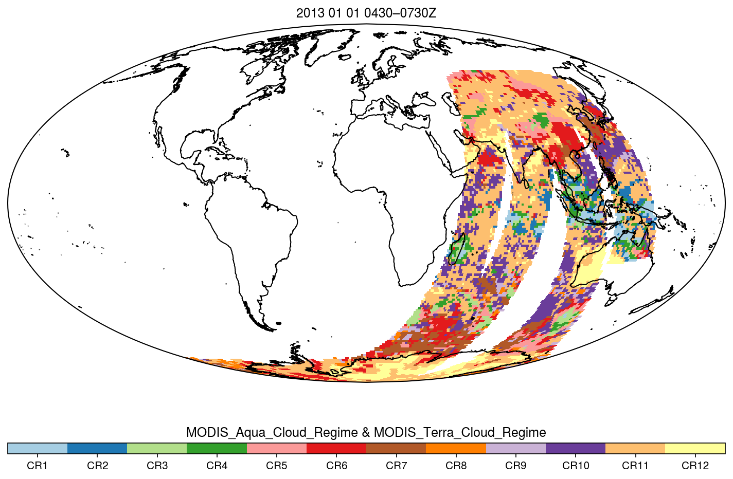
MODIS_CR_Equal_Angle_3h NGDA recent views
The MODIS Collection 6.1 Equal-Angle Three-Hourly Cloud Regime product. This product is a discrete classification of cloud fields at the mesoscale as observed by the MODIS... -
AMSR-MODIS Boundary Layer Water Vapor L3 Daily 1 degree x 1 degree V2 (AMDBLWV) at GES DISC NGDA recent views
Version 2 is the current version of this dataset. Version 2 uses an improved methodology to screen out high clouds. This data set provides an estimate the marine boundary layer... -
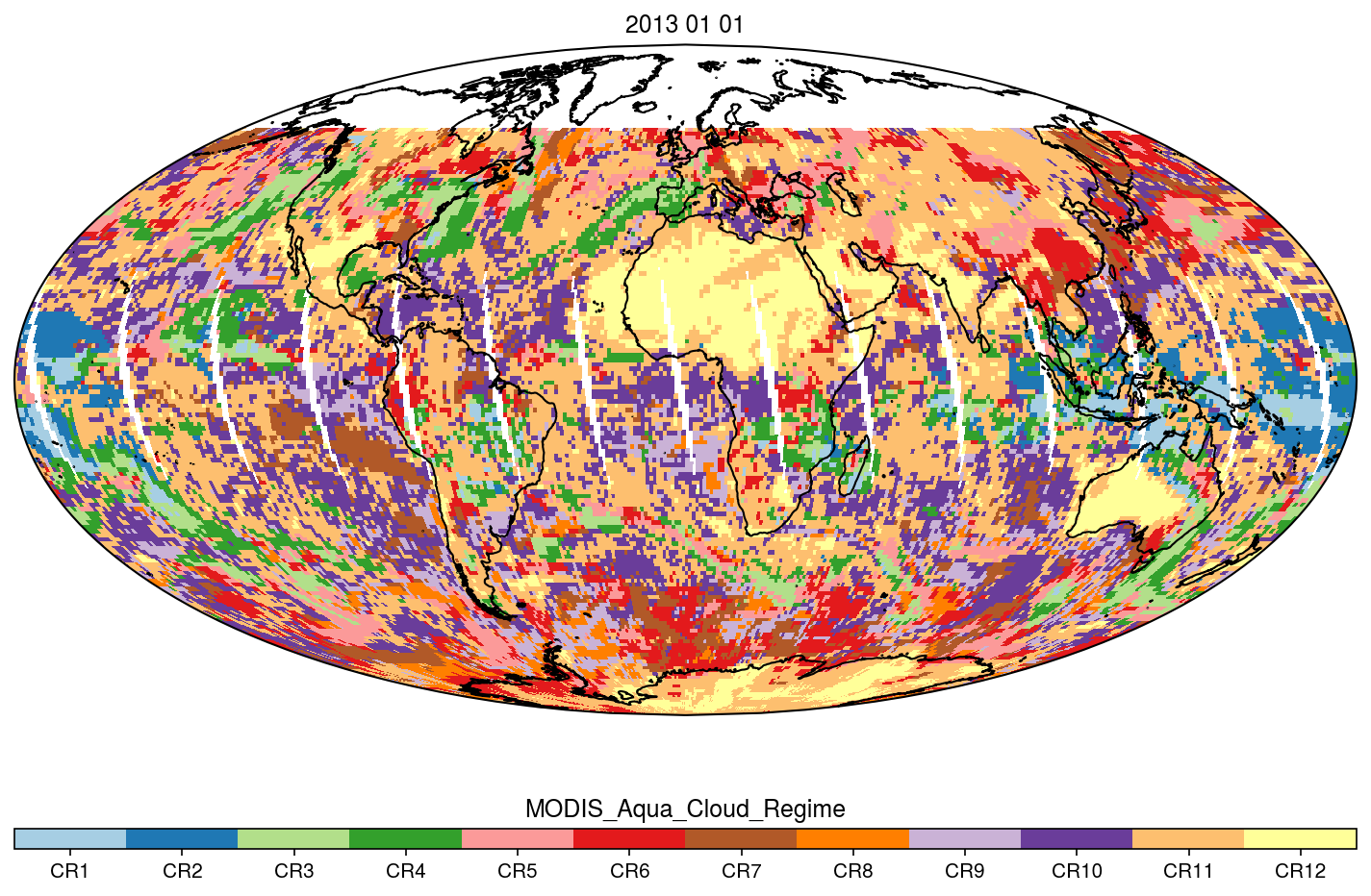
MODIS_CR_Equal_Angle_Daily NGDA recent views
The MODIS Collection 6.1 Equal-Angle Three-Hourly Cloud Regime product. This product is a discrete classification of cloud fields at the mesoscale as observed by the MODIS... -
MODIS/Aqua Clouds 1km and 5km 5-Min L2 Wide Swath Subset along CloudSat V002 (MAC06S1) at GES DISC NGDA recent views
This is the wide-swath MODIS/Aqua subset along CloudSat field of view track. The goal of the wide-swath subset is to select and return MODIS data that are within +-100 km across... -
MODIS/Terra Monthly mean Day-Time Land Surface Temperature at 1x1 degree V005 (MOD11CM1D) at GES DISC NGDA recent views
The dataset contains global monthly day-time land surface temperature averaged within 1 by 1 degree grid cells. The source for the data is MODIS/Terra MOD11C3 Collection 005... -
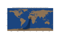
Aqua AIRS-MODIS Matchup Indexes V1.0 (AIRS_MDS_IND) at GES_DISC NGDA recent views
This is Aqua AIRS-MODIS collocation indexes, in netCDF-4 format. These data map AIRS profile indexes to those of MODIS. The basic task is to bring together retrievals of water... -
AMSR-MODIS Boundary Layer Water Vapor L3 Daily 1 degree x 1 degree V1 (AMDBLWV) at GES DISC NGDA recent views
This data set provides an estimate the marine boundary layer water vapor beneath uniform cloud fields. Microwave radiometry from AMSR-E and AMSR-2 provides the total column... -
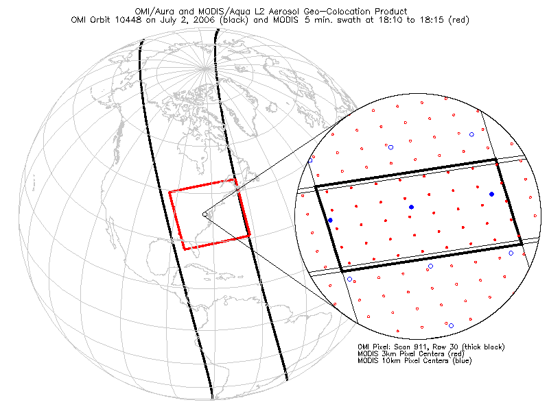
OMI/Aura and MODIS/Aqua Aerosol Geo-colocation Product 1-Orbit L2 Swath 13x24 km V003 (OMMYDAGEO) at GES DISC NGDA recent views
The OMI/Aura and MODIS/Aqua Aerosol Geo-colocation Product 1-Orbit L2 Swath 13x24 km (OMMYDAGEO) is a Level-2 orbital data product that links the MODIS/Aqua aerosol geo-... -
Carbon Monitoring System Lake Superior Primary Production Monthly V1 (CMSLakeSuperiorPPM) at GES DISC NGDA recent views
Monthly Average primary production/carbon fixation data for Lake Superior. The primary production data is derived using MODIS imagery with model data. The NASA Carbon Monitoring...

Official websites use .gov
A
.gov website belongs to an official government
organization in the United States.
Secure .gov websites use HTTPS
A
lock (
) or https:// means you’ve safely connected to
the .gov website. Share sensitive information only on official,
secure websites.