
-
MODIS/Terra+Aqua BRDF Model Parameters Daily L3 Global 1km SIN Grid V061 NGDA
The MCD19A3D Version 6.1 data product is a Moderate Resolution Imaging Spectroradiometer (MODIS) Terra and Aqua combined Bidirectional Reflectance Distribution Function (BRDF)... -
Vegetation Index and Phenology (VIP) Vegetation Indices 15Days Global 0.05Deg CMG V004 NGDA
The NASA Making Earth System Data Records for Use in Research Environments (MEaSUREs) (https://earthdata.nasa.gov/community/community-data-system-programs/measures-projects)... -
Vegetation Index and Phenology (VIP) Vegetation Indices Daily Global 0.05Deg CMG V004 NGDA
The NASA Making Earth System Data Records for Use in Research Environments (MEaSUREs) (https://earthdata.nasa.gov/community/community-data-system-programs/measures-projects)... -
Vegetation Index and Phenology (VIP) Phenology NDVI Yearly Global 0.05Deg CMG V004 NGDA
The NASA Making Earth System Data Records for Use in Research Environments (MEaSUREs) (https://earthdata.nasa.gov/community/community-data-system-programs/measures-projects)... -
Vegetation Index and Phenology (VIP) Vegetation Indices Monthly Global 0.05Deg CMG V004 NGDA
The NASA Making Earth System Data Records for Use in Research Environments (MEaSUREs) (https://earthdata.nasa.gov/community/community-data-system-programs/measures-projects)... -
Vegetation Index and Phenology (VIP) Vegetation Indices 7Days Global 0.05Deg CMG V004 NGDA
The NASA Making Earth System Data Records for Use in Research Environments (MEaSUREs) (https://earthdata.nasa.gov/community/community-data-system-programs/measures-projects)... -
Vegetation Index and Phenology (VIP) Phenology EVI-2 Yearly Global 0.05Deg CMG V004 NGDA
The NASA Making Earth System Data Records for Use in Research Environments (MEaSUREs) (https://earthdata.nasa.gov/community/community-data-system-programs/measures-projects)... -
ECOSTRESS Gridded Downscaled Soil Moisture Instantaneous L3 Global 70 m V002
The ECOsystem Spaceborne Thermal Radiometer Experiment on Space Station (ECOSTRESS) mission measures the temperature of plants to better understand how much water plants need... -
ECOSTRESS Tiled Downscaled Soil Moisture Instantaneous L3 Global 70 m V002
The ECOsystem Spaceborne Thermal Radiometer Experiment on Space Station (ECOSTRESS) mission measures the temperature of plants to better understand how much water plants need... -
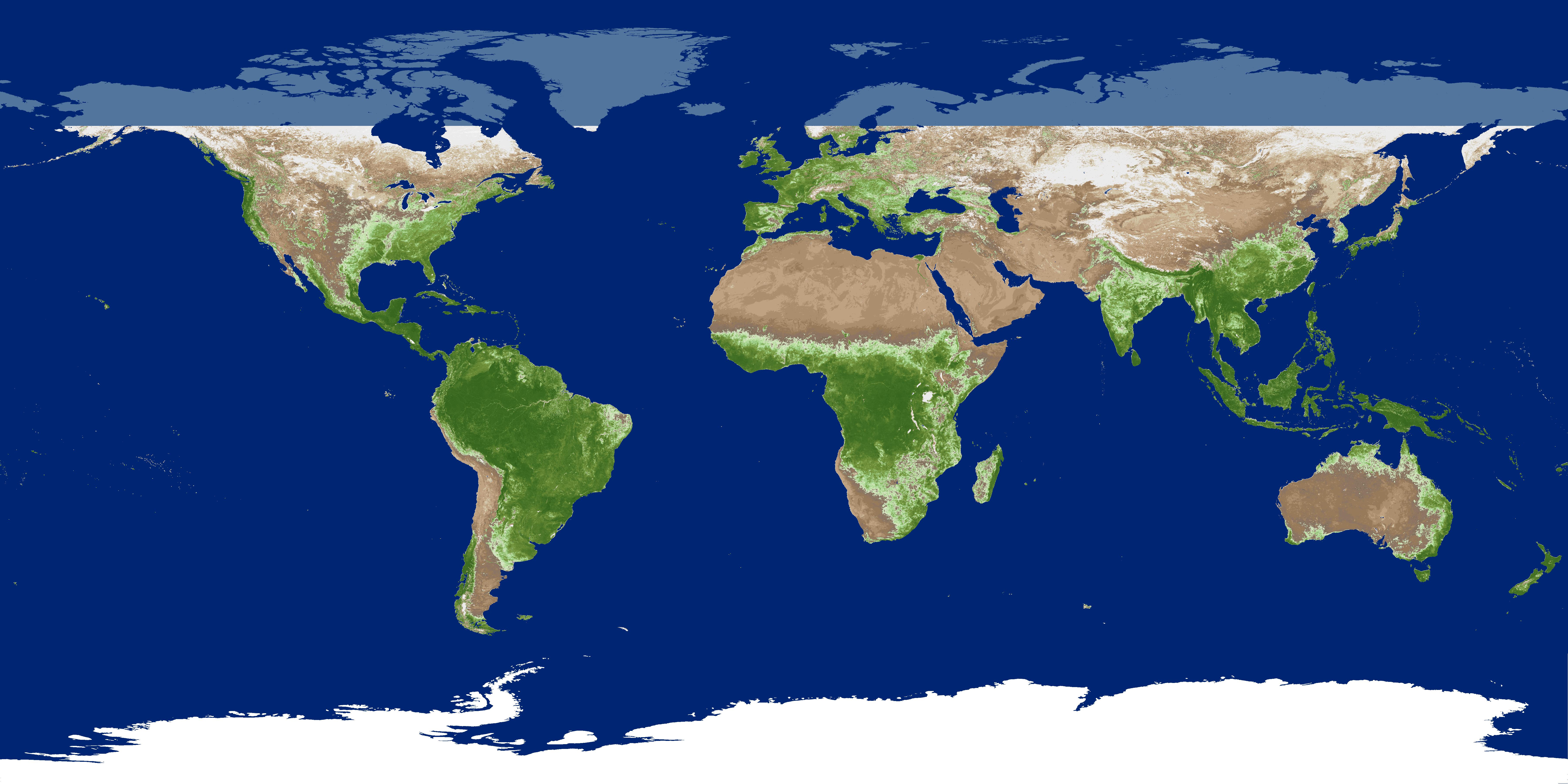
Global Land Cover Mapping and Estimation Yearly 30 m V001
NASA’s Making Earth System Data Records for Use in Research Environments (MEaSUREs) Global Land Cover Mapping and Estimation (GLanCE) annual 30 meter (m) Version 1 data product...

Official websites use .gov
A
.gov website belongs to an official government
organization in the United States.
Secure .gov websites use HTTPS
A
lock (
) or https:// means you’ve safely connected to
the .gov website. Share sensitive information only on official,
secure websites.