
-
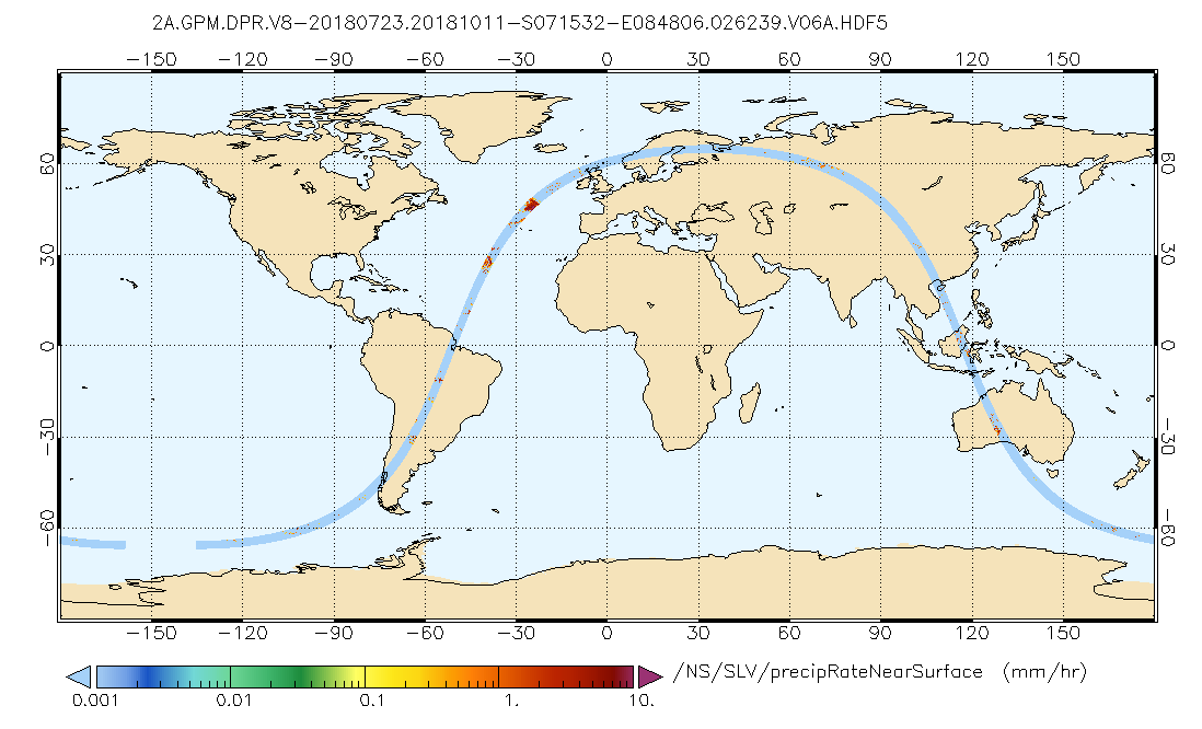
GPM DPR Precipitation Profile L2A 1.5 hours 5 km V07 (GPM_2ADPR) at GES DISC recent views
Version 07 is the current version of the data set. Older versions will no longer be available and have been superseded by Version 07. . 2ADPR provides single- and dual-... -
BOREAS Landsat TM Level-3s Imagery: Scaled At-Sensor Radiance in LGSOWG Format recent views
For BOREAS, the level-3s Landsat TM data, along with the other remotely sensed images, were collected in order to provide spatially extensive information over the primary study... -
SAFARI 2000 ER-2 Color-IR Aerial Photography, Dry Season 2000 recent views
Aerial photography from the NASA ER-2 high-altitude aircraft was collected to provide detailed and spatially extensive documentation over parts of the SAFARI study area. The... -
Global Distribution of Root Turnover in Terrestrial Ecosystems recent views
Estimates of root turnover rates were calculated from measurements of live root standing crop and belowground net primary production (BNPP) compiled from the primary literature.... -
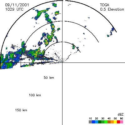
CAMEX-4 TOGA RADAR V1 recent views
The TOGA radar dataset consists of browse and radar data collected from the TOGA radar during the CAMEX-4 experiment. TOGA is a C-band linear polarized doppler radar using 500KW... -
SAFARI 2000 Landscape Photographs of Kalahari Transect, Mongu, Skukuza Sites recent views
This data set contains Global Positioning System (GPS) imprinted landscape photographs at 100-m intervals along the Large Grid Transects at Kalahari Transect sites in Botswana... -
SAFARI 2000 Fire Emission Data, Dry Season 2000 recent views
As part of the SAFARI 2000), the University of Montana participated in both ground-based and airborne campaigns during the southern African dry season of 2000 to measure trace... -
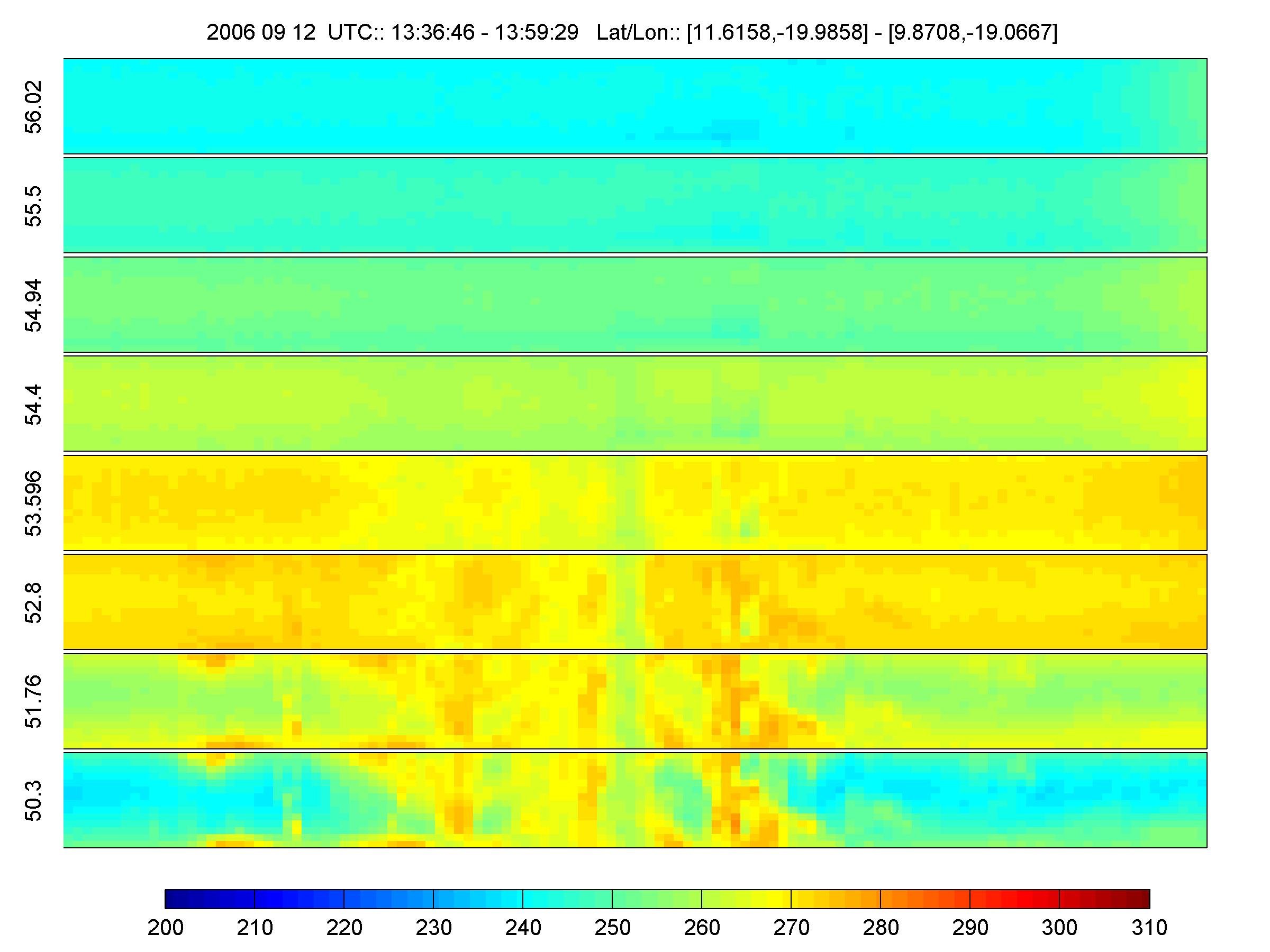
NAMMA HIGH ALTITUDE MMIC SOUNDING RADIOMETER (HAMSR) V1 recent views
The NAMMA High Altitude MMIC Sounding Radiometer (HAMSR) dataset consists of data collected by HAMSR, which is a 25-channel microwave atmospheric sounder operating as a cross-...

Official websites use .gov
A
.gov website belongs to an official government
organization in the United States.
Secure .gov websites use HTTPS
A
lock (
) or https:// means you’ve safely connected to
the .gov website. Share sensitive information only on official,
secure websites.