
-
CERES Energy Balanced and Filled (EBAF) TOA and Surface Monthly means data in netCDF Edition 4.2 recent views
CERES_EBAF_Edition4.2 is the Clouds and the Earth's Radiant Energy System (CERES) Energy Balanced and Filled (EBAF) Top-of-Atmosphere (TOA) and surface monthly means data in... -
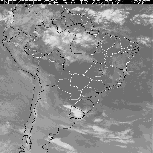
LBA-ECO CD-01 Meteorological Data, Tapajos and Amazon Rivers, Santarem, Brazil: 2001 recent views
This data set contains meteorological data collected around the confluence of the Tapajos River with the Amazon River in the Amazon Basin near Santarem, Brazil, in July and... -
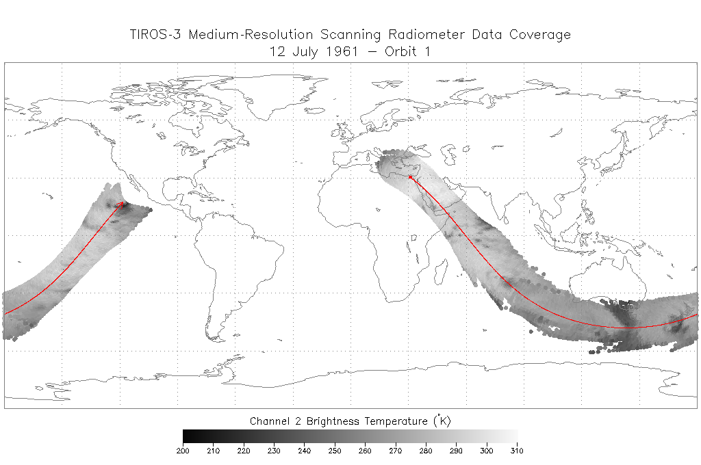
TIROS-3 Medium-Resolution Scanning Radiometer Level 1 Final Meteorological Radiation Data V001 (TIROS3L1FMRT) at GES DISC recent views
TIROS-3 Medium-Resolution Scanning Radiometer Level 1 Final Meteorological Radiation Data (FMRT) product contains radiances expressed in five infrared/visible wavelength... -
High Resolution Empirical Tide Prediction Software Version 14 recent views
This dataset provides sea surface height and ocean surface currents associated with the predictable astronomical tide at the M2, S2, N2, K1, and O1 frequencies. The tidal... -
SAFARI 2000 Global Burned Area Map, 1-km, Southern Africa, 2000 recent views
The Global Burned Area 2000 initiative (GBA2000) was launched by the Global Vegetation Mapping Unit of the Joint Research Centre of the European Commission, in partnership with... -
CARVE: L2 Column Gas and Uncertainty from Airborne FTS, Alaska, 2012-2015 recent views
This data set provides total vertical column O2, CO2, CH4, CO, and H2O, as well as dry-air columns of CO2, CH4, CO, and H2O from airborne campaigns over the Alaskan and Canadian... -
Pre-ABoVE: Active Layer Thickness and Soil Water Content, Barrow, Alaska, 2013 recent views
This data set provides estimates of Active Layer Thickness (ALT) determined with ground-based measurements, and calculated soil volumetric water content (VWC) at four selected... -
Soil Moisture Profiles and Temperature Data from SoilSCAPE Sites, USA recent views
This data set contains in-situ soil moisture profile and soil temperature data collected at 20-minute intervals at SoilSCAPE (Soil moisture Sensing Controller and oPtimal... -
BigFoot Field Data for North American Sites, 1999-2003 recent views
The BigFoot project gathered field data for selected EOS Land Validation Sites in North America from 1999 to 2003. Data collected and derived for varying intervals at the... -
Soil Organic Carbon Stock Estimates with Uncertainty across Latin America recent views
This dataset provides 5 x 5 km gridded estimates of soil organic carbon (SOC) across Latin America that were derived from existing point soil characterization data and compiled... -
NACP MCI: CO2 Flux from Inversion Modeling, Upper Midwest Region, USA, 2007 recent views
This data set provides estimates of Net Ecosystem Exchange (NEE) flux for the U.S. Upper Midwest at 0.5-degree resolution for the year 2007. Estimates were produced by two... -
ABoVE: Atmospheric Gas Concentrations from Airborne Flasks, Arctic-CAP, 2017 recent views
This dataset provides atmospheric carbon dioxide (CO2), methane (CH4), carbon monoxide (CO), molecular hydrogen (H2), nitrous oxide (N2O), sulfur hexafluoride (SF6), and other... -
A Concise Experiment Plan for the Arctic-Boreal Vulnerability Experiment recent views
This document presents the Concise Experiment Plan for NASA's Arctic-Boreal Vulnerability Experiment (ABoVE) to serve as a guide to the Program as it identifies the research to... -
Circumpolar Arctic Vegetation, Geobotanical, Physiographic Maps, 1982-2003 recent views
This data set provides the spatial distributions of vegetation types, geobotanical characteristics, and physiographic features for the circumpolar Arctic tundra biome for the... -
SORCE XPS Level 4 Solar Spectral Irradiance 1.0nm Res 24-Hour Means V012 (SOR4XPSD_LOW) at GES DISC recent views
The SORCE XPS Level 4 Solar Spectral Irradiance 1.0nm Res 24-Hour Means product (SOR4XPSD_LOW) contains modelled spectral extreme ultraviolet (XUV) irradiances based on... -
Hyperspectral Imagery from AVIRIS-NG for Sites in ID and CA, USA, 2014 and 2015 recent views
This dataset provides surface reflectance measured by the Airborne Visible/Infrared Imaging Spectrometer-Next Generation (AVIRIS-NG) instrument during flights over research... -
LBA-ECO LC-24 Historical Roads of the Legal Amazon: 1968-1993 recent views
This data set contains ESRI shapefiles of historical roads (basin-wide federal and state roads) in nine Brazilian states for the Legal Amazon: Amazonas, Para, Acre, Rondonia,... -
LBA-ECO LC-07 Validation Overflight for Amazon Mosaics, Raster, 1999 recent views
This data set includes high-resolution geocoded mosaics derived from the Validation Overflight for Amazon Mosaics (VOAM) aerial video surveys as part of the Large-Scale... -
NACP Site: Terrestrial Biosphere Model and Aggregated Flux Data in Standard Format recent views
This data set provides standardized output variables for gross primary productivity (GPP), net ecosystem exchange (NEE), leaf area index (LAI), ecosystem respiration (Re),... -
Pre-ABoVE: Ground-penetrating Radar Measurements of ALT on the Alaska North Slope recent views
This data set includes estimates of permafrost Active Layer Thickness (ALT; cm), and calculated uncertainties, derived using a ground-penetrating radar (GPR) system in the field...

Official websites use .gov
A
.gov website belongs to an official government
organization in the United States.
Secure .gov websites use HTTPS
A
lock (
) or https:// means you’ve safely connected to
the .gov website. Share sensitive information only on official,
secure websites.