
-
LiDAR Surveys over Selected Forest Research Sites, Brazilian Amazon, 2008-2018
This dataset provides the complete catalog of point cloud data collected during LiDAR surveys over selected forest research sites across the Amazon rainforest in Brazil between... -
Pantropical Forest Height and Biomass from GEDI and TanDEM-X Data Fusion
This dataset includes maps of canopy height and aboveground biomass at spatial resolutions of 25 m and 100 m for Mexico, Gabon, French Guiana, and the Amazon Basin. The GEDI-... -
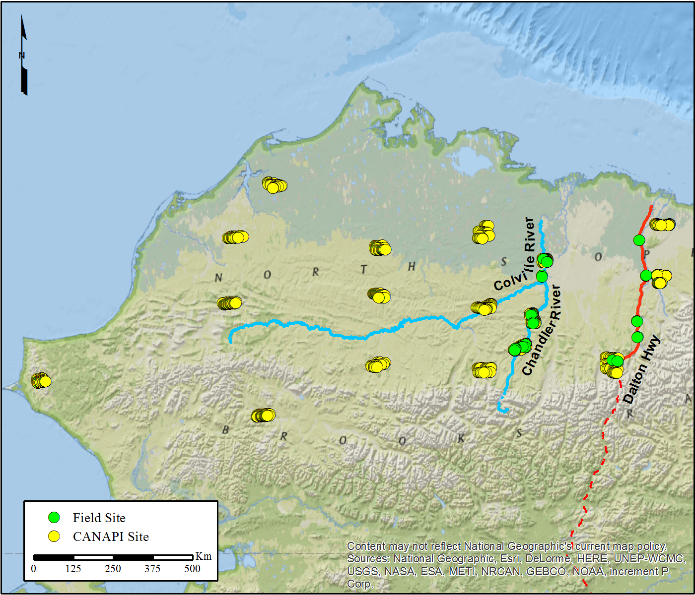
Northern and Mid-Latitude Soil Database, Version 1, R1
The U.S. Department of Agriculture, Agriculture and Agri-Food Canada, the Russian Academy of Agricultural Sciences, the University of Copenhagen Institute of Geography, the... -
SAFARI 2000 MODIS Airborne Simulator Data, Southern Africa, Dry Season 2000
This dataset contains the Moderate Resolution Imaging Spectroradiometer (MODIS) Airborne Simulator (MAS) multispectral data collected during the SAFARI 2000 project. The flights... -
Methane Plumes Derived from AVIRIS-NG over Point Sources across California, 2016-2017
This dataset provides maps of methane (CH4) plumes along flight lines over identified methane point-source emitting infrastructure across the State of California, USA collected... -
MASTER: FireSense, California and Southern US, Spring 2025
This dataset includes Level 1B (L1B) and Level 2 (L2) data products from the MODIS/ASTER Airborne Simulator (MASTER) instrument. The spectral data were collected as part of the... -
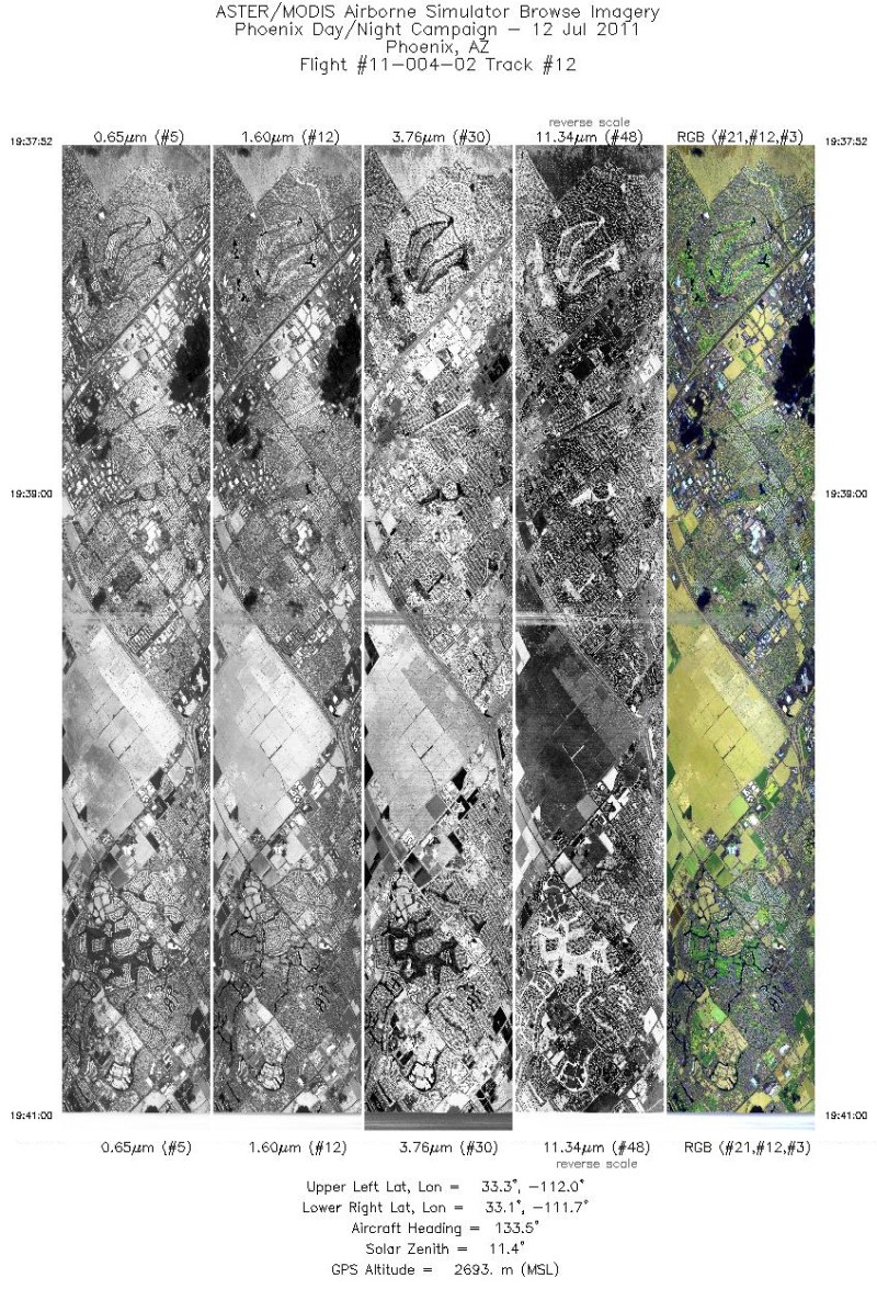
MASTER: Heat Island Airborne Study, Phoenix, Arizona, 2011
This dataset includes Level 1B (L1B) data products from the MODIS/ASTER Airborne Simulator (MASTER) instrument. The spectral data were collected during five flights aboard a...

Official websites use .gov
A
.gov website belongs to an official government
organization in the United States.
Secure .gov websites use HTTPS
A
lock (
) or https:// means you’ve safely connected to
the .gov website. Share sensitive information only on official,
secure websites.