
-
Global Man-made Impervious Surface (GMIS) Dataset From Landsat recent views
The Global Man-made Impervious Surface (GMIS) Dataset From Landsat consists of global estimates of fractional impervious cover derived from the Global Land Survey (GLS) Landsat... -
Yale Center for Earth Observation (YCEO) Surface Urban Heat Islands, Version 4, 2003-2018 recent views
The Yale Center for Earth Observation (YCEO) Surface Urban Heat Islands, Version 4, 2003-2018 includes annual, summertime, and wintertime Surface Urban Heat Island (SUHI)... -
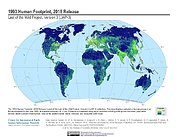
Last of the Wild Project, Version 3 (LWP-3): 2009 Human Footprint, 2018 Release recent views
The 2009 Human Footprint, 2018 Release provides a global map of the cumulative human pressure on the environment in 2009, at a spatial resolution of ~1 km. The human pressure is... -
Dar es Salaam Land Use and Informal Settlement Data Set recent views
The Dar es Salaam Land Use and Informal Settlement Data Set represents urban land use and consolidation of informal settlements for the years 1982, 1992, 1998, and 2002, in Dar... -
Global 1-km Downscaled Urban Land Extent Projection and Base Year Grids by SSP Scenarios, 2000-2100 recent views
The Global 1-km Downscaled Urban Land Extent Projection and Base Year Grids by SSP Scenarios, 2000-2100 consists of global SSP-consistent spatial urban land fraction data for... -
Last of the Wild Project, Version 2, 2005 (LWP-2): Global Human Influence Index (HII) Dataset (Geographic) recent views
The Global Human Influence Index Dataset of the Last of the Wild Project, Version 2, 2005 (LWP-2) is a global dataset of 1-kilometer grid cells, created from nine global data... -
Gridded Population of the World, Version 4 (GPWv4): Land and Water Area, Revision 11 recent views
The Gridded Population of the World, Version 4 (GPWv4): Land and Water Area, Revision 11 consists of two rasters that measure surface areas of land and water in square... -
Global Urban Heat Island (UHI) Data Set, 2013 recent views
The Urban Heat Island (UHI) effect represents the relatively higher temperatures found in urban areas compared to surrounding rural areas owing to higher proportions of... -
Last of the Wild Project, Version 3 (LWP-3): 1993 Human Footprint, 2018 Release recent views
The 1993 Human Footprint, 2018 Release provides a global map of the cumulative human pressure on the environment in 1993, at a spatial resolution of ~1 km. The human pressure is... -
Last of the Wild Project, Version 1, 2002 (LWP-1): Top One Percent Wild Areas Dataset (Geographic) recent views
The Top One Percent Wild Areas Dataset of the Last of the Wild Project, Version 1, 2002 (LWP-1) is derived from the LWP-1 Human Footprint Dataset. The gridded data are... -
Last of the Wild Project, Version 1, 2002 (LWP-1): Top One Percent Wild Areas Dataset (IGHP) recent views
The Top One Percent Wild Areas Dataset of the Last of the Wild Project, Version 1, 2002 (LWP-1) is derived from the LWP-1 Human Footprint Dataset. The gridded data are... -
Last of the Wild Project, Version 2, 2005 (LWP-2): Global Human Footprint Dataset (IGHP) recent views
The Global Human Footprint Dataset of the Last of the Wild Project, Version 2, 2005 (LWP-2) is the Human Influence Index (HII) normalized by biome. The HII is a global dataset... -
Last of the Wild Project, Version 1, 2002 (LWP-1): Last of the Wild Dataset (IGHP) recent views
The Last of the Wild Dataset of the Last of the Wild Project, Version 1, 2002 (LWP-1) is derived from the LWP-1 Human Footprint Dataset. The gridded data are classified... -
Last of the Wild Project, Version 1, 2002 (LWP-1): Global Human Footprint Dataset (Geographic) recent views
The Global Human Footprint Dataset of the Last of the Wild Project, Version 1, 2002 (LWP-1) is the Human Influence Index (HII) normalized by biome and realm. The HII is a global... -
Global Rural-Urban Mapping Project, Version 1 (GRUMPv1): Land and Geographic Unit Area Grids recent views
The Global Rural-Urban Mapping Project, Version 1 (GRUMPv1): Land and Geographic Unit Area Grids measure land areas in square kilometers and the mean Unit size (population-... -
Global Summer Land Surface Temperature (LST) Grids, 2013 recent views
The Global Summer Land Surface Temperature (LST) Grids, 2013, represent daytime maximum temperature and nighttime minimum temperature in degree Celsius at a spatial resolution... -
Last of the Wild Project, Version 1, 2002 (LWP-1): Global Human Footprint Dataset (IGHP) recent views
The Global Human Footprint Dataset of the Last of the Wild Project, Version 1, 2002 (LWP-1) is the Human Influence Index (HII) normalized by biome and realm. The HII is a global...

Official websites use .gov
A
.gov website belongs to an official government
organization in the United States.
Secure .gov websites use HTTPS
A
lock (
) or https:// means you’ve safely connected to
the .gov website. Share sensitive information only on official,
secure websites.