
-
Federal
Maritime Limits and Boundaries of United States of America NGDA
National Oceanic and Atmospheric Administration, Department of Commerce —
NOAA is responsible for depicting on its nautical charts the limits of the 12 nautical mile Territorial Sea, 24 nautical mile Contiguous Zone, and 200 nautical mile... -
Federal
National Fish Habitat Action Plan (NFHAP) - Coastal Spatial Framework and Coastal Indicator Data
National Oceanic and Atmospheric Administration, Department of Commerce —
The NFHAP Coastal Spatial Framework and Indicator Datasets consist of a geospatial base layer developed in ArcGIS, and associated data fields joined to the spatial... -
Federal
Seasonal Composite Raster Images for Sea Surface Temperature in the Gulf of Maine for Stellwagen Bank NMS
National Oceanic and Atmospheric Administration, Department of Commerce —
This personal geodatabase contains raster images of sea surface temperature (SST) in the Gulf of Maine. These raster images are seasonal composites, and were... -
Federal
Assessment of Existing Information for Atlantic Coastal Fish Habitat Partnership (ACFHP)
National Oceanic and Atmospheric Administration, Department of Commerce —
The ACFHP database consist of three primary data tables, joined within SQL Server, a relational DBMS: 1. The Bibliographic table provides information on over 500... -
Federal
H12698: NOS Hydrographic Survey , Approaches to Portsmouth, NH, 2014-05-30
National Oceanic and Atmospheric Administration, Department of Commerce —
The National Oceanic and Atmospheric Administration (NOAA) has the statutory mandate to collect hydrographic data in support of nautical chart compilation for safe... -
Federal
Estuarine Salinity Zones in US East Coast, Gulf of Mexico, and US West Coast from 1999-01-01 to 1999-12-31 (NCEI Accession 0127396)
National Oceanic and Atmospheric Administration, Department of Commerce —
These unprojected (geographic coordinates) 3-Zone Average Annual Salinity Digital Geographies are based on analysis of long-term salinity data for 147 estuaries of... -
Federal
Gulf of Maine - Water Salinity, Temperature and Sigma t (density) data from 1956 to 1980
National Oceanic and Atmospheric Administration, Department of Commerce —
This table contains water salinity, temperature and sigma t (density) data from 1956 to 1980 binned at 10 meter depth intervals (from 300 meters up to 0 meters) for... -
Federal
Bottom temperature product for the northeast U.S continental shelf obtained from a combination combination of observations and models, daily, 1/12 degree, 1959 - 2020
National Oceanic and Atmospheric Administration, Department of Commerce —
Two ocean products are combined, a regional ocean model (ROMS-NWA) and a global ocean data assimilated models (GLORYS12v1) to build a high-resolution, long-term... -
Federal
Stock Assessment Supplementary Information (SASINF)
National Oceanic and Atmospheric Administration, Department of Commerce —
In the interest of efficiency, clarity and standardization of stock assessment materials, the stock assessment reports for the 2015 Groundfish update have been... -
Federal
Dissolved inorganic carbon, total alkalinity, pH on Total Scale, nutrients and other variables collected from profile and discrete sample observations during NOAA Ship Henry B. Bigelow cruise HB1701 (EXPOCODE 33HH20170211) in the Gulf of Maine, Georges Bank, and Mid-Atlantic Bight from 2017-02-11 to 2017-02-23 (NCEI Accession 0169111)
National Oceanic and Atmospheric Administration, Department of Commerce —
This dataset contains dissolved inorganic carbon, total alkalinity, pH on total scale, nutrients and other variables measured from profile discrete measurement during... -
Federal
Dissolved inorganic carbon, alkalinity, pH, and other variables collected from profile and discrete sample observations using CTD, Niskin bottle, and other instruments from NOAA Ship Delaware II off the Northeast coast of the United States from 2012-02-02 to 2012-02-19 (NCEI Accession 0131423)
National Oceanic and Atmospheric Administration, Department of Commerce —
This dataset contains carbon and nutrient related data that were collected from CTD profile measurements in the Northeast coast of the United States (EXPOCODE:... -
Federal
H14000: NOS Hydrographic Survey , 2025-04-21
National Oceanic and Atmospheric Administration, Department of Commerce —
The National Oceanic and Atmospheric Administration (NOAA) has the statutory mandate to collect hydrographic data in support of nautical chart compilation for safe... -
Federal
Regional Hydrodynamic Model Outputs of the NOAA Operational Forecast System (OFS)
National Oceanic and Atmospheric Administration, Department of Commerce —
This dataset comprises output fields from NOAA Operational Forecast System (OFS) coastal ocean models. The National Ocean Service (NOS) maintains a suite of... -
Federal
Physical, chemical, and biological oceanographic data collected for the ECOHAB (ECology and Oceanography of Harmful Algal Blooms) project from 1993 to 2006
National Oceanic and Atmospheric Administration, Department of Commerce —
This dataset includes physical, chemical, and biological oceanographic data including Karenia brevis counts, biochemistry, and behavior, chlorophyll, water... -
Federal
Gulf of Maine Cooperative Bottom Longline Survey Database
National Oceanic and Atmospheric Administration, Department of Commerce —
This database is for a bottom longline (fixed gear) survey executed in the western and central Gulf of Maine targeting complex rocky habitats. The survey is operated... -
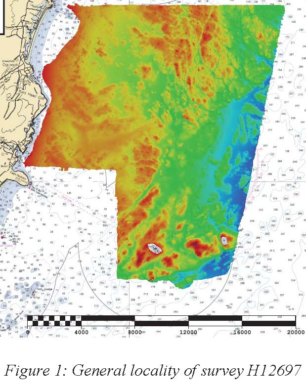
Federal
H12697: NOS Hydrographic Survey , Approaches to Portsmouth, NH, 2014-05-29
National Oceanic and Atmospheric Administration, Department of Commerce —
The National Oceanic and Atmospheric Administration (NOAA) has the statutory mandate to collect hydrographic data in support of nautical chart compilation for safe...

Official websites use .gov
A
.gov website belongs to an official government
organization in the United States.
Secure .gov websites use HTTPS
A
lock (
) or https:// means you’ve safely connected to
the .gov website. Share sensitive information only on official,
secure websites.