

WISE-CASING: Time Domain Reflectometry Data from Lab Experiment on Coaxial Cable
Access & Use Information
Downloads & Resources
-
Comparison Between Damaged Cable and Undamaged...eps
Comparison of the TDR responses between damaged cable and undamaged cable....
-
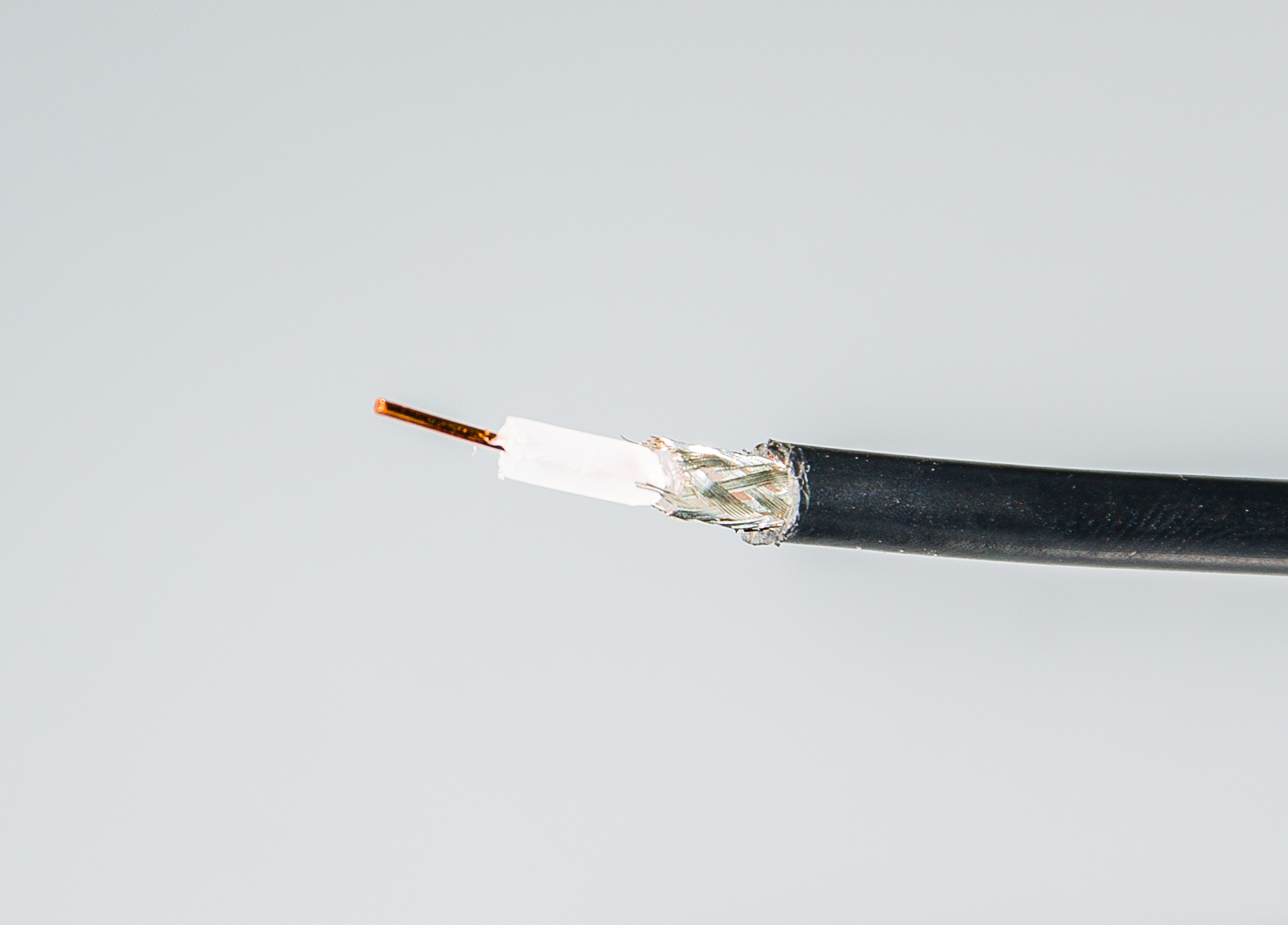
Picture of Coaxial Cable used in Experiment.jpgJPEG
A picture of the coaxial cable for the experiment. The amplitude of the data...
-
Summary of the Experiment.pptxPOWERPOINT
Summary of the experiment. The amplitude of the data is mV.
-
TDR 20m Coaxial Cable Lab Experiment .csvCSV
TDR response of the undamaged 20m coaxial cable with shorted termination. The...
-
TDR Shorted Termination with 120 Degree Cutaway.csvCSV
TDR response of the shorted termination with 120 degree cutaway at 40m of 85m...
-
TDR Shorted Termination Pre-Damage.csvCSV
TDR response of the shorted termination of undamaged cable. The amplitude of...
-
TDR 5m Coaxial Cable Lab Experiment.csvCSV
TDR response of the undamaged 5m coaxial cable with shorted termination. The...
-
TDR 10m Coaxial Cable Lab Experiment.csvCSV
TDR response of the undamaged coaxial cable with shorted termination. The...
-
Plot Comparison of Three Shorted Termination...PDF
Comparison of the three shorted termination with length 5m, 10m, and 20m. The...
-
Landing PageLanding Page
Dates
| Metadata Created Date | January 11, 2025 |
|---|---|
| Metadata Updated Date | January 20, 2025 |
Metadata Source
- Data.json Data.json Metadata
Harvested from OpenEI data.json
Additional Metadata
| Resource Type | Dataset |
|---|---|
| Metadata Created Date | January 11, 2025 |
| Metadata Updated Date | January 20, 2025 |
| Publisher | Lawrence Berkeley National Laboratory |
| Maintainer | |
| Doi | 10.15121/1559012 |
| Identifier | https://data.openei.org/submissions/7302 |
| Data First Published | 2018-03-15T06:00:00Z |
| Data Last Modified | 2020-01-27T22:39:08Z |
| Public Access Level | public |
| Bureau Code | 019:20 |
| Metadata Context | https://openei.org/data.json |
| Metadata Catalog ID | https://openei.org/data.json |
| Schema Version | https://project-open-data.cio.gov/v1.1/schema |
| Catalog Describedby | https://project-open-data.cio.gov/v1.1/schema/catalog.json |
| Data Quality | True |
| Datagov Dedupe Retained | 20250120155001 |
| Harvest Object Id | b7398074-c38a-4bf4-9461-41e868fb5614 |
| Harvest Source Id | 7cbf9085-0290-4e9f-bec1-91653baeddfd |
| Harvest Source Title | OpenEI data.json |
| Homepage URL | https://gdr.openei.org/submissions/1164 |
| License | https://creativecommons.org/licenses/by/4.0/ |
| Old Spatial | {"type":"Polygon","coordinates":-122.24025382119,37.876913157073,-122.24025382119,37.876913157073,-122.24025382119,37.876913157073,-122.24025382119,37.876913157073,-122.24025382119,37.876913157073} |
| Program Code | 019:006 |
| Projectlead | Mike Weathers |
| Projectnumber | EE0033208 |
| Projecttitle | Wellbore Integrity asSEssment with Casing-based Advanced SenSING (WISE-CASING) |
| Source Datajson Identifier | True |
| Source Hash | 4ae4956da2d8d88283ec39376e1036c4b7e8050eeb69bf64cec3ae3f6d6b8526 |
| Source Schema Version | 1.1 |
| Spatial | {"type":"Polygon","coordinates":-122.24025382119,37.876913157073,-122.24025382119,37.876913157073,-122.24025382119,37.876913157073,-122.24025382119,37.876913157073,-122.24025382119,37.876913157073} |
Didn't find what you're looking for? Suggest a dataset here.