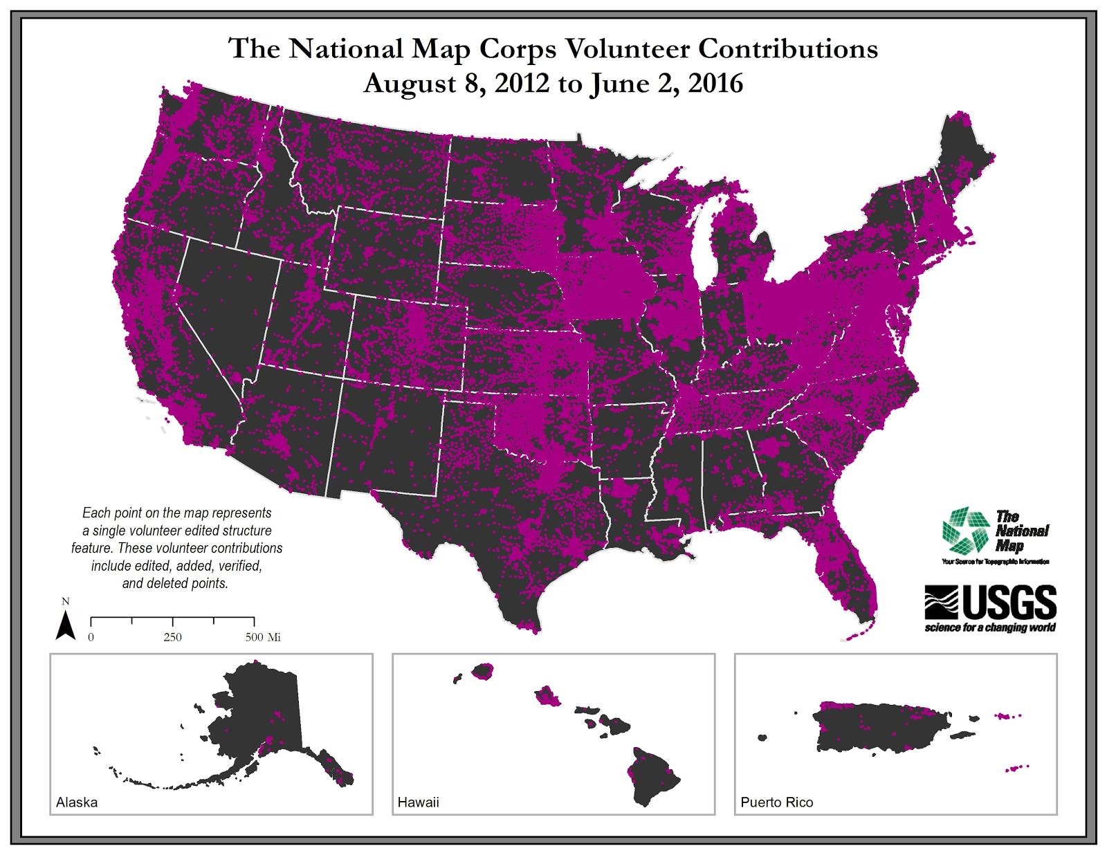
USGS National Map Corps VGI Structures Acquisition Plan Objectives for FY19 from The National Map - National Geospatial Data Asset (NGDA) USGS National Structures Dataset
Access & Use Information
Downloads & Resources
-
Web PageHTML
index.html
-
Web Resource
Dates
| Metadata Date | September 27, 2018 |
|---|---|
| Metadata Created Date | November 11, 2023 |
| Metadata Updated Date | November 11, 2023 |
| Reference Date(s) | January 1, 2017 (publication) |
| Frequency Of Update | annually |
Metadata Source
- ISO-19139 ISO-19139 Metadata
- FGDC Original FGDC Metadata
Harvested from The National Map Acquisition Plans
Graphic Preview

Additional Metadata
| Resource Type | Dataset |
|---|---|
| Metadata Date | September 27, 2018 |
| Metadata Created Date | November 11, 2023 |
| Metadata Updated Date | November 11, 2023 |
| Reference Date(s) | January 1, 2017 (publication) |
| Responsible Party | U.S. Geological Survey (Point of Contact) |
| Contact Email | |
| Guid | 9c9ef252-fe70-4b00-856c-1cea3b7cedd6_source |
| Access Constraints | Use Constraints: None, Access Constraints: None |
| Bbox East Long | -65 |
| Bbox North Lat | 71.5 |
| Bbox South Lat | 17.625 |
| Bbox West Long | -179.167 |
| Coupled Resource | |
| Frequency Of Update | annually |
| Graphic Preview Description | Browse graphic showing National Map Corps structures contributions. |
| Graphic Preview File | http://thor-f5.er.usgs.gov/ngtoc/metadata/waf/planned/browse/vgi-structures.jpg |
| Graphic Preview Type | JPG |
| Harvest Object Id | 9c9ef252-fe70-4b00-856c-1cea3b7cedd6 |
| Harvest Source Id | d8d978aa-05c4-4599-8628-7b5c3666b986 |
| Harvest Source Title | The National Map Acquisition Plans |
| Licence | |
| Lineage | |
| Metadata Language | eng; USA |
| Metadata Type | geospatial |
| Old Spatial | {"type": "Polygon", "coordinates": [[[-179.167, 17.625], [-65.0, 17.625], [-65.0, 71.5], [-179.167, 71.5], [-179.167, 17.625]]]} |
| Progress | planned |
| Spatial Data Service Type | |
| Spatial Reference System | |
| Spatial Harvester | True |
Didn't find what you're looking for? Suggest a dataset here.

