Soil Carbon Estimates in 20-cm Layers to 1-meter Depth, Conterminous US, 1970-1993
Access & Use Information
Downloads & Resources
-
Google Scholar search resultsHTML
Search results for publications that cite this dataset by its DOI.
-
Download this datasetHTML
This link allows direct data access via Earthdata login
-
View documentation related to this datasetHTML
ORNL DAAC Data Set Documentation
-
This dataset's landing pageHTML
Data set Landing Page DOI URL
-
View documentation related to this datasetPDF
Data Set Documentation
-
Get a related visualizationPNG
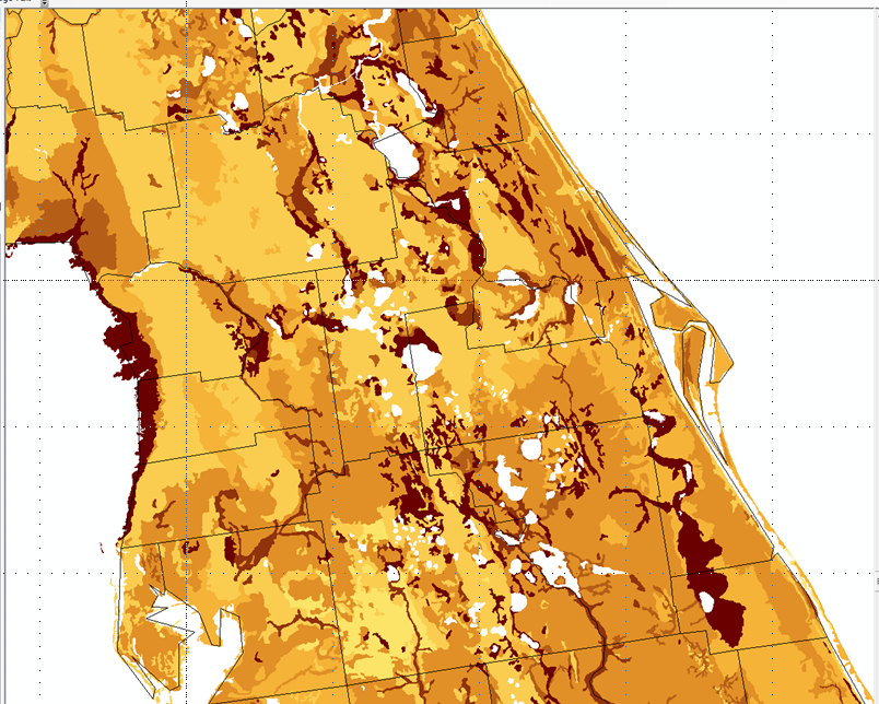
Soil carbon in g C/m2 for the 0-20 cm layer for central Florida.
-
Landing PageLanding Page
Dates
| Metadata Created Date | December 1, 2022 |
|---|---|
| Metadata Updated Date | December 7, 2023 |
Metadata Source
- Data.json Data.json Metadata
Harvested from NASA Data.json
Graphic Preview

Additional Metadata
| Resource Type | Dataset |
|---|---|
| Metadata Created Date | December 1, 2022 |
| Metadata Updated Date | December 7, 2023 |
| Publisher | ORNL_DAAC |
| Maintainer | |
| Identifier | C2216863502-ORNL_CLOUD |
| Data First Published | 2022-02-12 |
| Language | en-US |
| Data Last Modified | 2023-06-12 |
| Category | Soil, geospatial |
| Public Access Level | public |
| Bureau Code | 026:00 |
| Metadata Context | https://project-open-data.cio.gov/v1.1/schema/catalog.jsonld |
| Metadata Catalog ID | https://data.nasa.gov/data.json |
| Schema Version | https://project-open-data.cio.gov/v1.1/schema |
| Catalog Describedby | https://project-open-data.cio.gov/v1.1/schema/catalog.json |
| Citation | West, T.O. 2014. Soil Carbon Estimates in 20-cm Layers to 1-meter Depth, Conterminous US, 1970-1993. ORNL DAAC, Oak Ridge, Tennessee, USA. http://dx.doi.org/10.3334/ORNLDAAC/1238 |
| Graphic Preview Description | Soil carbon in g C/m2 for the 0-20 cm layer for central Florida. |
| Graphic Preview File | https://daac.ornl.gov/SOILS/guides/Fig2_west-soil_map_florida.png |
| Harvest Object Id | 69b2740c-967b-4a95-8853-867880eb9aa3 |
| Harvest Source Id | 58f92550-7a01-4f00-b1b2-8dc953bd598f |
| Harvest Source Title | NASA Data.json |
| Homepage URL | https://doi.org/10.3334/ORNLDAAC/1238 |
| Metadata Type | geospatial |
| Old Spatial | -135.68 22.27 -54.82 53.54 |
| Program Code | 026:001 |
| Source Datajson Identifier | True |
| Source Hash | bcf5e1bd28a966961528f153edff3dc8a9e58de647c60577c9cd1aaffbea50e9 |
| Source Schema Version | 1.1 |
| Spatial | |
| Temporal | 1970-01-01T00:00:00Z/1993-12-30T23:59:59Z |
Didn't find what you're looking for? Suggest a dataset here.

