

Snake River Plain FORGE: Well Data for INEL-1
Access & Use Information
Downloads & Resources
-
INEL-1 Caliper Raw Data.zipZIP
Raw data files for INEL-1 caliper log
-
INEL-1 Caliper Log 1462-3552ft.pdfPDF
Caliper log (4-arm) for INEL-1 from 1462 feet to 3552 feet.
-
INEL-1 Caliper Log 1900-2640ft.pdfPDF
Caliper log for core hole 2A, INEL-1, from 1900 feet to 2640 feet.
-
INEL-1 Caliper Log 0-3552ft.pdfPDF
Caliper log for INEL-1 from surface to 2552 feet over two runs, 4-arm caliper.
-
INEL-1 Core Sample 4874ft.jpgJPEG
Photo of an INEL-1 core sample from 4874ft.
-
INEL-1 Core Sample 10340ft.jpgJPEG
Photo of an INEL-1 core sample from 10340ft
-
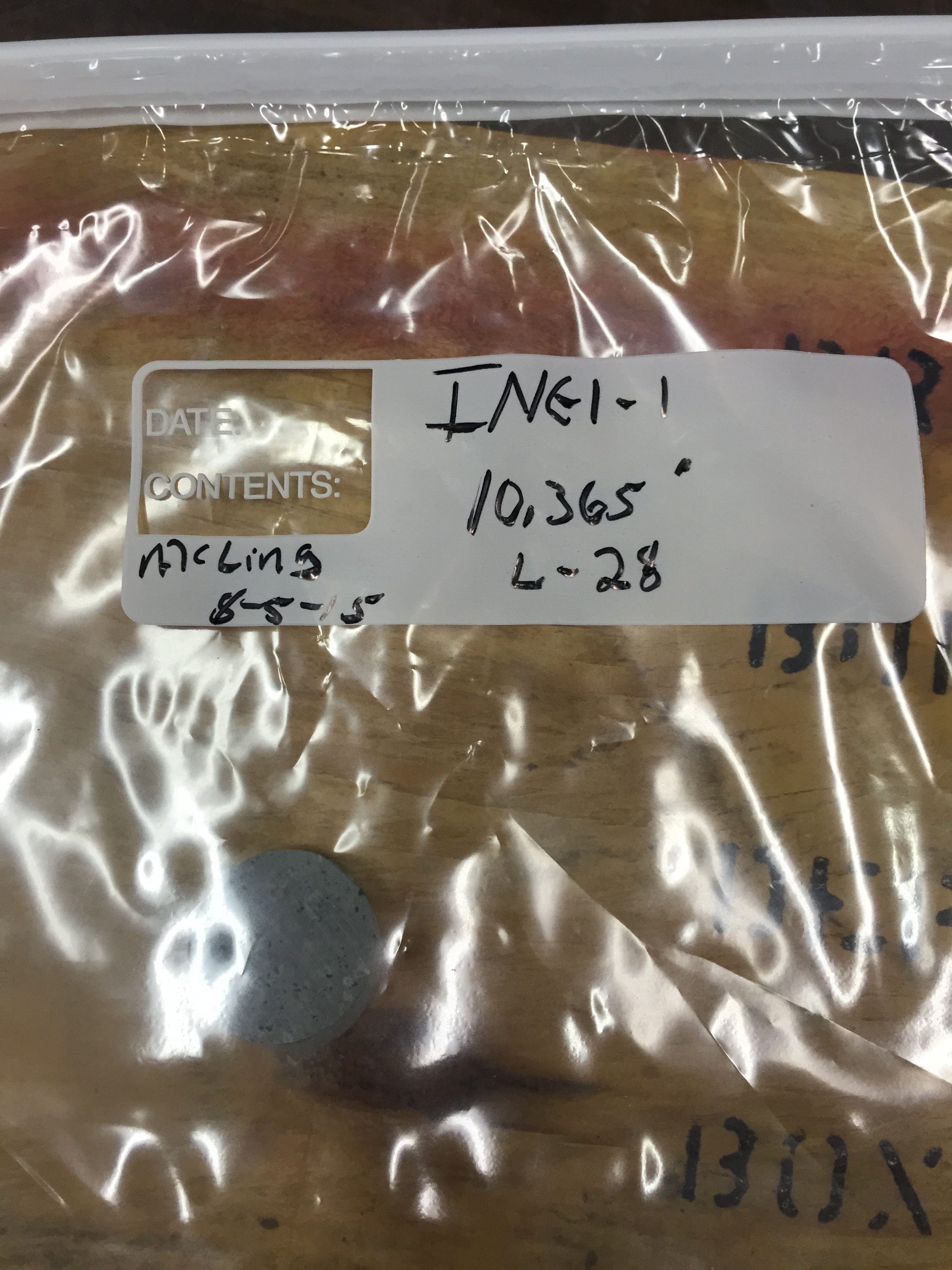
INEL-1 Core Sample 10365ft.jpgJPEG
Photo of an INEL-1 core sample from 10365ft
-
INEL-1 Density Log 0-1466ft Pre-cementation.pdfPDF
Log of INEL-1 uncompensated formation density before cementation to 1466 feet
-
INEL-1 Density Log 0-1466ft Post-cementation.pdfPDF
Log of INEL-1 uncompensated formation density after cementation to 1466 feet.
-
INEL-1 Density Log 1290-3512ft Pre-cementation.pdfPDF
Log of INEL-1 uncompensated formation density before cementation from 1290...
-
INEL-1 Full Color Logs.pdfPDF
Full color logs of the INEL-1 well
-
INEL-1 Fracture ID Log.pdfPDF
Fracture identification log for the INEL-1 well.
-
INEL-1 Gamma Raw Data.zipZIP
Raw gamma ray data for INEL-1. Data files are in text form.
-
INEL-1 Gamma Perforating Depth Control Log.pdfPDF
Gamma perforating depth control log for INEL-1
-
INEL-1 Gamma Frequency Plot.pdfPDF
Gamma frequency plot for the INEL-1 well
-
INEL-1 Gamma Ray Log.pdfPDF
Gamma ray log for INEL-1
-
INEL-1 Gamma Frequency Plot 2.pdfPDF
Gamma frequency plot for the INEL-1 well
-
INEL-1 Rock Strength Parameters.xlsxEXCEL
A simple spreadsheet with rock strength parameters (confining pressure,...
-
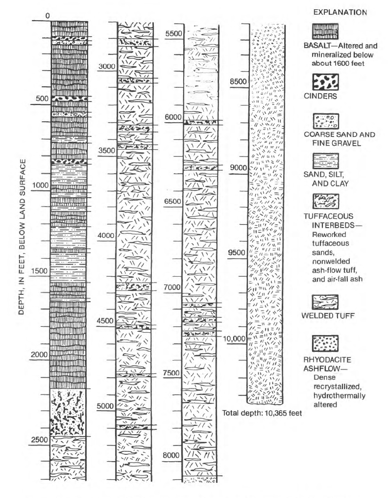
INEL-1 Litholog.pngPNG
Graphical overview of the lithology of INEL-1
-
INEL-1 LAS Raw Data.zipZIP
Raw LAS data in text files. The included README.txt file explains the data...
-
INEL-1 Lithology Data.txtTEXT
Raw lithology data in text form
-
INEL-1 Lithology Detailed.pdfPDF
Detailed chart of INEL-1 lithology by depth with well schematic
-
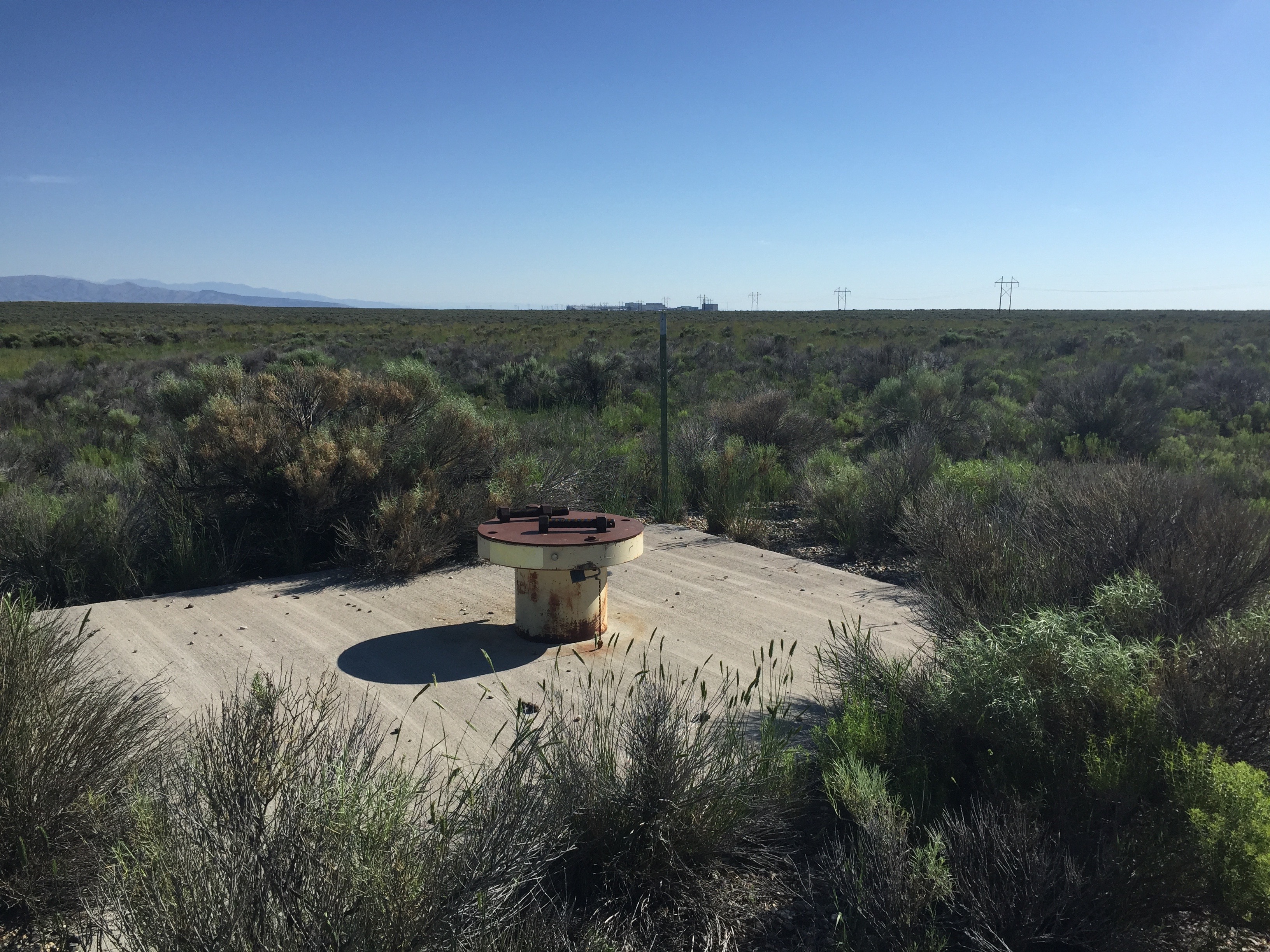
INEL-1 Surface.jpgJPEG
Surface photo of the INEL-1 well pad
-
INEL-1 Sonic Log.pdfPDF
Sonic log for the INEL-1 well
-
INEL-1 Simultaneous Comp Neutron - Formation...PDF
Simultaneous compensated neutron formation density log for INEL-1
-
INEL-1 TD 1982 and 1983 from Blackwell.tifTIFF
Temperature at depth chart comparing results from 1982 and 1983 for INEL-1.
-
INEL-1 Temperature Raw Data.zipZIP
Raw temperatue at depth data for INEL-1 in text files
-
INEL-1 Temperature Log 496-3553ft.pdfPDF
Temperature at depth log for INEL from 496 feet to 3553 feet
-
INEL-1 Temperature Log 3300-10230ft.pdfPDF
High resolution scan of the temperature at depth log for INEL-1 from 3300...
-
INEL-1 Density Log 3010-7172ft After Cementation.pdfPDF
Log of uncompensated formation density after cementation from 3010 feet to...
-
INEL-1A Lithology Data.txtTEXT
Raw lithology data in txt file form for INEL-1
-
INEL-1 Well File.pdfPDF
Scan of the INEL-1 well file
-
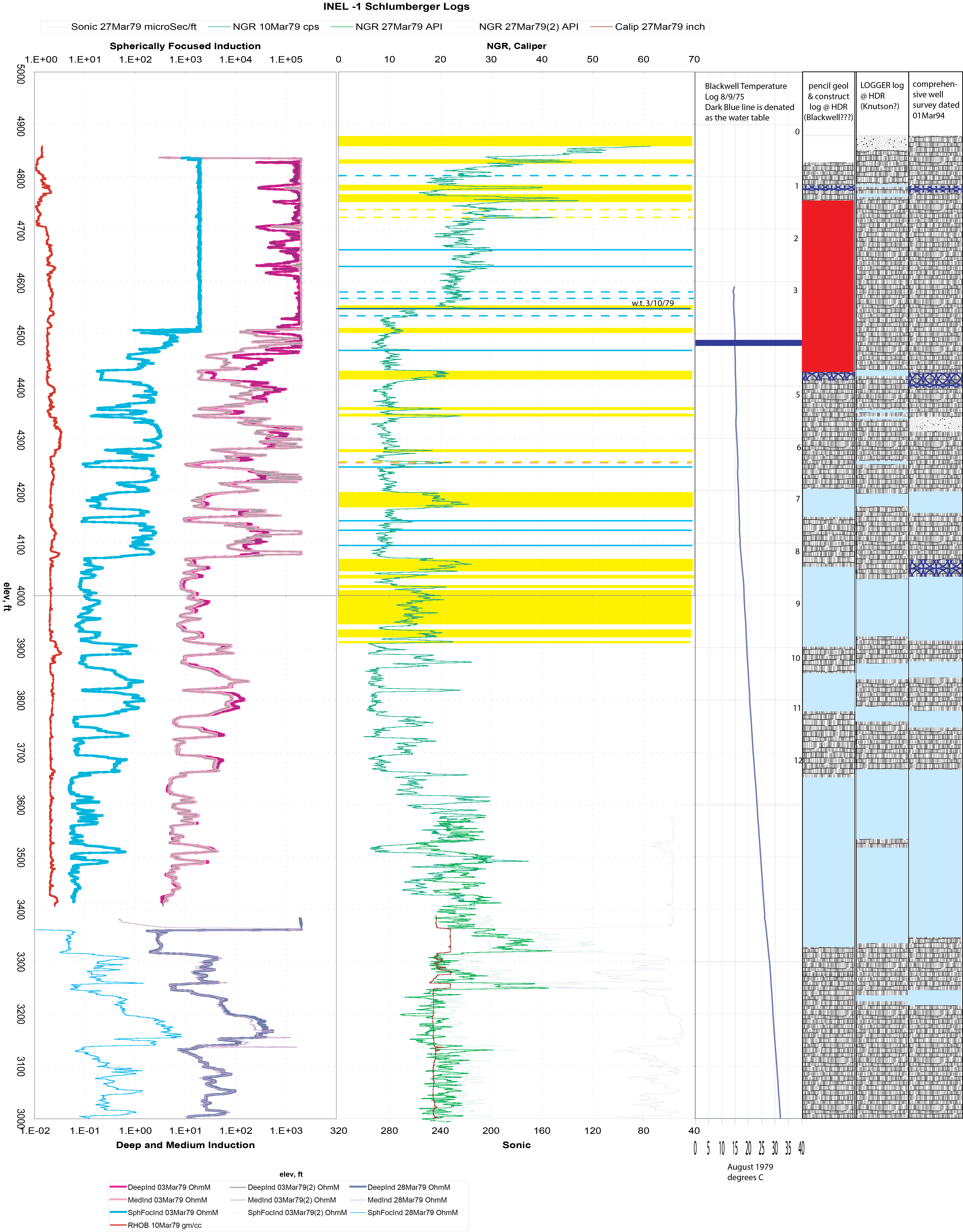
INEL-1 Schlumberger Logs.pngPNG
NGR, caliper, and lithology from Schlumberger logs for INEL-1
-
1980 Completion and Testing Report INEL-1.pdfPDF
Prestwich and Bowman, 1980. "Completion and Testing Report; INEL Geothermal...
-
Landing PageLanding Page
Dates
| Metadata Created Date | January 11, 2025 |
|---|---|
| Metadata Updated Date | January 20, 2025 |
Metadata Source
- Data.json Data.json Metadata
Harvested from OpenEI data.json
Additional Metadata
| Resource Type | Dataset |
|---|---|
| Metadata Created Date | January 11, 2025 |
| Metadata Updated Date | January 20, 2025 |
| Publisher | Idaho National Laboratory |
| Maintainer | |
| Doi | 10.15121/1261969 |
| Identifier | https://data.openei.org/submissions/6985 |
| Data First Published | 1979-03-01T07:00:00Z |
| Data Last Modified | 2019-11-15T01:30:28Z |
| Public Access Level | public |
| Bureau Code | 019:20 |
| Metadata Context | https://openei.org/data.json |
| Metadata Catalog ID | https://openei.org/data.json |
| Schema Version | https://project-open-data.cio.gov/v1.1/schema |
| Catalog Describedby | https://project-open-data.cio.gov/v1.1/schema/catalog.json |
| Data Quality | True |
| Datagov Dedupe Retained | 20250120143002 |
| Harvest Object Id | b3f7ed93-3255-4493-8d4b-b974cf16b510 |
| Harvest Source Id | 7cbf9085-0290-4e9f-bec1-91653baeddfd |
| Harvest Source Title | OpenEI data.json |
| Homepage URL | https://gdr.openei.org/submissions/792 |
| License | https://creativecommons.org/licenses/by/4.0/ |
| Old Spatial | {"type":"Polygon","coordinates":-112.94429130308,43.62132499125,-112.94418575463,43.62132499125,-112.94418575463,43.621391008732,-112.94429130308,43.621391008732,-112.94429130308,43.62132499125} |
| Program Code | 019:006 |
| Projectlead | Lauren Boyd |
| Projectnumber | EE0007159 |
| Projecttitle | Frontier Observatory for Research in Geothermal Energy: Snake River Plain, ID |
| Source Datajson Identifier | True |
| Source Hash | 342fab8e577066c5f027c5263f454e6e0682bc5a98ee21ae16d2c12d2763b95d |
| Source Schema Version | 1.1 |
| Spatial | {"type":"Polygon","coordinates":-112.94429130308,43.62132499125,-112.94418575463,43.62132499125,-112.94418575463,43.621391008732,-112.94429130308,43.621391008732,-112.94429130308,43.62132499125} |
Didn't find what you're looking for? Suggest a dataset here.