

SIF and Vegetation Indices in the US Midwestern Agroecosystems, 2016-2021
Access & Use Information
Public: This dataset is intended for public access and use.
License: No license information was provided. If this work was prepared by an officer or employee of the United States government as part of that person's official duties it is considered a U.S. Government Work.
Downloads & Resources
-
Data Information (Unknown Format)BIN
-
Data Information (HTML)HTML
-
Data Information (ZIP)ZIP
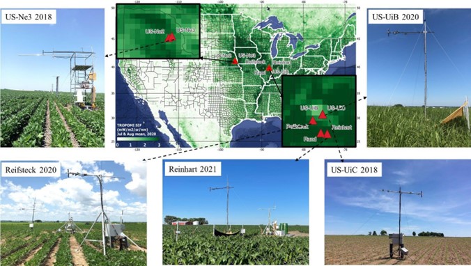
Crops_SIF_VegIndices_IL_NE_2136.zip
-
Data Information (JPEG)JPEG
Crops_SIF_VegIndices_IL_NE_Fig1.jpg
-
Data Information (PDF)PDF
Crops_SIF_VegIndices_IL_NE.pdf
-
Landing PageLanding Page
Dates
| Metadata Created Date | April 11, 2025 |
|---|---|
| Metadata Updated Date | February 19, 2026 |
Metadata Source
- Data.json Data.json Metadata
Harvested from NASA Data.json
Additional Metadata
| Resource Type | Dataset |
|---|---|
| Metadata Created Date | April 11, 2025 |
| Metadata Updated Date | February 19, 2026 |
| Publisher | ORNL_DAAC |
| Maintainer | |
| Identifier | 10.3334/ORNLDAAC/2136 |
| Data Last Modified | 2026-02-17 |
| Category | Earth Science |
| Public Access Level | public |
| Bureau Code | 026:00 |
| Metadata Context | https://project-open-data.cio.gov/v1.1/schema/catalog.jsonld |
| Schema Version | https://project-open-data.cio.gov/v1.1/schema |
| Catalog Describedby | https://project-open-data.cio.gov/v1.1/schema/catalog.json |
| Harvest Object Id | 33fc14ed-73c9-4b81-be2d-ef6ab603ab5b |
| Harvest Source Id | 58f92550-7a01-4f00-b1b2-8dc953bd598f |
| Harvest Source Title | NASA Data.json |
| Homepage URL | https://search.earthdata.nasa.gov/search?q=Crops_SIF_VegIndices_IL_NE_2136&ac=true |
| Old Spatial | {"WestBoundingCoordinate":-99.7022,"NorthBoundingCoordinate":42.3449,"EastBoundingCoordinate":-87.3976,"SouthBoundingCoordinate":38.7397},"CARTESIAN" |
| Program Code | 026:000 |
| Source Datajson Identifier | True |
| Source Hash | f387c6d7f33531f38a4c4809e18f8920376650bccb07cb21236624cb8d25d01f |
| Source Schema Version | 1.1 |
| Spatial | |
| Temporal | 2016-08-07/2016-08-07 |
Didn't find what you're looking for? Suggest a dataset here.