SBUV2/NOAA-14 Ozone (O3) Nadir Profile and Total Column 1 Day L2 V1 (SBUV2N14L2) at GES DISC
Access & Use Information
Downloads & Resources
-
Google Scholar search resultsHTML
Search results for publications that cite this dataset by its DOI.
-
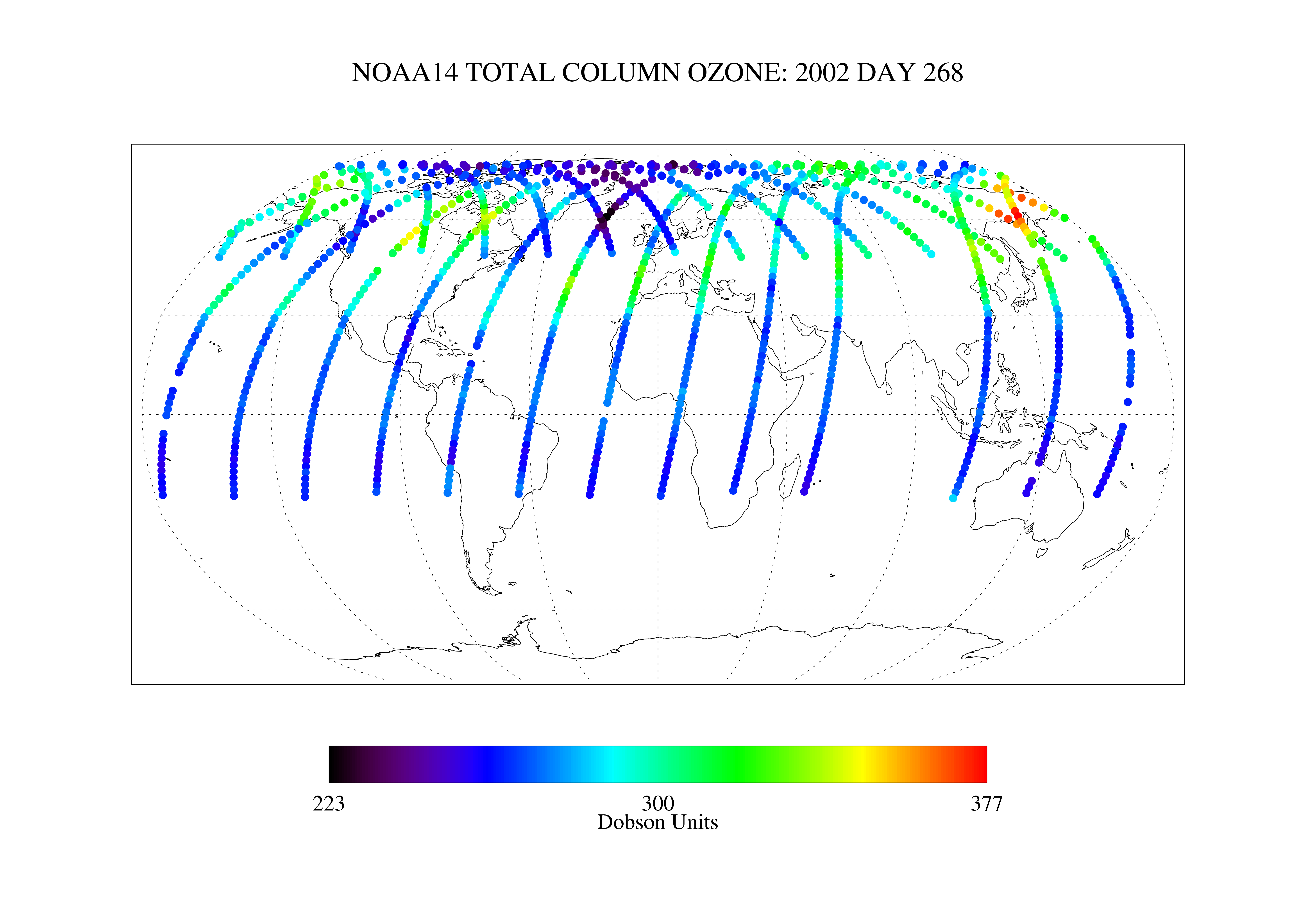
Get a related visualizationPNG
SBUV2N14L2_1.png
-
This dataset's landing pageHTML
Access the dataset landing page from the GES DISC website.
-
Download this dataset through a directory mapHTML
Access the data via HTTP.
-
Use OPeNDAP to access the dataset's dataHTML
Access the data via the OPeNDAP protocol.
-
Use THREDDS DATA to download the dataset's dataHTML
Access the data using the THREDDS Catalog.
-
View this dataset's read me documentPDF
README Document
-
Landing PageLanding Page
References
| https://doi.org/doi:10.5194/amt-5-2951-2012 |
| https://doi.org/doi:10.5194/amt-6-2533-2013 |
| https://doi.org/doi:10.1002/jgrd.50597 |
Dates
| Metadata Created Date | November 12, 2020 |
|---|---|
| Metadata Updated Date | December 6, 2023 |
Metadata Source
- Data.json Data.json Metadata
Harvested from NASA Data.json
Graphic Preview

Additional Metadata
| Resource Type | Dataset |
|---|---|
| Metadata Created Date | November 12, 2020 |
| Metadata Updated Date | December 6, 2023 |
| Publisher | NASA/GSFC/SED/ESD/GCDC/GESDISC |
| Maintainer | |
| Identifier | C1251051546-GES_DISC |
| Data First Published | 2013-07-02 |
| Language | en-US |
| Data Last Modified | 2013-07-02 |
| Category | MEaSUREs, geospatial |
| Public Access Level | public |
| Bureau Code | 026:00 |
| Metadata Context | https://project-open-data.cio.gov/v1.1/schema/catalog.jsonld |
| Metadata Catalog ID | https://data.nasa.gov/data.json |
| Schema Version | https://project-open-data.cio.gov/v1.1/schema |
| Catalog Describedby | https://project-open-data.cio.gov/v1.1/schema/catalog.json |
| Citation | P.K. Bhartia, et al.. 2012-08-07. SBUV2N14L2. Version 1. SBUV2/NOAA-14 Ozone (O3) Nadir Profile and Total Column 1 Day L2 V1. Greenbelt, MD, USA. Archived by National Aeronautics and Space Administration, U.S. Government, Goddard Earth Sciences Data and Information Services Center (GES DISC). https://doi.org/10.5067/MEASURES/OZONE/DATA205. https://disc.gsfc.nasa.gov/datacollection/SBUV2N14L2_1.html. Digital Science Data. |
| Creator | P.K. Bhartia, et al. |
| Data Presentation Form | Digital Science Data |
| Graphic Preview File | https://docserver.gesdisc.eosdis.nasa.gov/public/project/Images/SBUV2N14L2_1.png |
| Harvest Object Id | 3e4b63ac-5d51-43e8-ae1f-6b76327e0c52 |
| Harvest Source Id | 58f92550-7a01-4f00-b1b2-8dc953bd598f |
| Harvest Source Title | NASA Data.json |
| Homepage URL | https://doi.org/10.5067/MEASURES/OZONE/DATA205 |
| Metadata Type | geospatial |
| Old Spatial | -180.0 -90.0 180.0 90.0 |
| Program Code | 026:001 |
| Related Documents | https://doi.org/doi:10.5194/amt-5-2951-2012, https://doi.org/doi:10.5194/amt-6-2533-2013, https://doi.org/doi:10.1002/jgrd.50597 |
| Release Place | Greenbelt, MD, USA |
| Series Name | SBUV2N14L2 |
| Source Datajson Identifier | True |
| Source Hash | 4abe0a2c7f80fe4ff4de3d19e39cdad26f97c86c86c31aabe2ecd0100c32349e |
| Source Schema Version | 1.1 |
| Spatial | |
| Temporal | 1995-02-05T00:00:00Z/2006-09-28T23:59:59.999Z |
Didn't find what you're looking for? Suggest a dataset here.

