

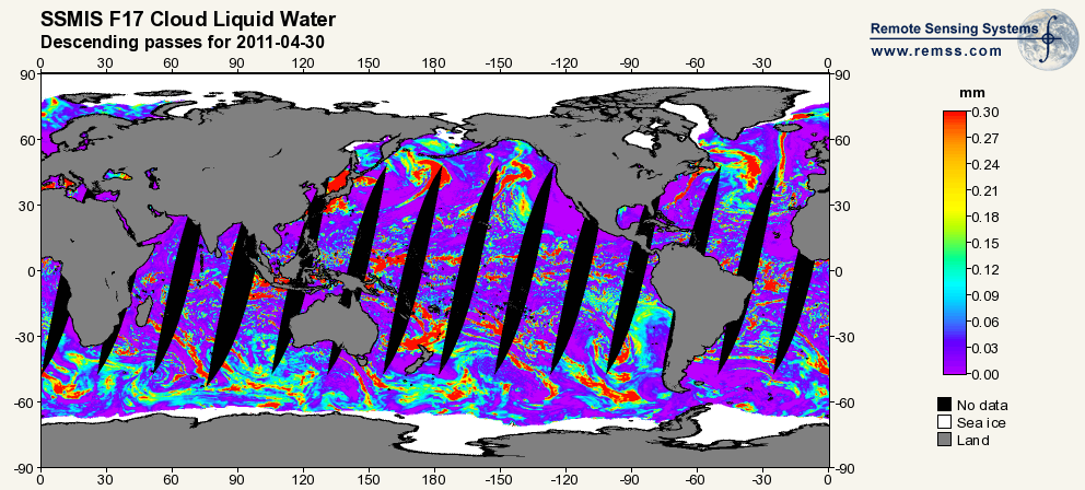
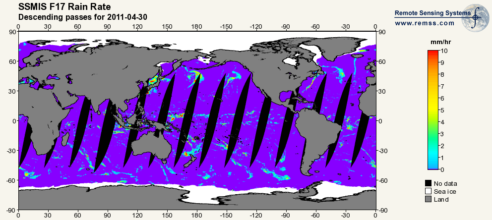
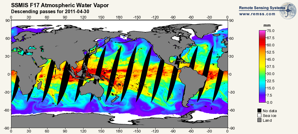
RSS SSMIS OCEAN PRODUCT GRIDS DAILY FROM DMSP F17 NETCDF V7
Access & Use Information
Downloads & Resources
-
Google Scholar search resultsHTML
Search results for publications that cite this dataset by its DOI.
-
Download this datasetHTML
Files may be downloaded directly to your workstation from this link
-
Get a related visualizationPNG
Sample browse image
-
Get a related visualizationPNG
Sample browse image
-
Get a related visualizationPNG
Sample browse image
-
Get a related visualizationPNG
Sample browse image
-
View documentation related to this datasetHTML
GHRC at UAH - SSM/I and SSMIS Data in NetCDF User's Guide
-
View information related to this datasetHTML
Digital Object Identifier for a collection of related datasets
-
View documentation related to this datasetHTML
The guide document contains detailed information about the dataset
-
View the primary investigator's documentation...PDF
SSM/I Rain Retrievals Within an Unified All-Weather Ocean Algorithm
-
View the primary investigator's documentation...PDF
A Well Calibrated Ocean Algorithm for SSM/I
-
View the primary investigator's documentation...PDF
Description of Remote Sensing Systems Version-7 Geophysical Retrievals
-
Use OPeNDAP to access the dataset's dataHTML
OPeNDAP server dataset access
-
View the documentation for this dataset's algorithmsPDF
AMSR Ocean Algorithm documentation supplement
-
View the documentation for this dataset's algorithmsPDF
AMSR Ocean Algorithm documentation
-
View the documentation for this dataset's algorithmsPDF
SSM/I Version-7 Calibration Report
-
Downloadable software applicationsHTML
netCDF read software
-
Get a related visualizationHTML
N/A
-
View documentation related to this datasetHTML
Instructions for citing GHRC data
-
Landing PageLanding Page
Dates
| Metadata Created Date | December 1, 2022 |
|---|---|
| Metadata Updated Date | December 7, 2023 |
Metadata Source
- Data.json Data.json Metadata
Harvested from NASA Data.json
Graphic Preview
Additional Metadata
| Resource Type | Dataset |
|---|---|
| Metadata Created Date | December 1, 2022 |
| Metadata Updated Date | December 7, 2023 |
| Publisher | NASA/MSFC/GHRC |
| Maintainer | |
| Identifier | C1996546695-GHRC_DAAC |
| Data First Published | 2012-07-02 |
| Language | en-US |
| Data Last Modified | 2022-04-28 |
| Category | DISCOVER, geospatial |
| Public Access Level | public |
| Bureau Code | 026:00 |
| Metadata Context | https://project-open-data.cio.gov/v1.1/schema/catalog.jsonld |
| Metadata Catalog ID | https://data.nasa.gov/data.json |
| Schema Version | https://project-open-data.cio.gov/v1.1/schema |
| Catalog Describedby | https://project-open-data.cio.gov/v1.1/schema/catalog.json |
| Citation | Wentz, Frank J, Kyle Hilburn and Deborah K Smith.2012. RSS SSMIS OCEAN PRODUCT GRIDS DAILY FROM DMSP F17 NETCDF indicate subset used. Dataset available online from the NASA Global Hydrometeorology Resource Center DAAC, Huntsville, Alabama, U.S.A. DOI: http://dx.doi.org/10.5067/MEASURES/DMSP-F17/SSMIS/DATA301 |
| Graphic Preview Description | N/A |
| Graphic Preview File | https://ghrc.nsstc.nasa.gov/pub/ssmis/f17/daily/browse/ |
| Harvest Object Id | b201569a-fffc-4d88-b108-c7c987eb4040 |
| Harvest Source Id | 58f92550-7a01-4f00-b1b2-8dc953bd598f |
| Harvest Source Title | NASA Data.json |
| Homepage URL | https://doi.org/10.5067/MEASURES/DMSP-F17/SSMIS/DATA301 |
| Metadata Type | geospatial |
| Old Spatial | -180.0 -90.0 180.0 90.0 |
| Program Code | 026:001 |
| Source Datajson Identifier | True |
| Source Hash | 420e001ba8968ea27827937dbc2500d145bd1aa204693e5e5b2f42c10722ad54 |
| Source Schema Version | 1.1 |
| Spatial | |
| Temporal | 2006-12-14T00:00:00Z/2022-05-03T00:00:00Z |
Didn't find what you're looking for? Suggest a dataset here.