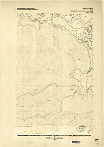
Reconnaissance geologic map of the Chamberlain Mountain quadrangle, Powell County, Montana (NGMDB)
Access & Use Information
Collection
This dataset is part of a deleted collection.
Downloads & Resources
-
Web PageHTML
proddesc_11275.htm
Dates
| Metadata Date | April 24, 2013 |
|---|---|
| Metadata Created Date | January 5, 2021 |
| Metadata Updated Date | January 5, 2021 |
| Reference Date(s) | January 1, 1979 (publication) |
| Frequency Of Update | UNPLANNED |
Metadata Source
- ISO-19139 ISO-19139 Metadata
- FGDC Original FGDC Metadata
Harvested from USGS National Geologic Map Database
Graphic Preview

Additional Metadata
| Resource Type | Dataset |
|---|---|
| Metadata Date | April 24, 2013 |
| Metadata Created Date | January 5, 2021 |
| Metadata Updated Date | January 5, 2021 |
| Reference Date(s) | January 1, 1979 (publication) |
| Responsible Party | U.S. Geological Survey (Point of Contact) |
| Contact Email | |
| Guid | |
| Access Constraints | Use Constraints: The geologic information should not be used in studies that are more detailed than the map scale of the publication., Access Constraints: none |
| Bbox East Long | -113.1250 |
| Bbox North Lat | 47.0000 |
| Bbox South Lat | 46.8750 |
| Bbox West Long | -113.2500 |
| Collection Package Id | 68093de6-f14f-4076-a040-7b2b0d735323 |
| Coupled Resource | |
| Frequency Of Update | UNPLANNED |
| Graphic Preview Description | Browse image (Publication may contain several sheets) |
| Graphic Preview File | http://ngmdb.usgs.gov/geoDataGov/browse/11275_1.display.gif |
| Graphic Preview Type | gif |
| Harvest Object Id | b20b03ee-01a7-4e26-8c80-aa24a11e1308 |
| Harvest Source Id | edbcef00-f353-45cc-b4ae-8ec9f57534d2 |
| Harvest Source Title | USGS National Geologic Map Database |
| Licence | Neither the United States Government nor any agency thereof, nor any of their employees, make any warranty, expressed or implied, or assumes any legal liability or responsibility for the accuracy, completeness, or usefulness of any information, apparatus, product, or process disclosed in this report, or represents that its use would not infringe privately owned rights. Reference herein to any specific commercial product, process, or service by trade name, trademark, manufacturer, or otherwise does not necessarily constitute or imply its endorsement, recommendation, or favoring by the United States Government or any agency thereof. |
| Metadata Language | eng; USA |
| Metadata Type | geospatial |
| Old Spatial | {"type": "Polygon", "coordinates": [[[-113.25, 46.875], [-113.125, 46.875], [-113.125, 47.0], [-113.25, 47.0], [-113.25, 46.875]]]} |
| Progress | completed |
| Spatial Data Service Type | |
| Spatial Reference System | |
| Spatial Harvester | True |
Didn't find what you're looking for? Suggest a dataset here.

