

QuikSCAT Level 2B Ocean Wind Vectors in 12.5km Slice Composites Version 3.1
Access & Use Information
Public: This dataset is intended for public access and use.
License:
See this page for license information.
Downloads & Resources
-
Web ResourceBIN
-
Web ResourceBIN
-
PDF FilePDF
qscat_l2b_v3_ug_v1_0.pdf
-
Web ResourceBIN
-
Web ResourceBIN
-
Web ResourceBIN
-
Web ResourceBIN
-
Web ResourceBIN
-
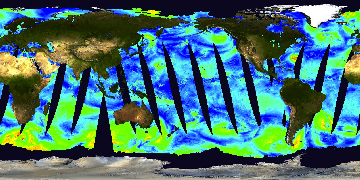
JPEG Image FileJPEG
QSCAT_LEVEL_2B_OWV_COMP_12_LCR_3.1.jpg
-
Original MetadataISO
The metadata's original source.
Dates
| Metadata Created Date | April 11, 2025 |
|---|---|
| Metadata Updated Date | March 12, 2026 |
Metadata Source
- Data.json Data.json Metadata
Harvested from NASA Data.json
Additional Metadata
| Resource Type | Dataset |
|---|---|
| Metadata Created Date | April 11, 2025 |
| Metadata Updated Date | March 12, 2026 |
| Publisher | NASA/JPL/PODAAC;NASA/JPL/QUIKSCAT |
| Maintainer | |
| Identifier | 10.5067/QSX12-L2B31 |
| Data Last Modified | 2026-03-10 |
| Category | Earth Science |
| Public Access Level | public |
| Bureau Code | 026:00 |
| Metadata Context | https://project-open-data.cio.gov/v1.1/schema/catalog.jsonld |
| Schema Version | https://project-open-data.cio.gov/v1.1/schema |
| Catalog Describedby | https://project-open-data.cio.gov/v1.1/schema/catalog.json |
| Harvest Object Id | 5e910db8-36a2-4d81-b52e-0bd85ceb8d8e |
| Harvest Source Id | 58f92550-7a01-4f00-b1b2-8dc953bd598f |
| Harvest Source Title | NASA Data.json |
| License | https://www.usa.gov/government-works |
| Old Spatial | "CARTESIAN",{"NorthBoundingCoordinate":90.0,"WestBoundingCoordinate":-180.0,"EastBoundingCoordinate":180.0,"SouthBoundingCoordinate":-90.0} |
| Program Code | 026:000 |
| Source Datajson Identifier | True |
| Source Hash | ee5badee2acfc22fe04448c526489e8eee8be32077e90c41cb1ae14ee9470457 |
| Source Schema Version | 1.1 |
| Spatial | |
| Temporal | 1999-10-27/2009-11-22 |
Didn't find what you're looking for? Suggest a dataset here.