

Quality Controlled Lightning Imaging Sensor (LIS) on International Space Station (ISS) Science Data V2
Access & Use Information
Downloads & Resources
-
Google Scholar search resultsHTML
Search results for publications that cite this dataset by its DOI.
-
Download this datasetHTML
Files may be downloaded directly to your workstation from this link
-
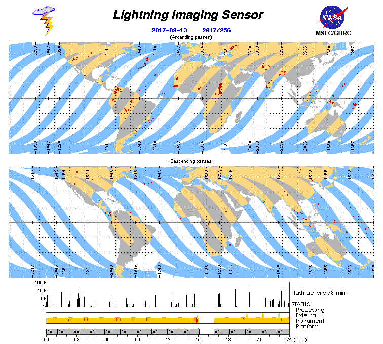
Get a related visualizationGIF
Sample Browse Image
-
View documentation related to this datasetPDF
Lightning Imaging Sensor (LIS) for the International Space Station (ISS):...
-
View documentation related to this datasetPDF
International Space Station (ISS) Lightning Imaging Sensor (LIS) Provisional...
-
View this dataset's documented anomaliesPDF
ISS LIS Data Processing Anomalies
-
View this dataset's publicationsHTML
Timing Uncertainty of the Lightning Imaging Sensor Advanced Search: Volume...
-
View this dataset's publicationsHTML
LIS on ISS: Expanded Global Coverage and Enhanced Applications
-
View this dataset's publicationsHTML
The detection of lightning from geostationary orbit
-
View this dataset's algorithm theoretical...PDF
ALGORITHM THEORETICAL BASIS DOCUMENT (ATBD) FOR THE LIGHTNING IMAGING SENSOR...
-
View this dataset's data recipesHTML
ISS LIS Lightning Flash Location Quickview using Python 2.7 and GIS
-
View this dataset's data recipesHTML
ISS LIS Lightning Flash Location Quickview using Python 3.0 and GIS
-
Downloadable software applicationsGZ
LISOTD V1.1 Software Package
-
The dataset's project home pageHTML
ISS Lightning Imaging Sensor (LIS) Data Sets
-
View a micro article on this datasetHTML
Lightning Micro Article
-
Get a related visualizationHTML
Browse Imagery
-
View documentation related to this datasetHTML
Instructions for citing GHRC data
-
Landing PageLanding Page
Dates
| Metadata Created Date | December 1, 2022 |
|---|---|
| Metadata Updated Date | December 7, 2023 |
Metadata Source
- Data.json Data.json Metadata
Harvested from NASA Data.json
Graphic Preview
Additional Metadata
| Resource Type | Dataset |
|---|---|
| Metadata Created Date | December 1, 2022 |
| Metadata Updated Date | December 7, 2023 |
| Publisher | NASA/MSFC/GHRC |
| Maintainer | |
| Identifier | C2303212754-GHRC_DAAC |
| Data First Published | 2022-06-29 |
| Language | en-US |
| Data Last Modified | 2022-06-29 |
| Category | LIS, geospatial |
| Public Access Level | public |
| Bureau Code | 026:00 |
| Metadata Context | https://project-open-data.cio.gov/v1.1/schema/catalog.jsonld |
| Metadata Catalog ID | https://data.nasa.gov/data.json |
| Schema Version | https://project-open-data.cio.gov/v1.1/schema |
| Catalog Describedby | https://project-open-data.cio.gov/v1.1/schema/catalog.json |
| Citation | Lang, Timothy .2022. Quality Controlled Lightning Imaging Sensor (LIS) on International Space Station (ISS) Science Data indicate subset used. Dataset available online from the NASA Global Hydrometeorology Resource Center DAAC, Huntsville, Alabama, U.S.A. DOI: http://dx.doi.org/10.5067/LIS/ISSLIS/DATA111 |
| Graphic Preview Description | Browse Imagery |
| Graphic Preview File | https://ghrc.nsstc.nasa.gov/pub/lis/iss/browse/final/ |
| Harvest Object Id | f488fbaa-f340-47a9-833a-73597362a1ce |
| Harvest Source Id | 58f92550-7a01-4f00-b1b2-8dc953bd598f |
| Harvest Source Title | NASA Data.json |
| Homepage URL | https://doi.org/10.5067/LIS/ISSLIS/DATA111 |
| Metadata Type | geospatial |
| Old Spatial | -180.0 -55.0 180.0 55.0 |
| Program Code | 026:001 |
| Source Datajson Identifier | True |
| Source Hash | 893135091eac8b3e5d01ee3e34c8e15fad11ce58d01e0cdf2682166cdbe3378b |
| Source Schema Version | 1.1 |
| Spatial | |
| Temporal | 2017-03-01T00:00:00Z/2023-02-28T00:00:00Z |
Didn't find what you're looking for? Suggest a dataset here.