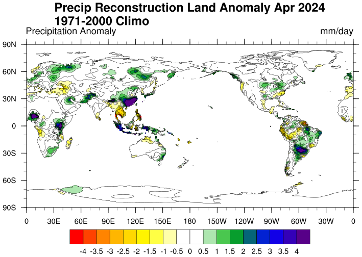
Precipitation Reconstruction over Land (PREC/L)
Access & Use Information
Downloads & Resources
-
Cite URLHTML
Information about the dataset
-
Thredds ServerHTML
Thredds Data server. Allows http, opendap, and possibly WCS and WMS downaloads.
-
FTP server
FTP server.
Dates
| Metadata Date | April 1, 2023 |
|---|---|
| Metadata Created Date | November 12, 2020 |
| Metadata Updated Date | October 6, 2023 |
| Reference Date(s) | April 1, 2023 (lastUpdate) |
| Frequency Of Update |
Metadata Source
- ISO-19139 ISO-19139 Metadata
Harvested from NOAA/ESRL/PSD
Graphic Preview

Additional Metadata
| Resource Type | Dataset |
|---|---|
| Metadata Date | April 1, 2023 |
| Metadata Created Date | November 12, 2020 |
| Metadata Updated Date | October 6, 2023 |
| Reference Date(s) | April 1, 2023 (lastUpdate) |
| Responsible Party | (Custodian) |
| Contact Email | |
| Guid | gov.noaa.psl.dataset.Precipitation_Reconstruction_over_Land_PRECL |
| Access Constraints | |
| Coupled Resource | |
| Frequency Of Update | |
| Graphic Preview File | https://psl.noaa.gov/data/gridded/images/small/precl.png |
| Harvest Object Id | 95efdeb9-3ace-487e-baa4-2b11791b58ba |
| Harvest Source Id | 9d930396-6206-4753-a731-106882c6d24c |
| Harvest Source Title | NOAA/ESRL/PSD |
| Licence | |
| Lineage | |
| Metadata Language | eng; USA |
| Metadata Type | geospatial |
| Progress | ongoing |
| Spatial Data Service Type | |
| Spatial Reference System | |
| Spatial Harvester | True |
| Temporal Extent Begin | 1948-01-01 |
| Temporal Extent End | 2023-04-01 |
Didn't find what you're looking for? Suggest a dataset here.

