

Get a related visualization
URL: https://daac.ornl.gov/GEDI/guides/ForestHt_Biomass_GEDI_TDX_Fig1.jpg
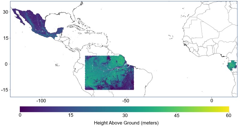
Forest canopy height from GEDI-TDX data fusion over Gabon, Mexico, French Guiana and the Amazon Basin. Source: height_mexico_25m.tif, height_gabon_25m.tif, height_frenchguiana_25m.tif, height_amazon_25m.tif
Source: Pantropical Forest Height and Biomass from GEDI and TanDEM-X Data Fusion
About this Resource
| Last updated | unknown |
|---|---|
| Created | unknown |
| Name | Get a related visualization |
| Format | JPEG Image File |
| License | License not specified |
| Created | 6 months ago |
| Media type | image/jpeg |
| has views | True |
| id | 66ff9496-e035-4a40-a2b1-de96b46ce5da |
| metadata modified | 6 months ago |
| package id | efdcfd99-0356-4877-87fd-54eb3ef43f55 |
| position | 5 |
| state | active |