Outgoing Longwave Radiation Daily Climate Data Record (OLR Daily CDR)
Access & Use Information
Downloads & Resources
-
Cite URLHTML
Information about the dataset
-
Thredds ServerHTML
Thredds Data server. Allows http, opendap, and possibly WCS and WMS downaloads.
-
FTP server
FTP server.
Dates
| Metadata Date | January 15, 2022 |
|---|---|
| Metadata Created Date | November 12, 2020 |
| Metadata Updated Date | October 6, 2023 |
| Reference Date(s) | January 15, 2022 (lastUpdate) |
| Frequency Of Update |
Metadata Source
- ISO-19139 ISO-19139 Metadata
Harvested from NOAA/ESRL/PSD
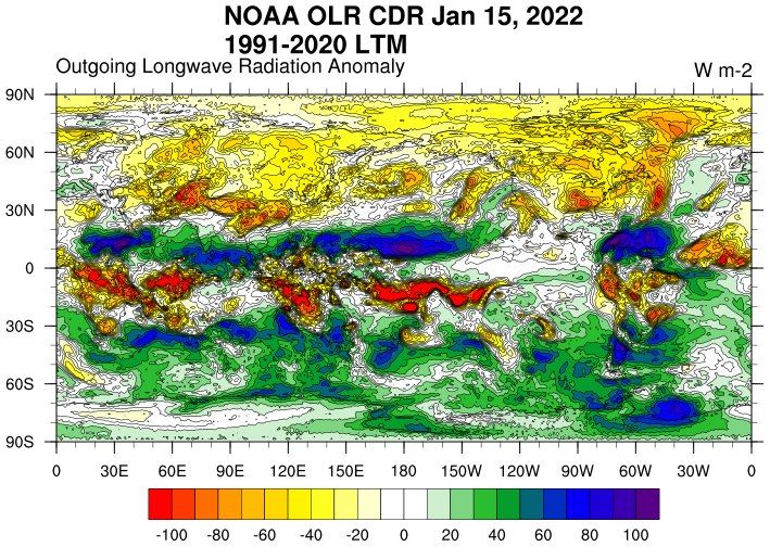
Graphic Preview

Additional Metadata
| Resource Type | Dataset |
|---|---|
| Metadata Date | January 15, 2022 |
| Metadata Created Date | November 12, 2020 |
| Metadata Updated Date | October 6, 2023 |
| Reference Date(s) | January 15, 2022 (lastUpdate) |
| Responsible Party | (Custodian) |
| Contact Email | |
| Guid | gov.noaa.psl.dataset.Outgoing_Longwave_Radiation_Daily_Climate_Data_Record_OLR_Daily_CDR |
| Access Constraints | |
| Coupled Resource | |
| Frequency Of Update | |
| Graphic Preview File | https://psl.noaa.gov/data/gridded/images/small/olrcdrd.png |
| Harvest Object Id | 01f4a388-8748-4c3d-9812-939a01b8ff74 |
| Harvest Source Id | 9d930396-6206-4753-a731-106882c6d24c |
| Harvest Source Title | NOAA/ESRL/PSD |
| Licence | |
| Lineage | |
| Metadata Language | eng; USA |
| Metadata Type | geospatial |
| Progress | ongoing |
| Spatial Data Service Type | |
| Spatial Reference System | |
| Spatial Harvester | True |
| Temporal Extent Begin | 1979-01-01 |
| Temporal Extent End | 2022-01-15 |
Didn't find what you're looking for? Suggest a dataset here.

