

OMG Conductivity Temperature Depth (CTD) Profiles
Access & Use Information
Public: This dataset is intended for public access and use.
License:
See this page for license information.
Downloads & Resources
-
Web ResourceBIN
-
PDF FilePDF
ORP_OMG_Debrief___Opportunity_2015.pdf
-
PDF FilePDF
ORP_2016_ctd_report.pdf
-
PDF FilePDF
JPL_OMG_Arctic_Access_2017_Overview.pdf
-
PDF FilePDF
OMG-AXCTD-2016-Campaign-Field-Report.pdf
-
PDF FilePDF
JPL_OMG_TerraSond_Rev0_Dec_14.pdf
-
PDF FilePDF
ORP_OMG_2018_Report.pdf
-
PDF FilePDF
JPL_OMG_Rev0_Nov_2016.pdf
-
PDF FilePDF
omg-ocean-ctd-users-guide.pdf
-
Text FileTEXT
README.txt
-
Web ResourceBIN
-
Web ResourceBIN
-
Web ResourceBIN
-
JPEG Image FileJPEG
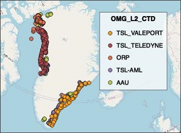
OMG_L2_CTD.jpg
-
Original MetadataISO
The metadata's original source.
Dates
| Metadata Created Date | April 11, 2025 |
|---|---|
| Metadata Updated Date | April 9, 2026 |
Metadata Source
- Data.json Data.json Metadata
Harvested from NASA Data.json
Additional Metadata
| Resource Type | Dataset |
|---|---|
| Metadata Created Date | April 11, 2025 |
| Metadata Updated Date | April 9, 2026 |
| Publisher | NASA/JPL/OMG;NASA/JPL/PODAAC |
| Maintainer | |
| Identifier | 10.5067/OMGEV-CTDS1 |
| Data Last Modified | 2026-04-06 |
| Category | Earth Science |
| Public Access Level | public |
| Bureau Code | 026:00 |
| Metadata Context | https://project-open-data.cio.gov/v1.1/schema/catalog.jsonld |
| Schema Version | https://project-open-data.cio.gov/v1.1/schema |
| Catalog Describedby | https://project-open-data.cio.gov/v1.1/schema/catalog.json |
| Harvest Object Id | f00277a6-cf2d-4a7e-bd5f-cc10a4eb82fc |
| Harvest Source Id | 58f92550-7a01-4f00-b1b2-8dc953bd598f |
| Harvest Source Title | NASA Data.json |
| License | https://www.usa.gov/government-works |
| Old Spatial | "CARTESIAN",{"WestBoundingCoordinate":-74.576,"SouthBoundingCoordinate":60.351,"EastBoundingCoordinate":53.406,"NorthBoundingCoordinate":79.841} |
| Program Code | 026:000 |
| Source Datajson Identifier | True |
| Source Hash | 5dc3dcd5df72815da0069a458163538a57dcbb09e1499733fcc36a54740ae0df |
| Source Schema Version | 1.1 |
| Spatial | |
| Temporal | 2015-07-25/2020-08-23 |
Didn't find what you're looking for? Suggest a dataset here.