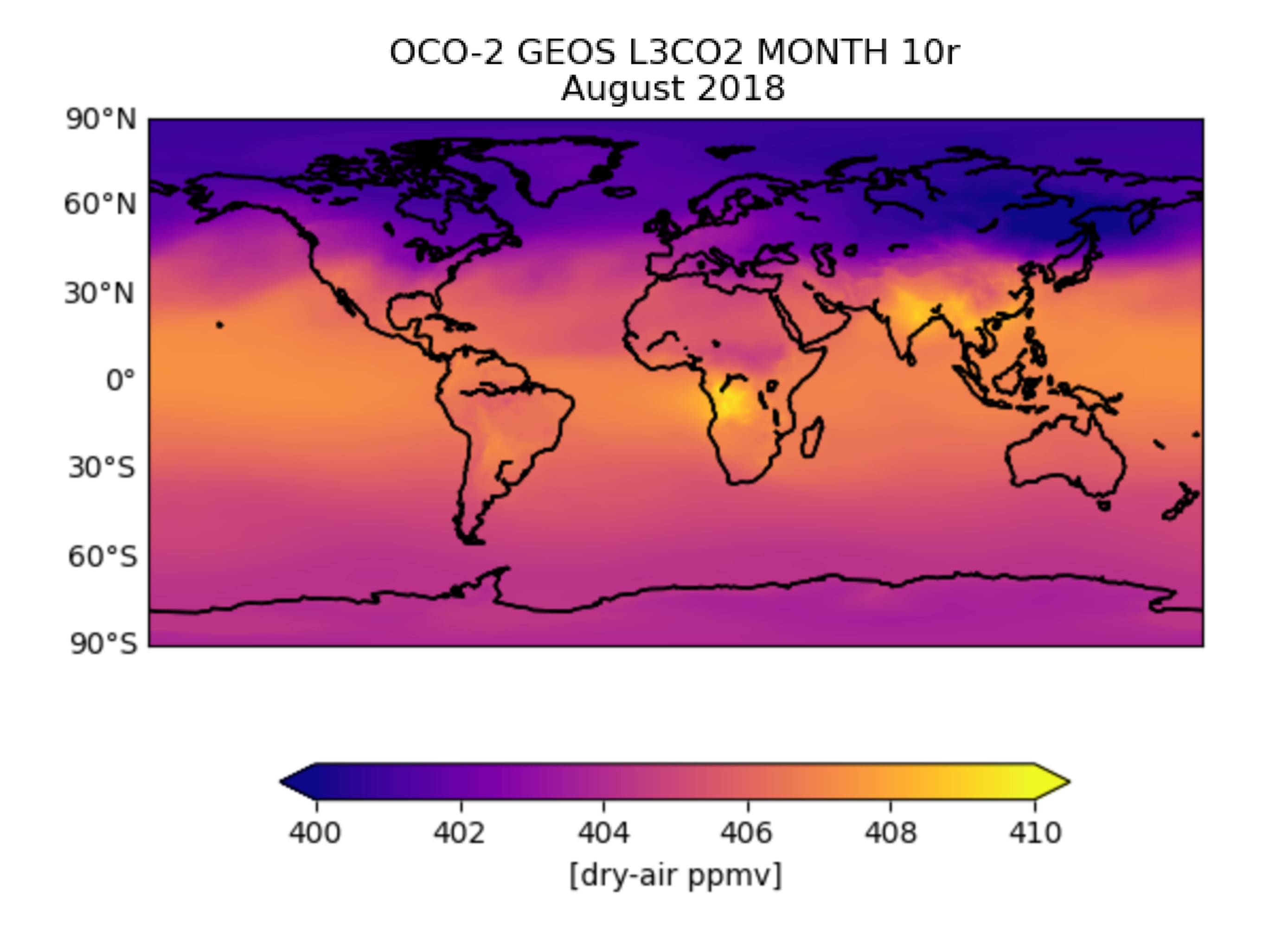
OCO-2 GEOS Level 3 monthly, 0.5x0.625 assimilated CO2 V10r (OCO2_GEOS_L3CO2_MONTH) at GES DISC
Access & Use Information
Downloads & Resources
-
Google Scholar search resultsHTML
Search results for publications that cite this dataset by its DOI.
-
Get a related visualizationPNG
OCO2_GEOS_L3CO2_MONTH_10r__201808.png
-
This dataset's landing pageHTML
Access the dataset landing page from the GES DISC website.
-
Download this dataset through a directory mapHTML
Access the data via HTTP
-
Use OPeNDAP to access the dataset's dataHTML
Access the data via the OPeNDAP protocol.
-
The dataset's project home pageHTML
OCO-2 Project Home Page
-
Download this dataset through Earthdata SearchHTML
Use the Earthdata Search to find and retrieve data sets across multiple data...
-
View this dataset's read me documentPDF
README document
-
View this dataset's user's guidePDF
User's Guide
-
View this dataset's algorithm theoretical...PDF
OCO_L2_ATBD.pdf
-
View documentation related to this datasetPDF
Bias Correction and Warn Levels
-
Downloadable software applicationsHTML
This software (NASA NTR-49044) retrieves a set of...
-
View documentation related to this datasetHTML
Publications from the Science Team
-
Landing PageLanding Page
Dates
| Metadata Created Date | December 1, 2022 |
|---|---|
| Metadata Updated Date | December 6, 2023 |
Metadata Source
- Data.json Data.json Metadata
Harvested from NASA Data.json
Graphic Preview

Additional Metadata
| Resource Type | Dataset |
|---|---|
| Metadata Created Date | December 1, 2022 |
| Metadata Updated Date | December 6, 2023 |
| Publisher | NASA/GSFC/SED/ESD/GCDC/GESDISC |
| Maintainer | |
| Identifier | C2240248790-GES_DISC |
| Data First Published | 2022-03-01 |
| Language | en-US |
| Data Last Modified | 2022-03-01 |
| Category | OCO-2, geospatial |
| Public Access Level | public |
| Bureau Code | 026:00 |
| Metadata Context | https://project-open-data.cio.gov/v1.1/schema/catalog.jsonld |
| Metadata Catalog ID | https://data.nasa.gov/data.json |
| Schema Version | https://project-open-data.cio.gov/v1.1/schema |
| Catalog Describedby | https://project-open-data.cio.gov/v1.1/schema/catalog.json |
| Citation | Brad Weir, Lesley Ott and OCO-2 Science Team. 2022-03-31. OCO2_GEOS_L3CO2_MONTH. Version 10r. OCO-2 GEOS Level 3 monthly, 0.5x0.625 assimilated CO2 V10r. Greenbelt, MD, USA. Archived by National Aeronautics and Space Administration, U.S. Government, Goddard Earth Sciences Data and Information Services Center (GES DISC). https://doi.org/10.5067/BGFIODET3HZ8. https://disc.gsfc.nasa.gov/datacollection/OCO2_GEOS_L3CO2_MONTH_10r.html. Digital Science Data. |
| Creator | Brad Weir, Lesley Ott and OCO-2 Science Team |
| Data Presentation Form | Digital Science Data |
| Graphic Preview File | https://docserver.gesdisc.eosdis.nasa.gov/public/project/OCO/OCO2_GEOS_L3CO2_MONTH_10r__201808.png |
| Harvest Object Id | a5d6937d-f7d0-4bf1-91d4-220b65012a25 |
| Harvest Source Id | 58f92550-7a01-4f00-b1b2-8dc953bd598f |
| Harvest Source Title | NASA Data.json |
| Homepage URL | https://doi.org/10.5067/BGFIODET3HZ8 |
| Metadata Type | geospatial |
| Old Spatial | -180.0 -90.0 180.0 90.0 |
| Program Code | 026:001 |
| Release Place | Greenbelt, MD, USA |
| Series Name | OCO2_GEOS_L3CO2_MONTH |
| Source Datajson Identifier | True |
| Source Hash | 9757431d0ea14880b8a06de61d10b8fd8a5835c15c72781439ac2326ffdec9f2 |
| Source Schema Version | 1.1 |
| Spatial | |
| Temporal | 2014-06-01T00:00:00Z/2023-02-28T00:00:00Z |
Didn't find what you're looking for? Suggest a dataset here.

