

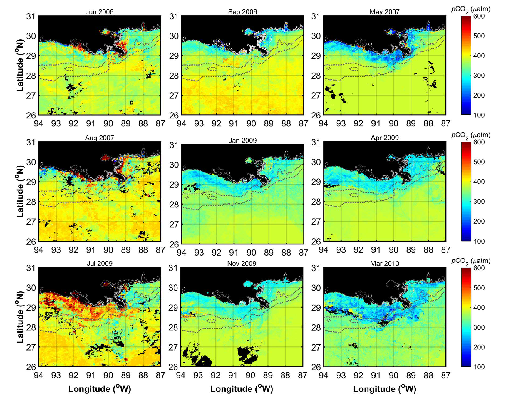
Ocean Surface pCO2 and Air-Sea CO2 Flux in the Northern Gulf of America, 2006-2010
Access & Use Information
Public: This dataset is intended for public access and use.
License: No license information was provided. If this work was prepared by an officer or employee of the United States government as part of that person's official duties it is considered a U.S. Government Work.
Downloads & Resources
-
Data Information (Unknown Format)BIN
-
Data Information (HTML)HTML
-
Data Information (Unknown Format)BIN
-
Data Information (ZIP)ZIP
CMS_Monthly_CO2_Gulf_1668.zip
-
Data Information (PNG)PNG
CMS_Monthly_CO2_Gulf_Fig1.png
-
Data Information (PDF)PDF
CMS_Monthly_CO2_Gulf.pdf
-
Landing PageLanding Page
Dates
| Metadata Created Date | April 11, 2025 |
|---|---|
| Metadata Updated Date | October 23, 2025 |
Metadata Source
- Data.json Data.json Metadata
Harvested from NASA Data.json
Additional Metadata
| Resource Type | Dataset |
|---|---|
| Metadata Created Date | April 11, 2025 |
| Metadata Updated Date | October 23, 2025 |
| Publisher | ORNL_DAAC |
| Maintainer | |
| Identifier | 10.3334/ORNLDAAC/1668 |
| Data Last Modified | 2025-09-11 |
| Category | Earth Science |
| Public Access Level | public |
| Bureau Code | 026:00 |
| Metadata Context | https://project-open-data.cio.gov/v1.1/schema/catalog.jsonld |
| Schema Version | https://project-open-data.cio.gov/v1.1/schema |
| Catalog Describedby | https://project-open-data.cio.gov/v1.1/schema/catalog.json |
| Harvest Object Id | 1aa67273-7549-44b2-a100-fd6380ed54b7 |
| Harvest Source Id | 58f92550-7a01-4f00-b1b2-8dc953bd598f |
| Harvest Source Title | NASA Data.json |
| Homepage URL | https://search.earthdata.nasa.gov/search?q=CMS_Monthly_CO2_Gulf_1668&ac=true |
| Old Spatial | {"WestBoundingCoordinate":-96.0,"NorthBoundingCoordinate":32.0,"EastBoundingCoordinate":-86.0,"SouthBoundingCoordinate":25.0},"CARTESIAN" |
| Program Code | 026:000 |
| Source Datajson Identifier | True |
| Source Hash | 0a861d051c5e58ea6d944b7c7d24f2bb9b8d60d8451dcb2c5bb742aaa98b72ad |
| Source Schema Version | 1.1 |
| Spatial | |
| Temporal | 2006-01-01/2006-01-01 |
Didn't find what you're looking for? Suggest a dataset here.