

Northern and Mid-Latitude Soil Database, Version 1, R1
Access & Use Information
Public: This dataset is intended for public access and use.
License: No license information was provided. If this work was prepared by an officer or employee of the United States government as part of that person's official duties it is considered a U.S. Government Work.
Downloads & Resources
-
Google Scholar search resultsHTML
Search results for publications that cite this dataset by its DOI.
-
Download this datasetHTML
This link allows direct data access via Earthdata login
-
View documentation related to this datasetHTML
ORNL DAAC Data Set Documentation
-
This dataset's landing pageHTML
Data set Landing Page DOI URL
-
View documentation related to this datasetPDF
Data Set Documentation
-
View documentation related to this datasetHTML
Data Set Documentation
-
View documentation related to this datasetJPEG
Data Set Documentation
-
View documentation related to this datasetJPEG
Data Set Documentation
-
Get a related visualizationPNG
Browse Image
-
Landing PageLanding Page
Dates
| Metadata Created Date | December 1, 2022 |
|---|---|
| Metadata Updated Date | December 6, 2023 |
Metadata Source
- Data.json Data.json Metadata
Harvested from NASA Data.json
Graphic Preview
Additional Metadata
| Resource Type | Dataset |
|---|---|
| Metadata Created Date | December 1, 2022 |
| Metadata Updated Date | December 6, 2023 |
| Publisher | ORNL_DAAC |
| Maintainer | |
| Identifier | C2216863233-ORNL_CLOUD |
| Data First Published | 2022-02-12 |
| Language | en-US |
| Data Last Modified | 2023-06-12 |
| Category | Soil, geospatial |
| Category Tag 16E15F51 D96E 4051 9124 75665Abdc6Ff | "Energy Infrastructure" |
| Public Access Level | public |
| Bureau Code | 026:00 |
| Metadata Context | https://project-open-data.cio.gov/v1.1/schema/catalog.jsonld |
| Metadata Catalog ID | https://data.nasa.gov/data.json |
| Schema Version | https://project-open-data.cio.gov/v1.1/schema |
| Catalog Describedby | https://project-open-data.cio.gov/v1.1/schema/catalog.json |
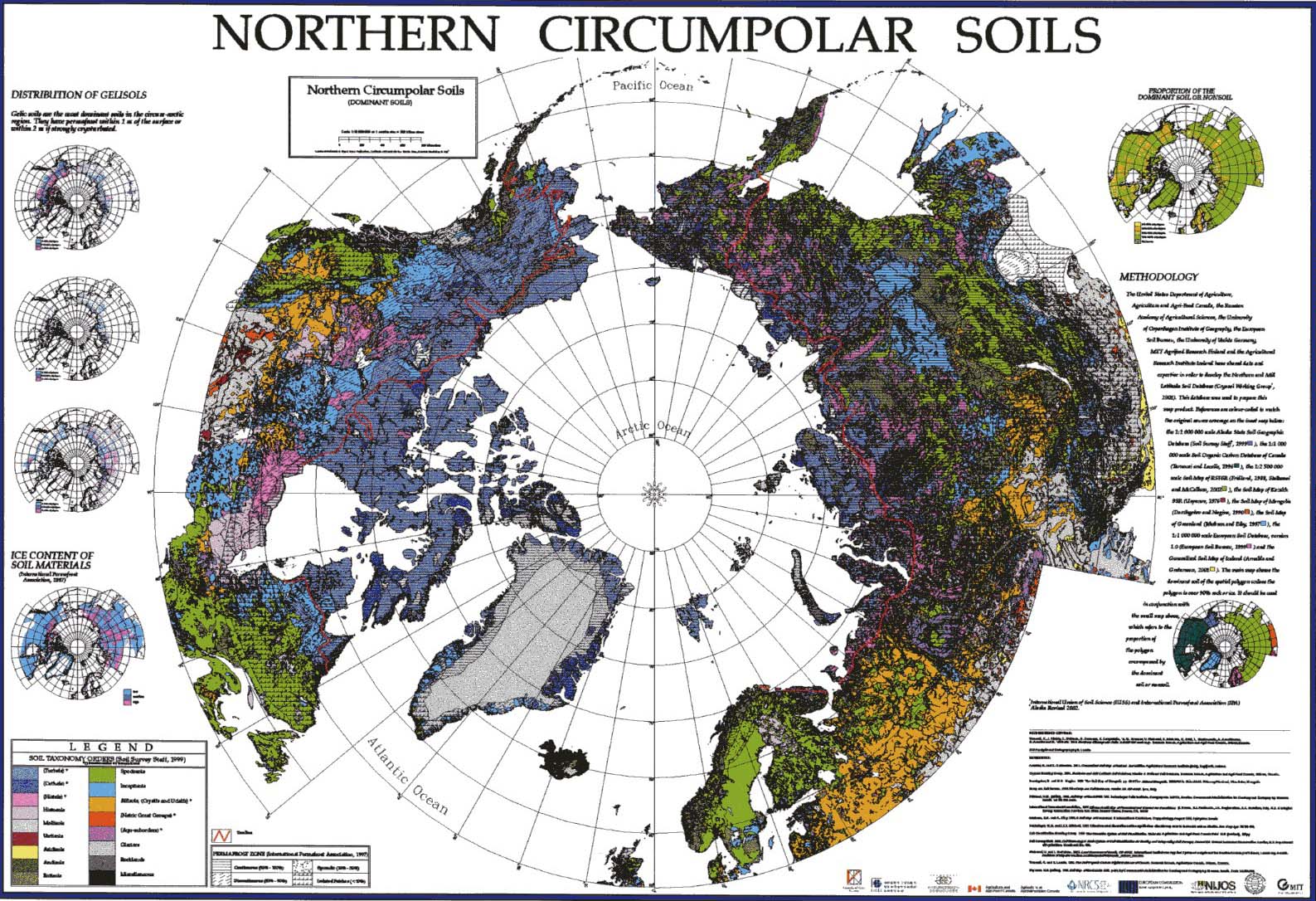
| Citation | Cryosol Working Group. 2014. Northern and Mid-Latitude Soil Database, Version 1, R1. ORNL DAAC, Oak Ridge, Tennessee, USA. http://dx.doi.org/10.3334/ORNLDAAC/705 |
| Graphic Preview Description | Browse Image |
| Graphic Preview File | https://daac.ornl.gov/graphics/browse/project/square/soil_logo_square.png |
| Harvest Object Id | d5b90892-e9be-4f6d-ab58-8435b88478f3 |
| Harvest Source Id | 58f92550-7a01-4f00-b1b2-8dc953bd598f |
| Harvest Source Title | NASA Data.json |
| Homepage URL | https://doi.org/10.3334/ORNLDAAC/705 |
| Metadata Type | geospatial |
| Old Spatial | -180.0 50.9 -129.3 71.4 |
| Program Code | 026:001 |
| Source Datajson Identifier | True |
| Source Hash | edee7f6c9b7a42da738ac05755916ade222c86ae675e7402bf7595ad05308067 |
| Source Schema Version | 1.1 |
| Spatial | |
| Temporal | 2001-01-01T00:00:00Z/2001-12-31T23:59:59Z |
Didn't find what you're looking for? Suggest a dataset here.