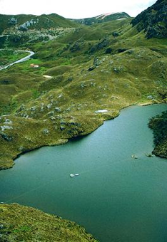
NOAA/WDS Paleoclimatology - Lake CF8, Baffin Island 2,400 Year Multiproxy Sediment Data
Access & Use Information
Downloads & Resources
-
Metadata Landing Page
NCEI landing page with general information and links to access the data.
-
NOAA Study Page
Study page with data access information.
-
NCEI Lake Page
General information for this data type.
-
NCEI Direct DownloadEXCEL
Direct download links for dataset files.
-
NCEI Direct DownloadTEXT
Direct download links for dataset files.
-
NCEI Contact Information
Information for contacts at NCEI.
-
GCMD Keyword Forum Page
Global Change Master Directory (GCMD). 2024. GCMD Keywords, Version 19....
-
GCMD Keyword Forum Page
Global Change Master Directory (GCMD). 2024. GCMD Keywords, Version 19....
-
PaST Thesaurus
-
GCMD Keyword Forum Page
Global Change Master Directory (GCMD). 2024. GCMD Keywords, Version 19....
-
Associated Reference published 2008
Thomas, E.K., Y. Axford, and J.P. Briner, 2008: Rapid 20th century...
Dates
| Metadata Date | August 6, 2024 |
|---|---|
| Metadata Created Date | December 2, 2022 |
| Metadata Updated Date | September 1, 2024 |
| Reference Date(s) | March 12, 2010 (publication) |
| Frequency Of Update |
Metadata Source
- ISO-19139 ISO-19139 Metadata
Harvested from NGDC Paleo
Graphic Preview

Additional Metadata
| Resource Type | Dataset |
|---|---|
| Metadata Date | August 6, 2024 |
| Metadata Created Date | December 2, 2022 |
| Metadata Updated Date | September 1, 2024 |
| Reference Date(s) | March 12, 2010 (publication) |
| Responsible Party | NOAA National Centers for Environmental Information (Point of Contact); NOAA World Data Service for Paleoclimatology (Point of Contact) |
| Contact Email | |
| Guid | noaa-lake-10457 |
| Access Constraints | Cite as: Thomas, E.K.; Axford, Y.; Briner, J.P. (2010-03-12): NOAA/WDS Paleoclimatology - Lake CF8, Baffin Island 2,400 Year Multiproxy Sediment Data. [indicate subset used]. NOAA National Centers for Environmental Information. https://doi.org/10.25921/dk43-t366. Accessed [date]., Distribution liability: NOAA and NCEI make no warranty, expressed or implied, regarding these data, nor does the fact of distribution constitute such a warranty. NOAA and NCEI cannot assume liability for any damages caused by any errors or omissions in these data. If appropriate, NCEI can only certify that the data it distributes are an authentic copy of the records that were accepted for inclusion in the NCEI archives., Use liability: NOAA and NCEI cannot provide any warranty as to the accuracy, reliability, or completeness of furnished data. Users assume responsibility to determine the usability of these data. The user is responsible for the results of any application of this data for other than its intended purpose., None, Please cite original publication, online resource, dataset and publication DOIs (where available), and date accessed when using downloaded data. If there is no publication information, please cite investigator, title, online resource, and date accessed. The appearance of external links associated with a dataset does not constitute endorsement by the Department of Commerce/National Oceanic and Atmospheric Administration of external Web sites or the information, products or services contained therein. For other than authorized activities, the Department of Commerce/NOAA does not exercise any editorial control over the information you may find at these locations. These links are provided consistent with the stated purpose of this Department of Commerce/NOAA Web site. |
| Bbox East Long | -68.95 |
| Bbox North Lat | 70.558 |
| Bbox South Lat | 70.558 |
| Bbox West Long | -68.95 |
| Coupled Resource | |
| Frequency Of Update | |
| Graphic Preview Description | Paleoclimatology - Lake |
| Graphic Preview File | https://www.ncei.noaa.gov/pub/data/paleo/webimages/pc-default-lake.png |
| Graphic Preview Type | PNG |
| Harvest Object Id | 5580e5ae-21ca-4dc1-a4ec-94cddfac9eeb |
| Harvest Source Id | ee428166-33c7-4eef-aee8-66156e0e9e08 |
| Harvest Source Title | NGDC Paleo |
| Licence | |
| Lineage | |
| Metadata Language | eng; USA |
| Metadata Type | geospatial |
| Old Spatial | {"type": "Point", "coordinates": [-68.95, 70.558]} |
| Progress | completed |
| Spatial Data Service Type | |
| Spatial Reference System | |
| Spatial Harvester | True |
| Temporal Extent Begin | -440 |
| Temporal Extent End | 2005 |
Didn't find what you're looking for? Suggest a dataset here.

