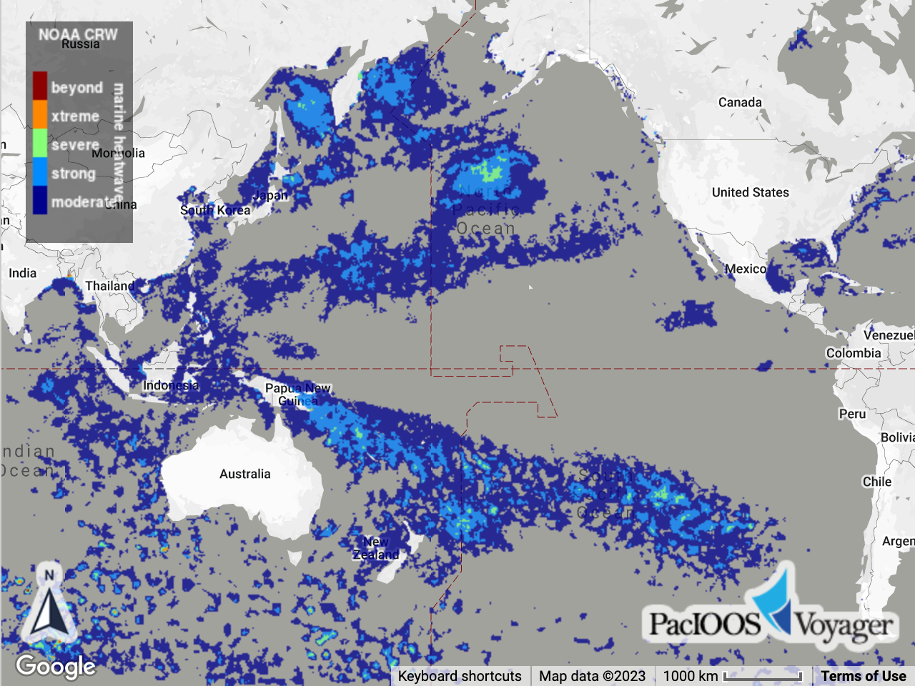
NOAA Coral Reef Watch Daily Global 5-km Satellite Monitoring Marine Heatwave Watch
Access & Use Information
Downloads & Resources
-
THREDDS Catalog
This URL provides a catalog page for this dataset within THREDDS Data Server...
-
File InformationHTML
This URL provides a standard OPeNDAP html interface for selecting data from...
-
PacIOOS Voyager (Google Maps API)
This URL provides a viewer and/or data access for this dataset.
-
ERDDAP
This URL provides a viewer and/or data access for this dataset.
-
ERDDAP
This URL provides a viewer and/or data access for this dataset.
-
Related URL
This URL provides additional information related to this dataset.
-
Web Resource
-
Web Resourceapplication/vnd.lotus-organizer
35 views
-
Web Resource
-
Web Resource
-
OPeNDAP
THREDDS OPeNDAP
-
Web Resource
-
OGC-WCSWCS
Open Geospatial Consortium Web Coverage Service (WCS)
-
Web Resource
-
OGC-WMSWMS
Open Geospatial Consortium Web Map Service (WMS)
-
Web Resource
-
THREDDS_NetCDF_SubsetHTML
THREDDS NetCDF Subset Service
Dates
| Metadata Date | February 16, 2024 |
|---|---|
| Metadata Created Date | October 7, 2023 |
| Metadata Updated Date | February 23, 2024 |
| Reference Date(s) | November 19, 2019 (creation), November 19, 2019 (issued), September 22, 2021 (revision) |
| Frequency Of Update |
Metadata Source
- ISO-19139 ISO-19139 Metadata
Harvested from ioos
Graphic Preview

Additional Metadata
| Resource Type | Dataset |
|---|---|
| Metadata Date | February 16, 2024 |
| Metadata Created Date | October 7, 2023 |
| Metadata Updated Date | February 23, 2024 |
| Reference Date(s) | November 19, 2019 (creation), November 19, 2019 (issued), September 22, 2021 (revision) |
| Responsible Party | NOAA Coral Reef Watch (CRW) (Point of Contact) |
| Contact Email | |
| Guid | mhw_5km |
| Access Constraints | |
| Bbox East Long | 179.97501 |
| Bbox North Lat | 89.975 |
| Bbox South Lat | -89.975 |
| Bbox West Long | -179.97501 |
| Coupled Resource | [{"title": [], "href": ["#DataIdentification"], "uuid": []}, {"title": [], "href": ["#DataIdentification"], "uuid": []}, {"title": [], "href": ["#DataIdentification"], "uuid": []}, {"title": [], "href": ["#DataIdentification"], "uuid": []}] |
| Frequency Of Update | |
| Graphic Preview Description | Sample image. |
| Graphic Preview File | http://pacioos.org/metadata/browse/mhw_5km.png |
| Harvest Object Id | c7cae6db-a9c9-49ba-8727-7af7feaaf9a6 |
| Harvest Source Id | 54e15a6e-6dde-4c9c-a8f0-345cc0dfccfb |
| Harvest Source Title | ioos |
| Licence | |
| Lineage | 2021-09-22T12:00:00Z Initial version released: v1.0. 2021-09-22T12:00:00Z Version 1.0.1 released. Fixed minor compatibility issue loading data into GIS applications by altering dimension names and coordinate variable names. 2023-01-05T19:26:00Z Data obtained from NOAA Coral Reef Watch and re-distributed via THREDDS Data Server (TDS) at PacIOOS to provide temporal aggregation and distribution through NetCDF/OPeNDAP utilities like ncWMS and ERDDAP. 2024-01-12T22:35:00Z Due to ongoing difficulty serving the entire time series aggregation through TDS, we are now limiting access to the latest 3 years. For the full time series, see PacIOOS ERDDAP instead. |
| Metadata Language | eng |
| Metadata Type | geospatial |
| Old Spatial | {"type": "Polygon", "coordinates": [[[-179.97501, -89.975], [179.97501, -89.975], [179.97501, 89.975], [-179.97501, 89.975], [-179.97501, -89.975]]]} |
| Progress | |
| Spatial Data Service Type | THREDDS OPeNDAP |
| Spatial Reference System | |
| Spatial Harvester | True |
| Temporal Extent Begin | 2021-02-15T12:00:00Z |
| Temporal Extent End | 2024-02-14T12:00:00Z |
Didn't find what you're looking for? Suggest a dataset here.

