

Datasets
-
GPM MHS on METOP-B Common Calibrated Brightness Temperature L1C 1.5 hours 17 km V07 (GPM_1CMETOPBMHS) at GES DISC
Version 07 is the current version of the data set. Older versions will no longer be available and have been superseded by Version 07.1CAMSR2 contains common calibrated... -
GPM IMERG Early Precipitation L3 1 day 0.1 degree x 0.1 degree V07 (GPM_3IMERGDE) at GES DISC
Version 07 is the current version of the data set. Older versions will no longer be available and have been superseded by Version 07.The Integrated Multi-satellitE Retrievals... -
JPSS-2 CrIS IMG: Collocated VIIRS level 1 / cloud mask statistical summary V3.0 (SNDRJ2CrISL1BIMG) at GES DISC
The Cross-track Infrared Sounder (CrIS) Level 1B Full Spectral Resolution (FSR) data files contain radiance measurements along with ancillary spacecraft, instrument, and... -
HNX/DragonTIGER Instrument Development Project
Precisely identifying the species of cosmic-ray nuclei detected by a satellite or balloon instrument requires the use of several complementary detector systems. In particular,... -
ISS_COORDS_2021-02-02
This data represents the best estimated real-time trajectory and local sightings opportunities for the International Space Station (ISS) as generated by the Trajectory... -
GPM GROUND VALIDATION DC-8 NAVIGATION AND HOUSEKEEPING DATA GCPEX V1
The GPM Ground Validation DC-8 Navigation and Housekeeping Data GCPEx dataset, which is composed of two types of files. GCPEx addressed shortcomings in the GPM snowfall... -
SatCORPS CERES GEO Edition 4 Meteosat-8 Southern Hemisphere Version 1.0
CER_GEO_Ed4_MET08_SH_V01 is the Satellite Cloud and Radiation Property retrieval System (SatCORPS) Clouds and the Earth's Radiant Energy System (CERES) Geostationary Satellite... -
IceBridge Photon Counting Lidar L1B Unclassified Geolocated Photon Elevations V001
This data set contains geolocated photon elevations captured over Antarctica using the Sigma Space photon counting lidar. The data were collected by scientists working on the... -
Global Land Survey 1990
Global Land Survey 1990 images were acquired from 1987 to 1997 by Landsat 4-5 TM. The U.S. Geological Survey (USGS) and the National Aeronautics and Space Administration (NASA)... -
NASA open-source code projects with A.I.-generated tags
A JSON that is used to build the content on code.nasa.gov. This JSON contains names, descriptions, links, and keyword tags for all NASA open-sourced code projects released... -
Terra MODIS Level-2 Regional 4µm Nighttime Sea Surface Temperature (SST4) Data, version R2019.0 NGDA
MODIS (or Moderate-Resolution Imaging Spectroradiometer) is a key instrument aboard the Terra (EOS AM) and Aqua (EOS PM) satellites. Terra's orbit around the Earth is timed so... -
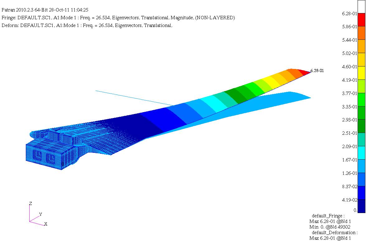
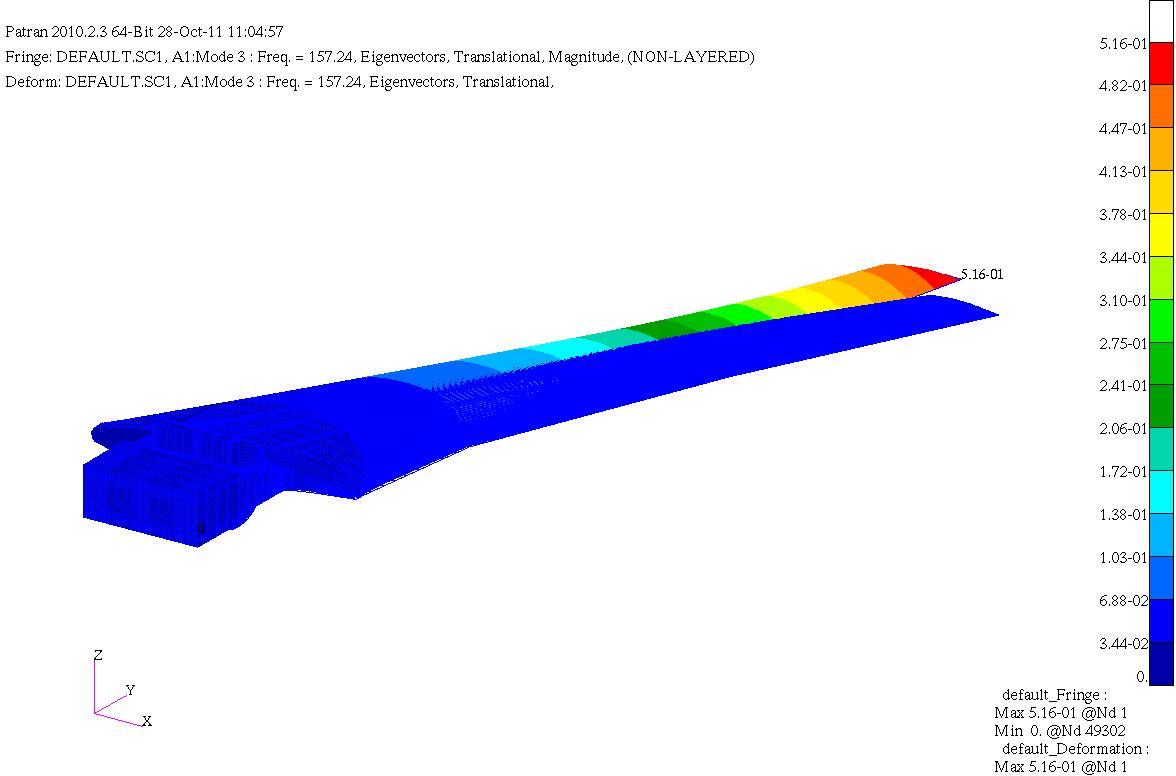
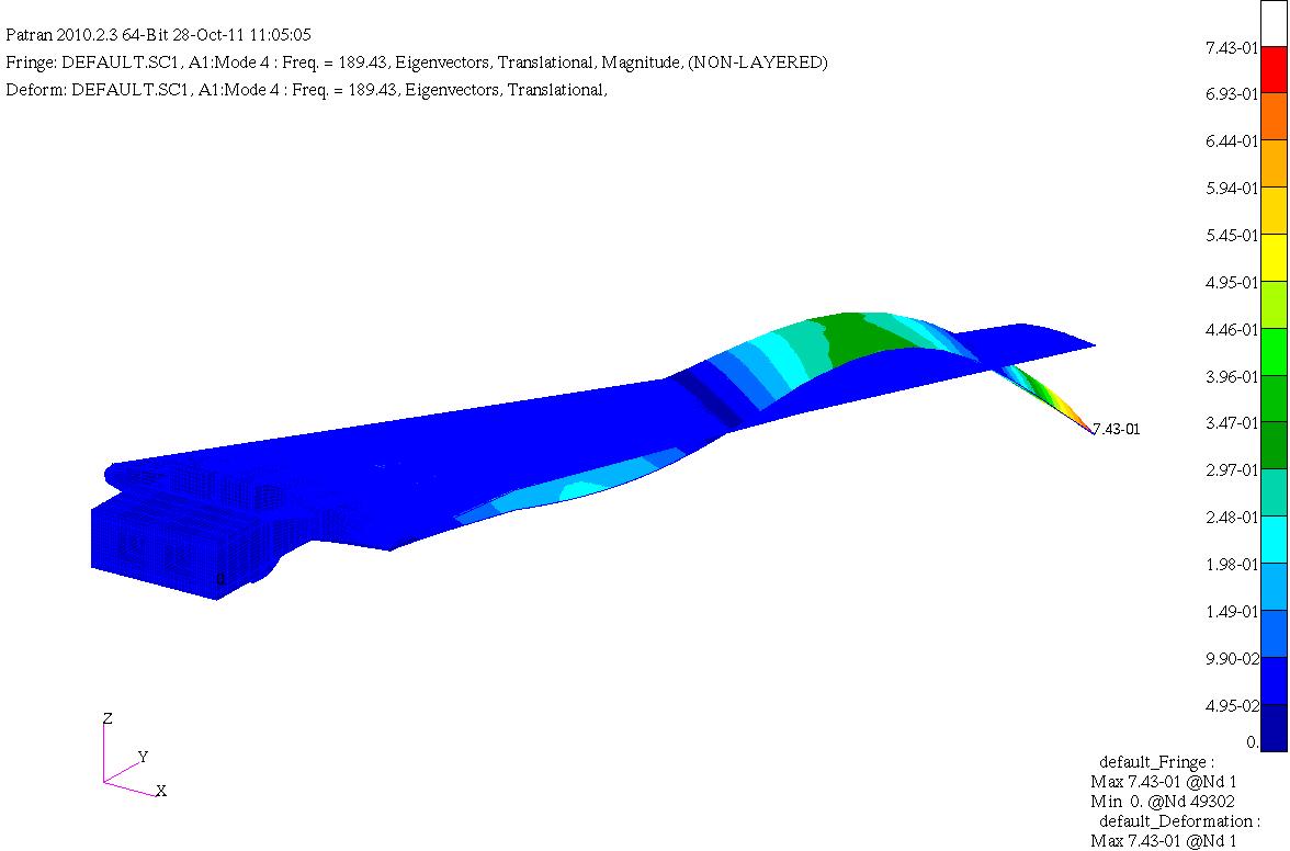
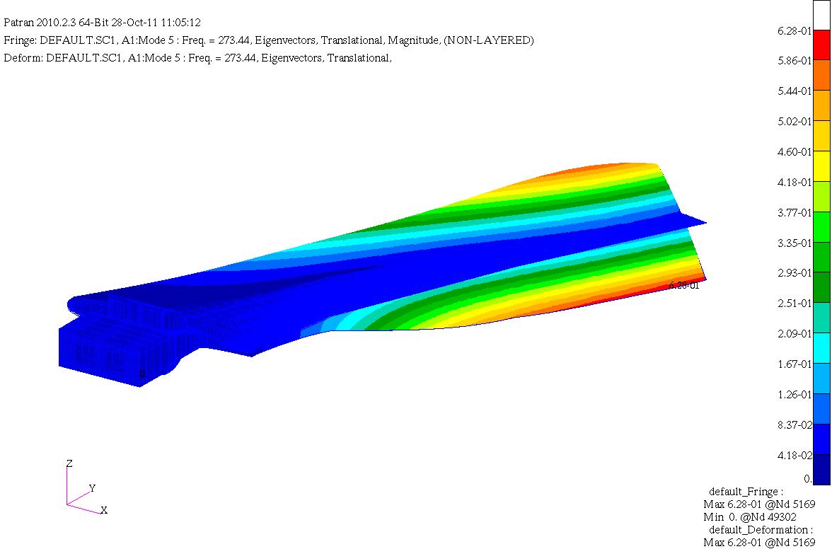
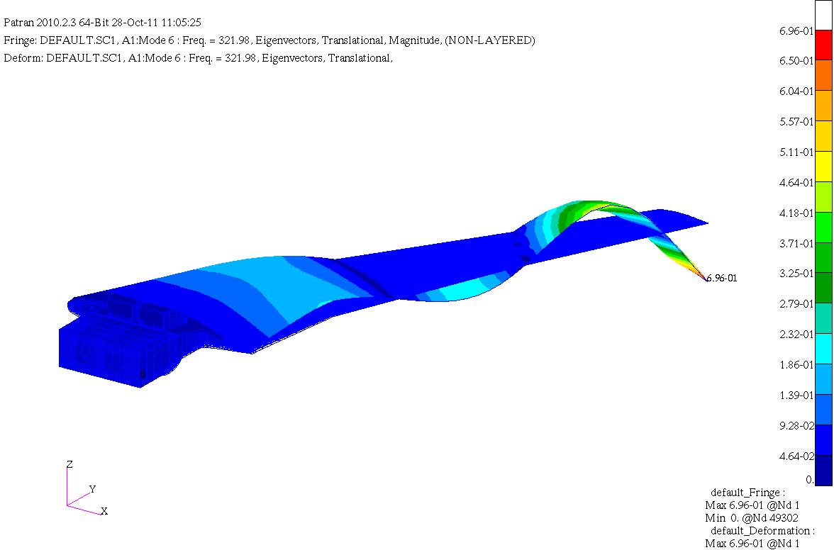
RSW Fully Tet Coarse Mesh
This is the fully tetra coarse mesh for the RSW based on gridding guidelines. -
MetOp-C ASCAT Level 2 Ocean Surface Wind Vectors Optimized for Coastal Ocean
This dataset contains operational near-real-time Level 2 coastal ocean surface wind vector retrievals from the Advanced Scatterometer (ASCAT) on MetOp-C at 12.5 km sampling... -
LVIS Classic L2 Geolocated Surface Elevation and Canopy Height Product V001
This data set contains Level-2 geolocated surface elevation and canopy height measurements collected by the NASA Land, Vegetation, and Ice Sensor (LVIS) Facility, an imaging... -
Turbulence Models: Shock Boundary Layer Interaction at M=2.05
Exp: Shock Boundary Layer Interaction at M=2.05. This web page provides data from experiments that may be useful for the validation of turbulence models. This resource is... -
GLAS/ICESat L1A Global Altimetry Data (HDF5) V033
Level-1A altimetry data (GLAH01) include the transmitted and received waveform from the altimeter. Each data granule has an associated browse product. -
ISS_COORDS_2021-08-15
This data represents the best estimated real-time trajectory and local sightings opportunities for the International Space Station (ISS) as generated by the Trajectory... -
AVHRR 1-km Global Land 10-Day Composites
The Advanced Very High Resolution Radiometer (AVHRR) 1-km Global Land 10-Day Composites data set project is a component of the National Aeronautics and Space Administration...