NACP: Climate Data Inputs (3-hourly) for Community Land Model, Western USA, 1979-2015
Access & Use Information
Downloads & Resources
-
Google Scholar search resultsHTML
Search results for publications that cite this dataset by its DOI.
-
Download this datasetHTML
This link allows direct data access via Earthdata login
-
View documentation related to this datasetHTML
ORNL DAAC Data Set Documentation
-
This dataset's landing pageHTML
Data set Landing Page DOI URL
-
Use OPeNDAP to access the dataset's dataHTML
USE SERVICE API
-
View documentation related to this datasetPDF
NACP: Climate Data Inputs (3-hourly) for Community Land Model, Western USA,...
-
View documentation related to this datasetPDF
NACP: Climate Data Inputs (3-hourly) for Community Land Model, Western USA,...
-
Get a related visualizationPNG
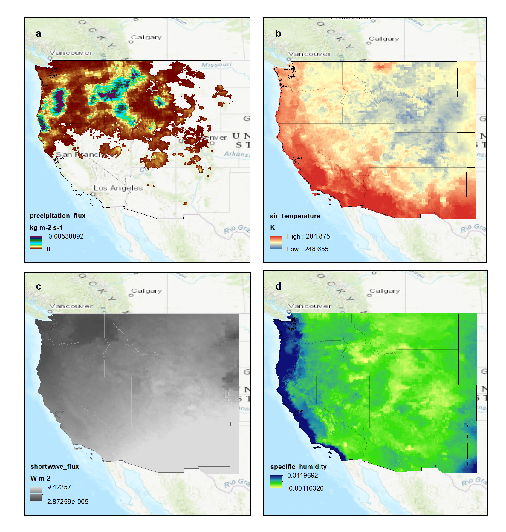
Four variables for the same 3-hour timestep, December 8, 2015, 12:00 AM to...
-
Landing PageLanding Page
Dates
| Metadata Created Date | May 30, 2023 |
|---|---|
| Metadata Updated Date | December 6, 2023 |
Metadata Source
- Data.json Data.json Metadata
Harvested from NASA Data.json
Graphic Preview

Additional Metadata
| Resource Type | Dataset |
|---|---|
| Metadata Created Date | May 30, 2023 |
| Metadata Updated Date | December 6, 2023 |
| Publisher | ORNL_DAAC |
| Maintainer | |
| Identifier | C2517357574-ORNL_CLOUD |
| Data First Published | 2020-11-18 |
| Language | en-US |
| Data Last Modified | 2023-07-17 |
| Category | NACP, geospatial |
| Public Access Level | public |
| Bureau Code | 026:00 |
| Metadata Context | https://project-open-data.cio.gov/v1.1/schema/catalog.jsonld |
| Metadata Catalog ID | https://data.nasa.gov/data.json |
| Schema Version | https://project-open-data.cio.gov/v1.1/schema |
| Catalog Describedby | https://project-open-data.cio.gov/v1.1/schema/catalog.json |
| Citation | Rupp, D., and P. Buotte. 2020. NACP: Climate Data Inputs (3-hourly) for Community Land Model, Western USA, 1979-2015. ORNL DAAC, Oak Ridge, Tennessee, USA. https://doi.org/10.3334/ORNLDAAC/1682 |
| Graphic Preview Description | Four variables for the same 3-hour timestep, December 8, 2015, 12:00 AM to 3:00 AM, a) precipitation flux (kg m-2 s-1) b) air temperature (K) c) shortwave radiation flux (W m-2) d) specific humidity. Source: western_USA_precipitation_3hr_2015-12.nc4 |
| Graphic Preview File | https://daac.ornl.gov/NACP/guides/HighRes_ClimateData_Western_US_Fig1.png |
| Harvest Object Id | 428845f1-50e7-490e-96a0-ac0b561dc854 |
| Harvest Source Id | 58f92550-7a01-4f00-b1b2-8dc953bd598f |
| Harvest Source Title | NASA Data.json |
| Homepage URL | https://doi.org/10.3334/ORNLDAAC/1682 |
| Metadata Type | geospatial |
| Old Spatial | -124.81 31.19 -101.98 49.02 |
| Program Code | 026:001 |
| Source Datajson Identifier | True |
| Source Hash | 229105cfdc160c483e96f4bb96224373d9fd7094363481c7204397705b000cdc |
| Source Schema Version | 1.1 |
| Spatial | |
| Temporal | 1979-01-01T00:00:00Z/2016-01-01T23:59:59Z |
Didn't find what you're looking for? Suggest a dataset here.

