

Multi-Satellite Merged Ozone (O3) Profile and Total Column 1 Month Zonal Mean L3 Global 5.0 degree Latitude Zones V1 (MSO3L3zm5) at GES DISC
Access & Use Information
Public: This dataset is intended for public access and use.
License: No license information was provided. If this work was prepared by an officer or employee of the United States government as part of that person's official duties it is considered a U.S. Government Work.
Downloads & Resources
-
Data Information (PNG)PNG
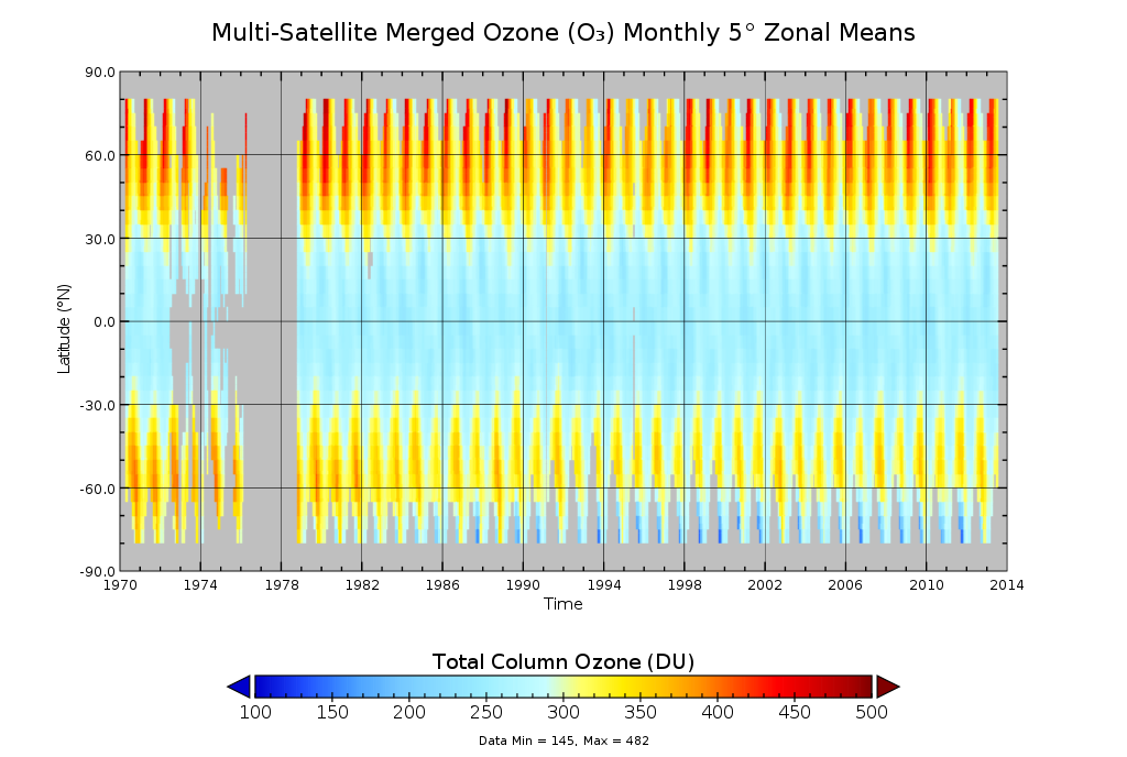
MSO3L3zm5_1.png
-
Data Information (HTML)HTML
MSO3L3zm5_1.html
-
Data Information (Unknown Format)BIN
-
Data Information (HTML)HTML
MSO3L3zm5_v01-02-2013m0907t142428.h5.html
-
Data Information (XML)XML
catalog.xml
-
Landing PageLanding Page
Dates
| Metadata Created Date | April 11, 2025 |
|---|---|
| Metadata Updated Date | September 19, 2025 |
Metadata Source
- Data.json Data.json Metadata
Harvested from NASA Data.json
Additional Metadata
| Resource Type | Dataset |
|---|---|
| Metadata Created Date | April 11, 2025 |
| Metadata Updated Date | September 19, 2025 |
| Publisher | NASA/GSFC/SED/ESD/TISL/GESDISC |
| Maintainer | |
| Identifier | 10.5067/MEASURES/OZONE/DATA310 |
| Data Last Modified | 2025-09-11 |
| Category | Earth Science |
| Public Access Level | public |
| Bureau Code | 026:00 |
| Metadata Context | https://project-open-data.cio.gov/v1.1/schema/catalog.jsonld |
| Schema Version | https://project-open-data.cio.gov/v1.1/schema |
| Catalog Describedby | https://project-open-data.cio.gov/v1.1/schema/catalog.json |
| Harvest Object Id | 700af845-4b2f-4bb3-86c1-b3fd4595e1bc |
| Harvest Source Id | 58f92550-7a01-4f00-b1b2-8dc953bd598f |
| Harvest Source Title | NASA Data.json |
| Homepage URL | https://docserver.gesdisc.eosdis.nasa.gov/public/project/Images/MSO3L3zm5_1.png |
| Old Spatial | "CARTESIAN",{"WestBoundingCoordinate":-180,"NorthBoundingCoordinate":80,"EastBoundingCoordinate":180,"SouthBoundingCoordinate":-80} |
| Program Code | 026:000 |
| Source Datajson Identifier | True |
| Source Hash | e255e78abd5ecf77e219da8aa975f94d77a242702284d2377665f236406633ef |
| Source Schema Version | 1.1 |
| Spatial | |
| Temporal | 1970-05-01/1970-05-01 |
Didn't find what you're looking for? Suggest a dataset here.