

MISR Level 2 TOA/Cloud Aerosol Product subset for the VBBE region V002
Access & Use Information
Downloads & Resources
-
Data Information (HTML)HTML
misr_loc.html
-
Data Information (Unknown Format)BIN
-
Data Information (Unknown Format)BIN
-
Data Information (Unknown Format)BIN
-
Data Information (JPEG)JPEG
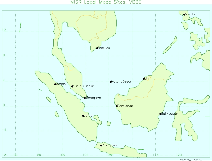
local_mode_vbbe.jpg
-
Data Information (Unknown Format)BIN
misr_campaign_vbbe.kml
-
Data Information (PDF)PDF
ASDC_MISR_Overview_2023.pdf
-
Data Information (HTML)HTML
VBEMI2AE.002
-
Data Information (Unknown Format)BIN
-
Data Information (Unknown Format)BIN
-
Data Information (PDF)PDF
terra-maneuvers.pdf
-
Data Information (Unknown Format)BIN
-
Data Information (PDF)PDF
L2TC_Cloud_Product.pdf
-
Data Information (PDF)PDF
file_descriptions.pdf
-
Data Information (PDF)PDF
misr_ov2.pdf
-
Data Information (PDF)PDF
index.pdf
-
Data Information (PDF)PDF
pge9.pdf
-
Data Information (PDF)PDF
specific_products.pdf
-
Data Information (PDF)PDF
misr_dps.pdf
-
Data Information (PDF)PDF
vbbe_calendar.pdf
-
Data Information (HTML)HTML
overview.html
-
Data Information (PDF)PDF
L2_AS_Products.pdf
-
Data Information (PDF)PDF
NASA_SOP_2008_Aerosols_over_Australia.pdf
-
Data Information (HTML)HTML
contents.html
-
Data Information (Unknown Format)BIN
-
Data Information (Unknown Format)BIN
-
Data Information (Unknown Format)BIN
-
Data Information (Unknown Format)BIN
-
Data Information (Unknown Format)BIN
-
Data Information (PDF)PDF
vbbe.pdf
-
Data Information (PDF)PDF
DPS_Cloud_V001.pdf
-
Data Information (PDF)PDF
NASA_SOP_2005_Cloudy_with_a_Chance_of_Drizzle.pdf
-
Data Information (PDF)PDF
NASA_SOP_2009_Smoke_over_Athens.pdf
-
Data Information (PDF)PDF
NASA_SOP_2007_Following_the_World_Trade_Center_plume.pdf
-
Data Information (PDF)PDF
MISR_Science_Data_Product_Guide.pdf
-
Data Information (PDF)PDF
DPS_AEROSOL_V023.20180125.pdf
-
Data Information (Unknown Format)BIN
misr_paths.kml
-
Landing PageLanding Page
Dates
| Metadata Created Date | April 9, 2025 |
|---|---|
| Metadata Updated Date | September 19, 2025 |
Metadata Source
- Data.json Data.json Metadata
Harvested from NASA Data.json
Additional Metadata
| Resource Type | Dataset |
|---|---|
| Metadata Created Date | April 9, 2025 |
| Metadata Updated Date | September 19, 2025 |
| Publisher | NASA/LARC/SD/ASDC;NASA/JPL/MISR |
| Maintainer | |
| Identifier | 10.5067/TERRA/MISR/VBEMI2AE.002 |
| Data Last Modified | 2025-09-11 |
| Category | Earth Science |
| Public Access Level | public |
| Bureau Code | 026:00 |
| Metadata Context | https://project-open-data.cio.gov/v1.1/schema/catalog.jsonld |
| Schema Version | https://project-open-data.cio.gov/v1.1/schema |
| Catalog Describedby | https://project-open-data.cio.gov/v1.1/schema/catalog.json |
| Harvest Object Id | ad9fb37b-b651-40a5-a697-3b3f726d0795 |
| Harvest Source Id | 58f92550-7a01-4f00-b1b2-8dc953bd598f |
| Harvest Source Title | NASA Data.json |
| Homepage URL | https://l0dup05.larc.nasa.gov/misr_loc/misr_loc.html |
| Old Spatial | "CARTESIAN",{"WestBoundingCoordinate":-180,"NorthBoundingCoordinate":90,"EastBoundingCoordinate":180,"SouthBoundingCoordinate":-90} |
| Program Code | 026:000 |
| Source Datajson Identifier | True |
| Source Hash | 20e370ebd7cb7af6c536ea48e5aeaecdc99026cb0ae75545a1e146b05988ed0f |
| Source Schema Version | 1.1 |
| Spatial | |
| Temporal | 2007-08-01/2007-08-01 |
Didn't find what you're looking for? Suggest a dataset here.