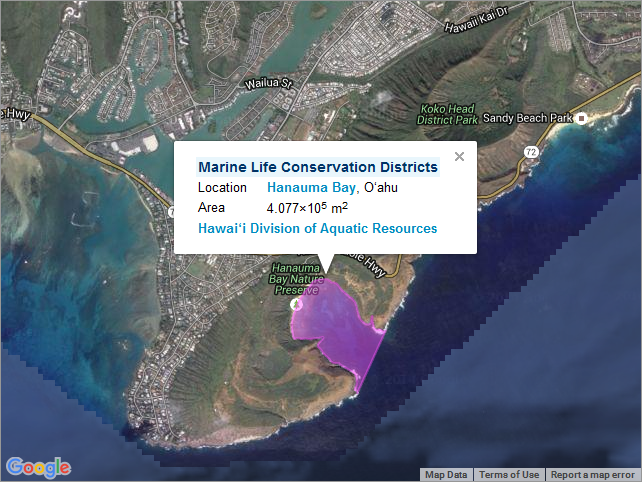
Marine Life Conservation Districts - Hawaii
Access & Use Information
Downloads & Resources
-
Web Resource
-
Web Resource
35 views
-
Web Resource
-
Web Resource
-
Web Resource
35 views
-
OGC-WFSWFS
Open Geospatial Consortium Web Feature Service (WFS). Supported WFS versions...
-
Web Resource
-
Web Resource
35 views
-
OGC-WMSWMS
Open Geospatial Consortium Web Map Service (WMS). Supported WMS versions...
-
Web Resource
-
Web Resource
35 views
-
OGC-WMS-CWMS
21 views
Open Geospatial Consortium Web Map Service - Cached (WMS-C). Use of WMS-C is...
Dates
| Metadata Date | March 30, 2021 |
|---|---|
| Metadata Created Date | November 12, 2020 |
| Metadata Updated Date | October 14, 2022 |
| Reference Date(s) | January 25, 2016 (creation), January 25, 2016 (issued), January 25, 2016 (revision) |
| Frequency Of Update |
Metadata Source
- ISO-19139 ISO-19139 Metadata
Harvested from ioos
Graphic Preview

Additional Metadata
| Resource Type | Dataset |
|---|---|
| Metadata Date | March 30, 2021 |
| Metadata Created Date | November 12, 2020 |
| Metadata Updated Date | October 14, 2022 |
| Reference Date(s) | January 25, 2016 (creation), January 25, 2016 (issued), January 25, 2016 (revision) |
| Responsible Party | Hawaii Statewide GIS Program (Point of Contact) |
| Contact Email | |
| Guid | hi_sohdop_all_mlcd |
| Access Constraints | |
| Bbox East Long | -154.816699971 |
| Bbox North Lat | 21.6548199994 |
| Bbox South Lat | 19.4702963218 |
| Bbox West Long | -158.0702831 |
| Coupled Resource | [{"title": [], "href": ["#DataIdentification"], "uuid": []}, {"title": [], "href": ["#DataIdentification"], "uuid": []}, {"title": [], "href": ["#DataIdentification"], "uuid": []}] |
| Frequency Of Update | |
| Graphic Preview Description | Sample image. |
| Graphic Preview File | http://pacioos.org/metadata/browse/hi_sohdop_all_mlcd.png |
| Harvest Object Id | 81361243-65b6-4344-8134-cc6005c93d01 |
| Harvest Source Id | 54e15a6e-6dde-4c9c-a8f0-345cc0dfccfb |
| Harvest Source Title | ioos |
| Licence | |
| Metadata Language | eng |
| Metadata Type | geospatial |
| Old Spatial | {"type": "Polygon", "coordinates": [[[-158.0702831, 19.4702963218], [-154.816699971, 19.4702963218], [-154.816699971, 21.6548199994], [-158.0702831, 21.6548199994], [-158.0702831, 19.4702963218]]]} |
| Progress | |
| Spatial Data Service Type | Open Geospatial Consortium Web Feature Service (WFS) |
| Spatial Reference System | |
| Spatial Harvester | True |
Didn't find what you're looking for? Suggest a dataset here.

