

LUMCON Marine Center, LA
Access & Use Information
Downloads & Resources
-
DescribeSensor - Station: LUML1sos
DescribeSensor URL for station LUMCON Marine Center, LA
-
Station: LUML1 - Air pressure - JSONsos
GetObservation download link for Air pressure in JSON
-
Station: LUML1 - Air pressure - XML (IOOS SOS...sos
GetObservation download link for Air pressure in XML (IOOS SOS v1.0 Profile)
-
Station: LUML1 - Air temperature - JSONsos
GetObservation download link for Air temperature in JSON
-
Station: LUML1 - Air temperature - XML (IOOS...sos
GetObservation download link for Air temperature in XML (IOOS SOS v1.0 Profile)
-
Station: LUML1 - Mass concentration of...sos
GetObservation download link for Mass concentration of chlorophyll in sea...
-
Station: LUML1 - Mass concentration of...sos
GetObservation download link for Mass concentration of chlorophyll in sea...
-
Station: LUML1 - Mass concentration of oxygen...sos
GetObservation download link for Mass concentration of oxygen in sea water in...
-
Station: LUML1 - Mass concentration of oxygen...sos
GetObservation download link for Mass concentration of oxygen in sea water in...
-
Station: LUML1 - Relative humidity - JSONsos
GetObservation download link for Relative humidity in JSON
-
Station: LUML1 - Relative humidity - XML (IOOS...sos
GetObservation download link for Relative humidity in XML (IOOS SOS v1.0...
-
Station: LUML1 - Sea water practical salinity - JSONsos
GetObservation download link for Sea water practical salinity in JSON
-
Station: LUML1 - Sea water practical salinity...sos
GetObservation download link for Sea water practical salinity in XML (IOOS...
-
Station: LUML1 - Sea water temperature - JSONsos
GetObservation download link for Sea water temperature in JSON
-
Station: LUML1 - Sea water temperature - XML...sos
GetObservation download link for Sea water temperature in XML (IOOS SOS v1.0...
-
Station: LUML1 - Wind speed - JSONsos
GetObservation download link for Wind speed in JSON
-
Station: LUML1 - Wind speed - XML (IOOS SOS...sos
GetObservation download link for Wind speed in XML (IOOS SOS v1.0 Profile)
-
Station: LUML1 - Wind speed of gust - JSONsos
GetObservation download link for Wind speed of gust in JSON
-
Station: LUML1 - Wind speed of gust - XML...sos
GetObservation download link for Wind speed of gust in XML (IOOS SOS v1.0...
-
Station: LUML1 - Wind to direction - JSONsos
GetObservation download link for Wind to direction in JSON
-
Station: LUML1 - Wind to direction - XML (IOOS...sos
GetObservation download link for Wind to direction in XML (IOOS SOS v1.0...
-
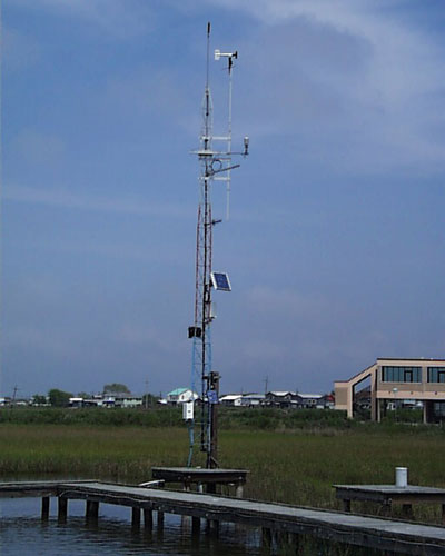
JPEG Image FileJPEG
luml1.jpg
-
Web Resource
-
Web Resourceapplication/vnd.lotus-organizer
-
Web Resource
-
Web Resourceapplication/vnd.lotus-organizer
-
Web Resourceapplication/vnd.lotus-organizer
-
52N SOSsos
Open Geospatial Consortium Sensor Observation Service (SOS)
Dates
| Metadata Date | September 11, 2020 |
|---|---|
| Metadata Created Date | October 7, 2023 |
| Metadata Updated Date | October 7, 2023 |
| Reference Date(s) | 2020 (publication) |
| Frequency Of Update | continual |
Metadata Source
- ISO-19139 ISO-19139 Metadata
Harvested from ioos
Additional Metadata
| Resource Type | Dataset |
|---|---|
| Metadata Date | September 11, 2020 |
| Metadata Created Date | October 7, 2023 |
| Metadata Updated Date | October 7, 2023 |
| Reference Date(s) | 2020 (publication) |
| Responsible Party | Gulf of Mexico Coastal and Ocean Observing System (Point of Contact) |
| Contact Email | |
| Guid | gcoos1.tamu.edu:8080-urn_ioos_station_lumcon_luml1 |
| Access Constraints | |
| Bbox East Long | -90.66333 |
| Bbox North Lat | 29.25333 |
| Bbox South Lat | 29.25333 |
| Bbox West Long | -90.66333 |
| Coupled Resource | [{"title": [], "href": ["#DataIdentification"], "uuid": []}] |
| Frequency Of Update | continual |
| Harvest Object Id | de2ec24f-c810-4525-8fec-183d0aeaa566 |
| Harvest Source Id | 54e15a6e-6dde-4c9c-a8f0-345cc0dfccfb |
| Harvest Source Title | ioos |
| Licence | |
| Lineage | |
| Metadata Language | eng; USA |
| Metadata Type | geospatial |
| Old Spatial | {"type": "Point", "coordinates": [-90.66333, 29.25333]} |
| Progress | onGoing |
| Spatial Data Service Type | OGC:SOS |
| Spatial Reference System | |
| Spatial Harvester | True |
| Temporal Extent Begin | 2020-08-15T00:00:00+00:00 |
| Temporal Extent End | 2020-08-18T20:30:00+00:00 |
Didn't find what you're looking for? Suggest a dataset here.