

ISLSCP II Atmospheric Carbon Dioxide Consumption by Continental Erosion
Access & Use Information
Downloads & Resources
-
Data Information (Unknown Format)BIN
-
Data Information (HTML)HTML
-
Data Information (ZIP)ZIP
atmos_co2_by_erosion_xdeg_1019.zip
-
Data Information (PNG)PNG
1019_1_fit.png
-
Data Information (Unknown Format)BIN
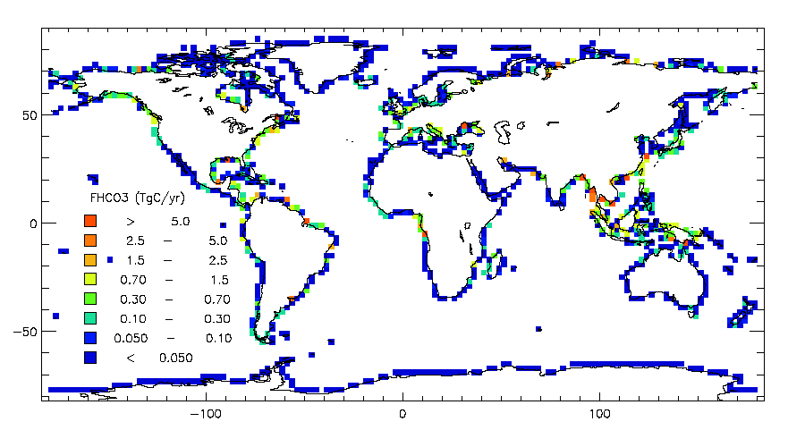
cont_flux_hco3_hd.gif
-
Data Information (PDF)PDF
1_atmos_co2_by_erosion_doc.pdf
-
Data Information (Unknown Format)BIN
ocean_flux_doc_hd.gif
-
Data Information (Unknown Format)BIN
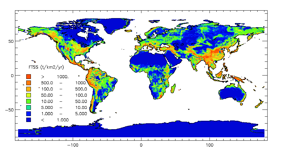
cont_flux_tss_hd.gif
-
Data Information (Unknown Format)BIN
ocean_flux_co2rw_hd.gif
-
Data Information (PDF)PDF
atmos_co2_by_erosion_xdeg.pdf
-
Data Information (Unknown Format)BIN
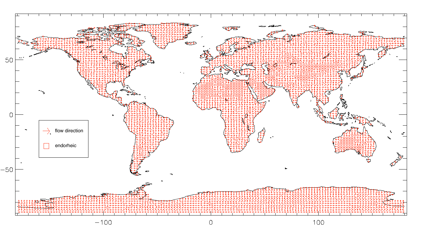
flow_dir.gif
-
Data Information (Unknown Format)BIN
0_atmos_co2_erosion_readme.txt
-
Data Information (Unknown Format)BIN
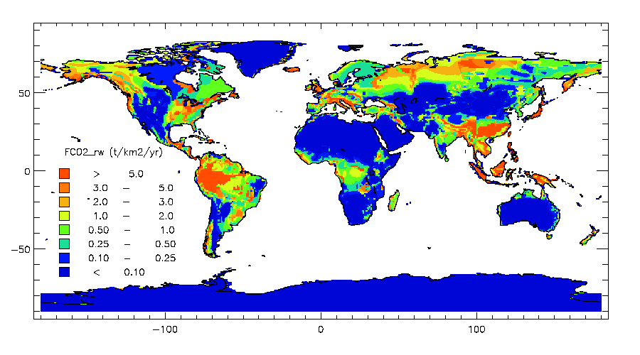
cont_flux_co2rw_hd.gif
-
Data Information (Unknown Format)BIN
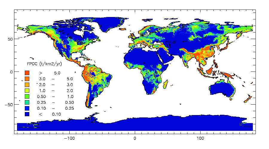
cont_flux_poc_hd.gif
-
Data Information (Unknown Format)BIN
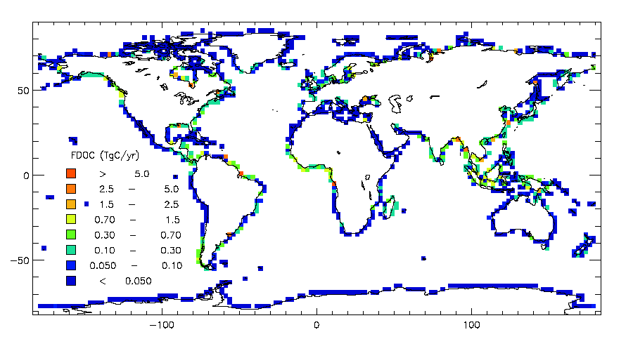
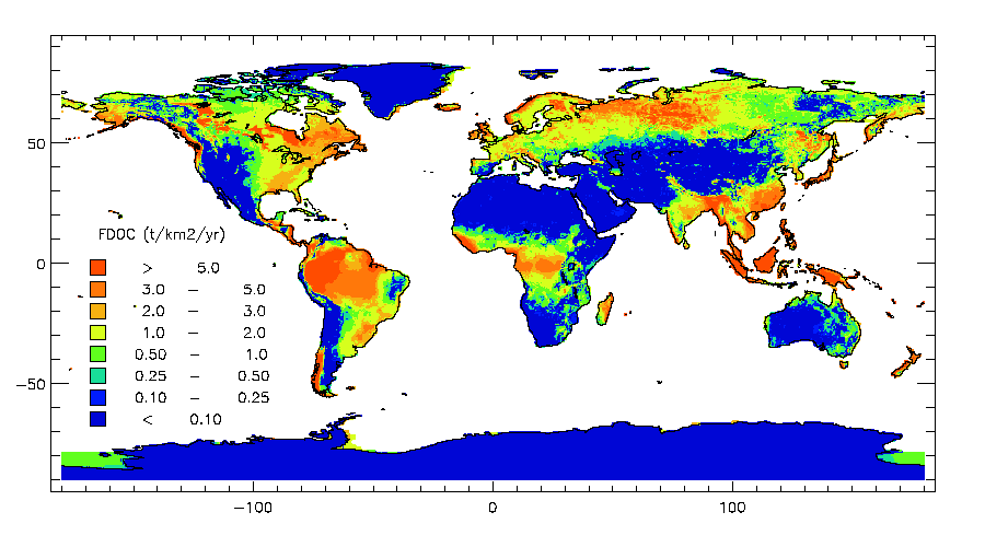
cont_flux_doc_hd.gif
-
Data Information (Unknown Format)BIN
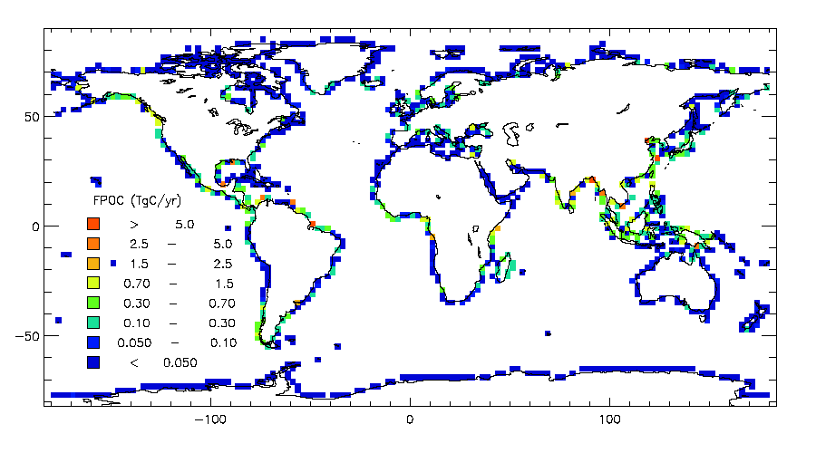
ocean_flux_poc_hd.gif
-
Data Information (Unknown Format)BIN
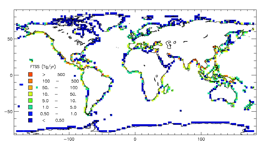
ocean_flux_tss_hd.gif
-
Data Information (Unknown Format)BIN
ocean_flux_hco3_hd.gif
-
Landing PageLanding Page
Dates
| Metadata Created Date | April 11, 2025 |
|---|---|
| Metadata Updated Date | September 19, 2025 |
Metadata Source
- Data.json Data.json Metadata
Harvested from NASA Data.json
Additional Metadata
| Resource Type | Dataset |
|---|---|
| Metadata Created Date | April 11, 2025 |
| Metadata Updated Date | September 19, 2025 |
| Publisher | ORNL_DAAC |
| Maintainer | |
| Identifier | 10.3334/ORNLDAAC/1019 |
| Data Last Modified | 2025-09-11 |
| Category | Earth Science |
| Category Tag 16E15F51 D96E 4051 9124 75665Abdc6Ff | "Arctic","Permafrost and Arctic Landscapes","Arctic Peoples and Ecosystems" |
| Public Access Level | public |
| Bureau Code | 026:00 |
| Metadata Context | https://project-open-data.cio.gov/v1.1/schema/catalog.jsonld |
| Schema Version | https://project-open-data.cio.gov/v1.1/schema |
| Catalog Describedby | https://project-open-data.cio.gov/v1.1/schema/catalog.json |
| Harvest Object Id | 525e07d4-5bc9-4301-81c1-216c51563c5c |
| Harvest Source Id | 58f92550-7a01-4f00-b1b2-8dc953bd598f |
| Harvest Source Title | NASA Data.json |
| Homepage URL | https://search.earthdata.nasa.gov/search?q=atmos_co2_by_erosion_xdeg_1019&ac=true |
| Old Spatial | {"WestBoundingCoordinate":-180.0,"NorthBoundingCoordinate":90.0,"EastBoundingCoordinate":180.0,"SouthBoundingCoordinate":-90.0},"CARTESIAN" |
| Program Code | 026:000 |
| Source Datajson Identifier | True |
| Source Hash | 5fc1a04d5390576f2992e910e949aedcf653cca80e588cf6acfec05d11efd69d |
| Source Schema Version | 1.1 |
| Spatial | |
| Temporal | 1986-01-01/1986-01-01 |
Didn't find what you're looking for? Suggest a dataset here.