

GPM Ground Validation Upper Air Radiosonde LPVEx V1
Access & Use Information
Downloads & Resources
-
Google Scholar search resultsHTML
Search results for publications that cite this dataset by its DOI.
-
Download this datasetHTML
Files may be downloaded directly to your workstation from this link
-
Get a related visualizationPNG
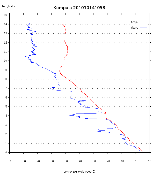
Sample Browse Image
-
View documentation related to this datasetHTML
Radiosonde: The dataset documentation
-
View documentation related to this datasetPDF
Automatic Sounding Station Vaisala AUTOSONDE AS41
-
View documentation related to this datasetPDF
Vaisala MARWIN Sounding System MW32
-
View information related to this datasetHTML
LPVEx Field Campaign Collection DOI
-
View documentation related to this datasetPDF
The guide document contains detailed information about the dataset
-
View this dataset's publicationsHTML
WRF–SBM Simulations of Melting-Layer Structure in Mixed-Phase Precipitation...
-
View this dataset's publicationsPDF
Light Precipitation Validation Experiment (LPVEx) Science Plan
-
View this dataset's publicationsHTML
The NASA CloudSat/GPM Light Precipitation Validation Experiment (LPVEx)
-
The dataset's project home pageHTML
The home page for the project or program which sponsored the dataset
-
Get a related visualizationHTML
Browse images illustrate the nature and coverage of the data
-
View documentation related to this datasetHTML
Instructions for citing GHRC data
-
Landing PageLanding Page
Dates
| Metadata Created Date | December 1, 2022 |
|---|---|
| Metadata Updated Date | December 6, 2023 |
Metadata Source
- Data.json Data.json Metadata
Harvested from NASA Data.json
Graphic Preview
Additional Metadata
| Resource Type | Dataset |
|---|---|
| Metadata Created Date | December 1, 2022 |
| Metadata Updated Date | December 6, 2023 |
| Publisher | NASA/MSFC/GHRC |
| Maintainer | |
| Identifier | C1979814144-GHRC_DAAC |
| Data First Published | 2019-05-14 |
| Language | en-US |
| Data Last Modified | 2022-04-28 |
| Category | LPVEX, geospatial |
| Public Access Level | public |
| Bureau Code | 026:00 |
| Metadata Context | https://project-open-data.cio.gov/v1.1/schema/catalog.jsonld |
| Metadata Catalog ID | https://data.nasa.gov/data.json |
| Schema Version | https://project-open-data.cio.gov/v1.1/schema |
| Catalog Describedby | https://project-open-data.cio.gov/v1.1/schema/catalog.json |
| Citation | Moisseev, Dmitri N.2019. GPM Ground Validation Upper Air Radiosonde LPVEx indicate subset used. Dataset available online from the NASA Global Hydrometeorology Resource Center DAAC, Huntsville, Alabama, U.S.A. DOI: http://dx.doi.org/10.5067/GPMGV/LPVEX/RADIOSONDE/DATA101 |
| Graphic Preview Description | Browse images illustrate the nature and coverage of the data |
| Graphic Preview File | https://ghrc.nsstc.nasa.gov/pub/fieldCampaigns/gpmValidation/lpvex/radiosonde/browse/Kumpula/ |
| Harvest Object Id | 7322c7d7-b000-4f44-a19b-5f5669b6ef60 |
| Harvest Source Id | 58f92550-7a01-4f00-b1b2-8dc953bd598f |
| Harvest Source Title | NASA Data.json |
| Homepage URL | https://doi.org/10.5067/GPMGV/LPVEX/RADIOSONDE/DATA101 |
| Metadata Type | geospatial |
| Old Spatial | 24.877 58.8 26.96 61.01 |
| Program Code | 026:001 |
| Source Datajson Identifier | True |
| Source Hash | dc7c09b494e13e001af8638aada481287ae6199650f6ae540f42e3bb5ee16533 |
| Source Schema Version | 1.1 |
| Spatial | |
| Temporal | 2010-09-15T04:23:21Z/2011-01-28T12:30:04Z |
Didn't find what you're looking for? Suggest a dataset here.