GOES-R Series Level 1b EXIS X-Ray Sensor (XRS) Science-Quality Products
Access & Use Information
Downloads & Resources
-
EXIS XRS L1b science-quality daily files...
Files available for download. From the above URL, choose satellite (e.g.,...
-
GOES-R Space Weather Data Access Information PageHTML
Website for information on GOES-R space weather data
-
GOES-R EXIS XRS Level 1b Science-Quality Data ReadmePDF
Readme for GOES-R EXIS XRS Level 1b Science-Quality Data
-
NASA GCMD Keyword Community PageHTML
Overview of the NASA GCMD Keywords.
-
NASA GCMD Keyword Community PageHTML
Overview of the NASA GCMD Keywords.
-
NASA GCMD Keyword Community PageHTML
Overview of the NASA GCMD Keywords.
-
NASA GCMD Keyword Community PageHTML
Overview of the NASA GCMD Keywords.
-
NASA GCMD Keyword Community PageHTML
Overview of the NASA GCMD Keywords.
-
NASA GCMD Keyword Community PageHTML
Overview of the NASA GCMD Keywords.
-
NASA GCMD Keyword Community PageHTML
Overview of the NASA GCMD Keywords.
-
NASA GCMD Keyword Community PageHTML
Overview of the NASA GCMD Keywords.
-
GOES-R Series Product Definition and User Guide (PUG)PDF
GOES-R Series PUG, Vol. 3 (L1b Products)
-
GOES-R EXIS XRS L1b Science-Quality Data ReadMePDF
ReadMe for GOES-R EXIS XRS L1b Science-Quality Data
Dates
| Metadata Date | September 27, 2022 |
|---|---|
| Metadata Created Date | May 5, 2023 |
| Metadata Updated Date | May 5, 2023 |
| Reference Date(s) | July 18, 2018 (publication) |
| Frequency Of Update | daily |
Metadata Source
- ISO-19139 ISO-19139 Metadata
Harvested from NGDC STP Space Weather
Graphic Preview

Additional Metadata
| Resource Type | Dataset |
|---|---|
| Metadata Date | September 27, 2022 |
| Metadata Created Date | May 5, 2023 |
| Metadata Updated Date | May 5, 2023 |
| Reference Date(s) | July 18, 2018 (publication) |
| Responsible Party | NOAA National Centers for Environmental Information (Point of contact) |
| Contact Email | |
| Guid | gov.noaa.ncei.swx:exis-l1b-sfxr-sci-goesr |
| Access Constraints | Cite this dataset when used as a source: GOES-R EXIS XRS L1b Science-Quality Data. NOAA National Centers for Environmental Information., NCEI cannot assume liability for any damages caused by any errors or omissions in the data, nor as a result of the failure of the data to function on a particular system. NCEI makes no warranty, expressed or implied, nor does the fact of distribution constitute such a warranty. NCEI can only certify that the data it distributes are an authentic copy of the records that were accepted for inclusion in the NCEI archives. |
| Coupled Resource | |
| Frequency Of Update | daily |
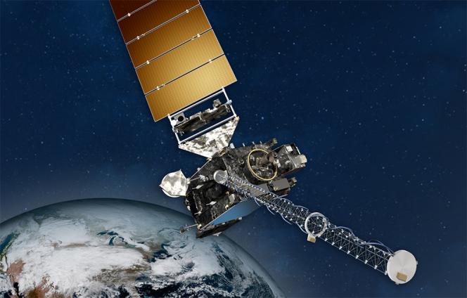
| Graphic Preview Description | NOAA GOES Spacecraft |
| Graphic Preview File | https://www.ncei.noaa.gov/pub/data/metadata/images/noaa_goesr_series_satellite_illustration.jpg |
| Graphic Preview Type | JPEG |
| Harvest Object Id | 54cd23c8-5994-415f-870f-2a350b0d4a1f |
| Harvest Source Id | 720e273e-9143-4e92-8a4c-fe2bf3aacd0b |
| Harvest Source Title | NGDC STP Space Weather |
| Licence | Users of the GOES-R XRS L1b Science-Quality data are responsible for inspecting the data and understanding the known caveats prior to use. Questions about this science quality data set can be sent to courtney.peck@noaa.gov or janet.machol@noaa.gov, while questions about data access should be sent to goesr.spaceweatherdata@noaa.gov. |
| Lineage | This dataset was produced by and is archived at the NOAA National Centers for Environmental Information (NCEI). |
| Metadata Language | eng; USA |
| Metadata Type | geospatial |
| Progress | planned |
| Spatial Data Service Type | |
| Spatial Reference System | |
| Spatial Harvester | True |
| Temporal Extent Begin | 2017-12-08 |
Didn't find what you're looking for? Suggest a dataset here.

