Geodetic Control Information on Passive Marks: Horizontal and Vertical Geodetic Control Data for the United States - National Geospatial Data Asset (NGDA) Geodetic Control Information on Passive Marks
Access & Use Information
Downloads & Resources
-
https://www.ngs.noaa.gov/datasheets/?Explain=Ar...
Downloadable Data | File Compression: Download options include PC Zip and...
-
http://www.ngs.noaa.gov/cgi-bin/ds_pid_sf.prl
Downloadable Data | File Compression: Download options include PC Zip and...
-
http://www.ngs.noaa.gov/cgi-bin/ds_cors_sf.prl
Downloadable Data | File Compression: Download options include PC Zip and...
-
http://www.ngs.noaa.gov/cgi-bin/ds_radius_sf.prl
Downloadable Data | File Compression: Download options include PC Zip and...
-
http://www.ngs.noaa.gov/cgi-bin/ds_mm_sf.prl
Downloadable Data | File Compression: Download options include PC Zip and...
-
http://www.ngs.noaa.gov/cgi-bin/ds_desig_sf.prl
Downloadable Data | File Compression: Download options include PC Zip and...
-
http://www.ngs.noaa.gov/cgi-bin/ds_proj_sf.prl
Downloadable Data | File Compression: Download options include PC Zip and...
-
http://www.ngs.noaa.gov/cgi-bin/ds_quads_sf.prl
Downloadable Data | File Compression: Download options include PC Zip and...
-
http://www.ngs.noaa.gov/cgi-bin/ds_county_sf.prl
Downloadable Data | File Compression: Download options include PC Zip and...
-
http://www.ngs.noaa.gov/cgi-bin/ds_dates_sf.prl
Downloadable Data | File Compression: Download options include PC Zip and...
-
Full Metadata Record
View the complete metadata record on InPort for more information about this...
-
Citation URL
Online Resource
-
GCMD Keyword Forum Page
24 views
Global Change Master Directory (GCMD). 2024. GCMD Keywords, Version 19....
-
NOAA Data Management Plan (DMP)PDF
NOAA Data Management Plan for this record on InPort.
Dates
| Metadata Date | February 29, 2024 |
|---|---|
| Metadata Created Date | October 31, 2024 |
| Metadata Updated Date | October 31, 2024 |
| Reference Date(s) | 1746 (creation), 2020 (revision), 2004 (publication) |
| Frequency Of Update | continual |
Metadata Source
- ISO-19139 ISO-19139 Metadata
Harvested from NOS NGS
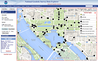
Graphic Preview

Additional Metadata
| Resource Type | Dataset |
|---|---|
| Metadata Date | February 29, 2024 |
| Metadata Created Date | October 31, 2024 |
| Metadata Updated Date | October 31, 2024 |
| Reference Date(s) | 1746 (creation), 2020 (revision), 2004 (publication) |
| Responsible Party | NGS Communications and Outreach Branch (Point of Contact, Custodian) |
| Contact Email | |
| Guid | gov.noaa.nmfs.inport:39738 |
| Access Constraints | Cite As: National Geodetic Survey, [Date of Access]: Geodetic Control Information on Passive Marks: Horizontal and Vertical Geodetic Control Data for the United States - National Geospatial Data Asset (NGDA) Geodetic Control Information on Passive Marks [Data Date Range], https://www.fisheries.noaa.gov/inport/item/39738., Access Constraints: Geodetic Data are in the public domain, not restricted from access or distribution., Use Constraints: Not restricted; Geodetic Data, including software were developed and compiled with U.S. Government funding; no proprietary rights may be attached to them nor may they be sold to the U.S. Government as part of any procurement of ADP products or services., Distribution Liability: The distributor does not assume liability |
| Bbox East Long | -60.953117 |
| Bbox North Lat | 71.386726 |
| Bbox South Lat | 5.330196 |
| Bbox West Long | -180 |
| Coupled Resource | |
| Frequency Of Update | continual |
| Graphic Preview File | https://www.ngs.noaa.gov/datasheets/images/NGSDE2.png |
| Harvest Object Id | ea504df8-5093-43fe-b3a6-0628710b515f |
| Harvest Source Id | ea6e63e6-96bb-4fb1-a72f-b7af08062c83 |
| Harvest Source Title | NOS NGS |
| Licence | NOAA provides no warranty, nor accepts any liability occurring from any incomplete, incorrect, or misleading data, or from any incorrect, incomplete, or misleading use of the data. It is the responsibility of the user to determine whether or not the data is suitable for the intended purpose. |
| Lineage | |
| Metadata Language | eng |
| Metadata Type | geospatial |
| Old Spatial | {"type": "Polygon", "coordinates": [[[-180.0, 5.330196], [-60.953117, 5.330196], [-60.953117, 71.386726], [-180.0, 71.386726], [-180.0, 5.330196]]]} |
| Progress | completed |
| Spatial Data Service Type | |
| Spatial Reference System | EPSG::4269 |
| Spatial Harvester | True |
Didn't find what you're looking for? Suggest a dataset here.

