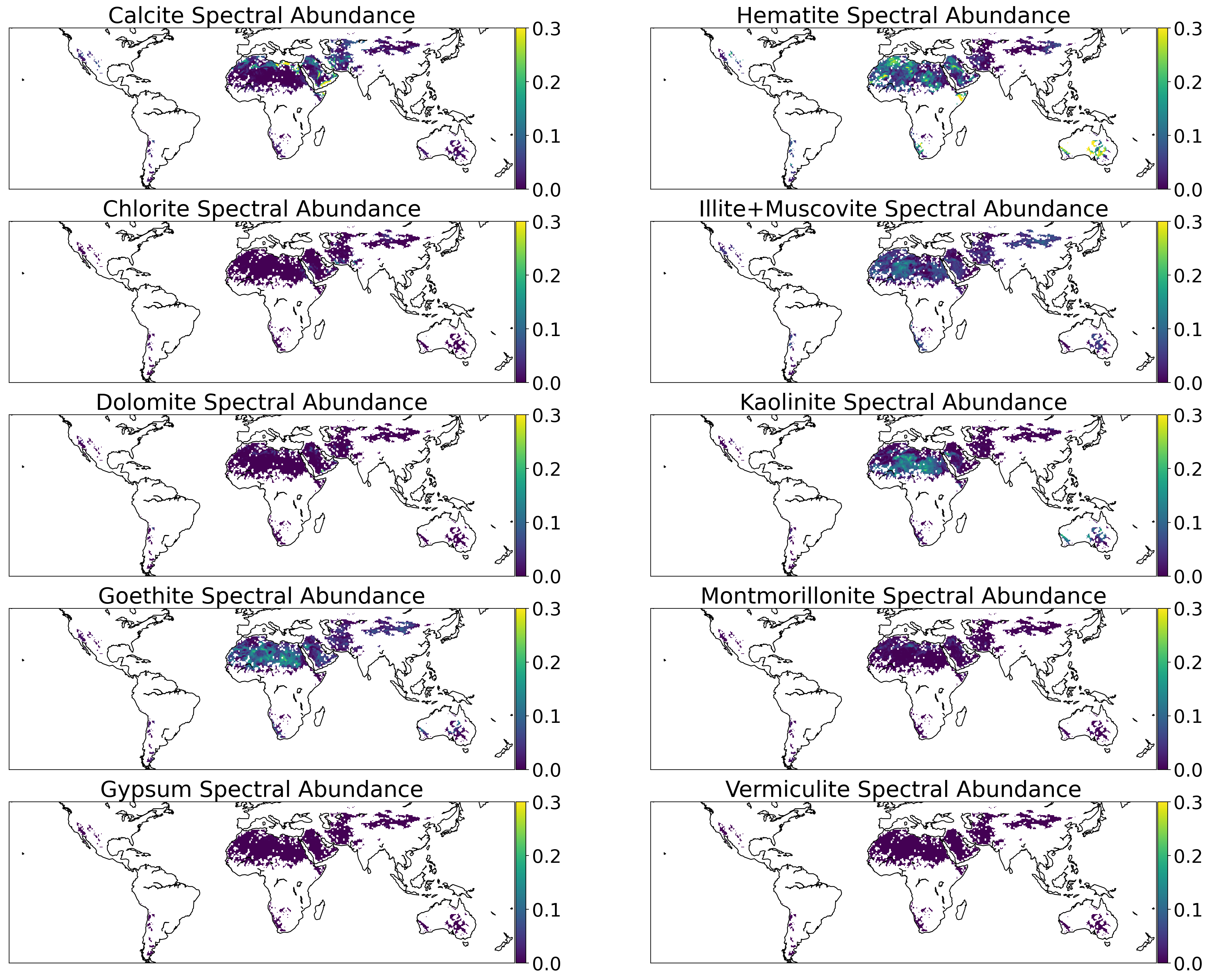
EMIT L3 Aggregated Mineral Spectral Abundance and Uncertainty 0.5 Deg V001
Access & Use Information
Downloads & Resources
-
Google Scholar search resultsHTML
Search results for publications that cite this dataset by its DOI.
-
The dataset's project home pageHTML
The EMIT website provides detailed information on the EMIT mission,...
-
The dataset's project home pageHTML
The LP DAAC website provides detailed information on discovery, distribution,...
-
This dataset's landing pageHTML
The LP DAAC product page provides information on Science Data Set layers and...
-
Download this dataset through Earthdata SearchHTML
Earthdata Search allows users to search, discover, visualize, refine, and...
-
View this dataset's algorithm theoretical...PDF
The Algorithm Theoretical Basis Document (ATBD) describes the physical and...
-
View this dataset's user's guidePDF
The technical information in the User's Guide enables users to interpret and...
-
View this dataset's science data product...HTML
EMIT Level 3 science data system repository.
-
Get a related visualizationPNG
Browse image for Earthdata Search.
-
View this dataset's how-to documentationHTML
The LP DAAC GitHub repository provides guides, Python notebooks, and scripts...
-
View this dataset's how-to documentationHTML
EMIT data E-Learning resources provided by NASA's LP DAAC.
-
Landing PageLanding Page
Dates
| Metadata Created Date | October 4, 2023 |
|---|---|
| Metadata Updated Date | September 16, 2024 |
Metadata Source
- Data.json Data.json Metadata
Harvested from NASA Data.json
Other Data Resources
- Geoplatform Metadata Information
Graphic Preview

Additional Metadata
| Resource Type | Dataset |
|---|---|
| Metadata Created Date | October 4, 2023 |
| Metadata Updated Date | September 16, 2024 |
| Publisher | LP DAAC |
| Maintainer | |
| Identifier | C2408752948-LPCLOUD |
| Data First Published | 2023-09-28 |
| Language | en-US |
| Data Last Modified | 2023-09-28 |
| Category | EMIT, geospatial |
| Public Access Level | public |
| Bureau Code | 026:00 |
| Metadata Context | https://project-open-data.cio.gov/v1.1/schema/catalog.jsonld |
| Metadata Catalog ID | https://data.nasa.gov/data.json |
| Schema Version | https://project-open-data.cio.gov/v1.1/schema |
| Catalog Describedby | https://project-open-data.cio.gov/v1.1/schema/catalog.json |
| Citation | Robert Green. 2023-09-28. EMITL3ASA.001. EMIT L3 Aggregated Mineral Spectral Abundance and Uncertainty 0.5 Deg V001. Archived by National Aeronautics and Space Administration, U.S. Government, NASA EOSDIS Land Processes Distributed Active Archive Center. https://doi.org/10.5067/EMIT/EMITL3ASA.001. https://doi.org/10.5067/EMIT/EMITL3ASA.001. The DOI landing page provides citations in APA and Chicago styles.. |
| Creator | Robert Green |
| Graphic Preview Description | Browse image for Earthdata Search. |
| Graphic Preview File | https://data.lpdaac.earthdatacloud.nasa.gov/lp-prod-public/EMITL3ASA.001/EMIT_L3_ASA_001/EMIT_L3_ASA_001.png |
| Harvest Object Id | 97120b22-187a-4b75-bb16-56812ee53df2 |
| Harvest Source Id | 58f92550-7a01-4f00-b1b2-8dc953bd598f |
| Harvest Source Title | NASA Data.json |
| Homepage URL | https://doi.org/10.5067/EMIT/EMITL3ASA.001 |
| Metadata Type | geospatial |
| Old Spatial | -165.0 -54.5 179.5 55.0 |
| Program Code | 026:001 |
| Series Name | EMITL3ASA.001 |
| Source Datajson Identifier | True |
| Source Hash | 74b860c612f8776269bc75ffb84e6e2ae44190af08f1d529757ab3ab5ad55f96 |
| Source Schema Version | 1.1 |
| Spatial | |
| Temporal | 2022-08-10T00:00:00Z/2023-07-30T23:59:59Z |
Didn't find what you're looking for? Suggest a dataset here.


