Earth System Research Laboratory Carbon Cycle and Greenhouse Gases Group Flask-Air Sample Measurements of CO2, CH4, CO, N2O, H2, and SF6 from the Aircraft Program, 1992-Present
Access & Use Information
Downloads & Resources
-
NCEI Dataset Landing Page
Landing page for the dataset.
-
ESRL/GMD CCGG Group Website
Project page with dataset information.
-
ESRL/GMD ObsPack Aircraft Direct Download Website
Direct download for dataset files.
-
NOAA National Centers for Environmental...
NCEI home page with information, data access and contact information.
-
Global Change Master Directory (GCMD) Keywords
The information provided on this page seeks to define how the GCMD Keywords...
-
GCOS Essential Climate Variables
Overview of the GCOS Essential Climate Variables.
-
Global Change Master Directory (GCMD) Keywords
The information provided on this page seeks to define how the GCMD Keywords...
-
Global Change Master Directory (GCMD) Keywords
The information provided on this page seeks to define how the GCMD Keywords...
-
Global Change Master Directory (GCMD) Keywords
The information provided on this page seeks to define how the GCMD Keywords...
-
Global Change Master Directory (GCMD) Keywords
The information provided on this page seeks to define how the GCMD Keywords...
-
Global Change Master Directory (GCMD) Keywords
The information provided on this page seeks to define how the GCMD Keywords...
-
Global Change Master Directory (GCMD) Keywords
The information provided on this page seeks to define how the GCMD Keywords...
-
Global Change Master Directory (GCMD) Keywords
The information provided on this page seeks to define how the GCMD Keywords...
-
ObsPack: a framework for the preparation,...PDF
PDF of ObsPack Paper
-
Seasonal climatology of CO2 across North...
PDF from Wiley Online Library
Dates
| Metadata Date | June 23, 2023 |
|---|---|
| Metadata Created Date | February 3, 2023 |
| Metadata Updated Date | September 19, 2023 |
| Reference Date(s) | 2017-10 (publication), November 9, 1992 (creation) |
| Frequency Of Update | annually |
Metadata Source
- ISO-19139 ISO-19139 Metadata
Harvested from ncdc
Graphic Preview

Additional Metadata
| Resource Type | Dataset |
|---|---|
| Metadata Date | June 23, 2023 |
| Metadata Created Date | February 3, 2023 |
| Metadata Updated Date | September 19, 2023 |
| Reference Date(s) | 2017-10 (publication), November 9, 1992 (creation) |
| Responsible Party | DOC/NOAA/ESRL/GMD > Global Monitoring Division, Earth System Research Laboratory, NOAA, U.S. Department of Commerce (Point of Contact); NOAA National Centers for Environmental Information (Point of Contact) |
| Contact Email | |
| Guid | gov.noaa.ncdc:C01544 |
| Access Constraints | Cite as: C. Sweeney, J. Higgs, S. Wolter, A. Crotwell, D. Neff, E. Dlugokencky, P. Lang, P. Novelli, J. Mund, E. Moglia, M. Crotwell, and NOAA ESRL (2017): Earth System Research Laboratory Carbon Cycle and Greenhouse Gases Group Flask-Air Sample Measurements of CO2, CH4, CO, N2O, H2, and SF6 from the Aircraft Program, 1992-Present, Version 1. [User indicate subset used]. NOAA National Centers for Environmental Information. DOI: 10.7289/V5N58JMF [User indicate access date]., The information contained herein is provided as a public service, with the understanding that the NOAA/ESRL Global Monitoring Divison makes no warranties, either expressed or implied, concerning the accuracy, completeness, reliability, or suitability of the information., Distribution liability: NOAA and NCEI make no warranty, expressed or implied, regarding these data, nor does the fact of distribution constitute such a warranty. NOAA and NCEI cannot assume liability for any damages caused by any errors or omissions in these data. If appropriate, NCEI can only certify that the data it distributes are an authentic copy of the records that were accepted for inclusion in the NCEI archives., Use liability: NOAA and NCEI cannot provide any warranty as to the accuracy, reliability, or completeness of furnished data. Users assume responsibility to determine the usability of these data. The user is responsible for the results of any application of this data for other than its intended purpose. |
| Bbox East Long | 180.0 |
| Bbox North Lat | 90.0 |
| Bbox South Lat | -90.0 |
| Bbox West Long | -180.0 |
| Coupled Resource | |
| Frequency Of Update | annually |
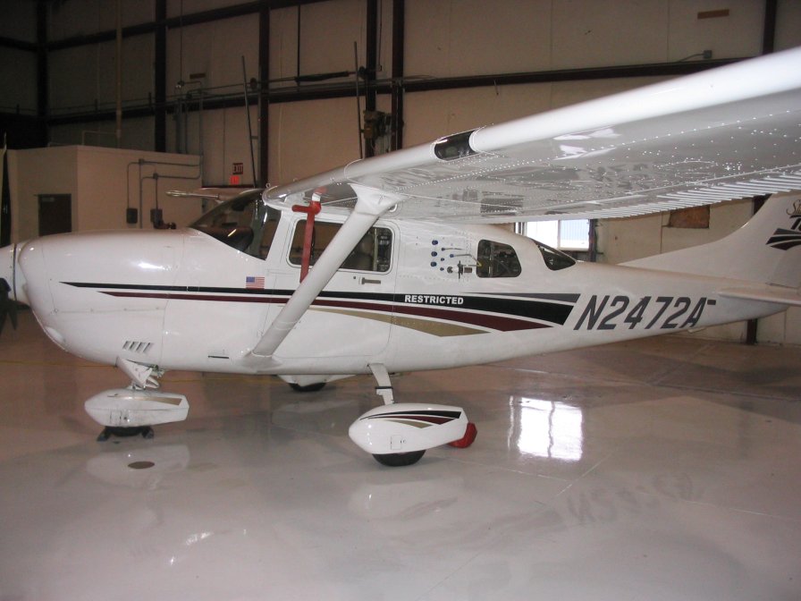
| Graphic Preview Description | Aircraft Program Airplane |
| Graphic Preview File | https://www.esrl.noaa.gov/gmd/ccgg/aircraft/images/AAO_plane.jpg |
| Graphic Preview Type | JPEG |
| Harvest Object Id | c3255678-716d-42d0-9c70-a7cffc777054 |
| Harvest Source Id | 2cb3ef77-1683-4c2a-9119-dc65e50917c6 |
| Harvest Source Title | ncdc |
| Licence | |
| Lineage | Raw data from the 12-pack flask sampling systems from the aircraft flights are sent back to NOAA/ESRL in Boulder, CO for analysis. The greenhouse gases are measured by the Measurement of Atmospheric Gases that Influence Climate Change (MAGICC) system on one of two nearly-identical automated analytical systems. Halocarbons and hydrocarbons are measured using a GC/mass spectrometric technique. A subset of 12-pack flasks is also analyzed for isotopes of CO2 at the University of Colorado INSTAAR Stable Isotope Lab. There are multiple levels of quality control for 12-pack flask samples taken at each aircraft site, but there are also multiple sources of errors that are assessed in the lab. Once data are analyzed the data are compiled into standard NetCDF files at ESRL/GMD and are archived at the NOAA National Centers for Environmental Information (NCEI). |
| Metadata Language | eng; USA |
| Metadata Type | geospatial |
| Old Spatial | {"type": "Polygon", "coordinates": [[[-180.0, -90.0], [180.0, -90.0], [180.0, 90.0], [-180.0, 90.0], [-180.0, -90.0]]]} |
| Progress | onGoing |
| Spatial Data Service Type | |
| Spatial Reference System | |
| Spatial Harvester | True |
| Temporal Extent Begin | 1992-11-09 |
Didn't find what you're looking for? Suggest a dataset here.

