

Development Threat Index
Access & Use Information
Public: This dataset is intended for public access and use.
License: No license information was provided. If this work was prepared by an officer or employee of the United States government as part of that person's official duties it is considered a U.S. Government Work.
Downloads & Resources
-
Google Scholar search resultsHTML
Search results for publications that cite this dataset by its DOI.
-
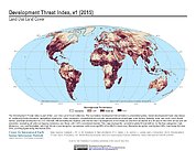
Get a related visualizationJPEG
Sample browse graphic of the data set.
-
Get a related map visualizationHTML
Maps Download Page
-
View documentation related to this datasetHTML
Data Set Overview Page
References
| https://doi.org/10.1371/journal.pone.0138334 |
Dates
| Metadata Created Date | November 12, 2020 |
|---|---|
| Metadata Updated Date | August 23, 2025 |
Metadata Source
- Data.json Data.json Metadata
Harvested from NASA Data.json
Additional Metadata
| Resource Type | Dataset |
|---|---|
| Metadata Created Date | November 12, 2020 |
| Metadata Updated Date | August 23, 2025 |
| Publisher | SEDAC |
| Maintainer | |
| Identifier | C1620075032-SEDAC |
| Data First Published | 2019-05-16 |
| Language | en-US |
| Data Last Modified | 2025-07-17 |
| Category | LULC, geospatial |
| Public Access Level | public |
| Bureau Code | 026:00 |
| Metadata Context | https://project-open-data.cio.gov/v1.1/schema/catalog.jsonld |
| Schema Version | https://project-open-data.cio.gov/v1.1/schema |
| Catalog Describedby | https://project-open-data.cio.gov/v1.1/schema/catalog.json |
| Harvest Object Id | 02839870-1b07-4da9-a697-4c6efb13fa1e |
| Harvest Source Id | 58f92550-7a01-4f00-b1b2-8dc953bd598f |
| Harvest Source Title | NASA Data.json |
| Metadata Type | geospatial |
| Old Spatial | -180.0 -65.25 180.0 90.0 |
| Program Code | 026:001 |
| Related Documents | https://doi.org/10.1371/journal.pone.0138334 |
| Source Datajson Identifier | True |
| Source Hash | b3fc507c9caa30de7c29e018e6b5fe5487d753f465ed78274d0ad792b59c5bcc |
| Source Schema Version | 1.1 |
| Spatial | |
| Temporal | 2015-01-01T00:00:00Z/2015-12-31T00:00:00Z |
Didn't find what you're looking for? Suggest a dataset here.