

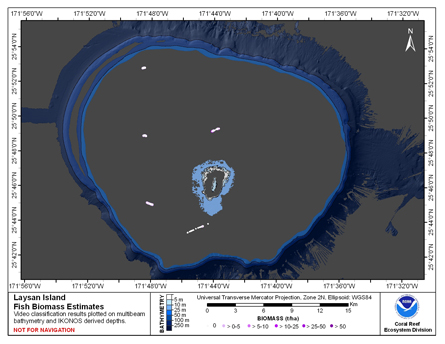
CRED Fish Biomass Estimates map at Laysan Island
Access & Use Information
License: No license information was provided. If this work was prepared by an officer or employee of the United States government as part of that person's official duties it is considered a U.S. Government Work.
Downloads & Resources
-
Web Resource
-
JPEG Image FileJPEG
LAY_TOAD_MF_445.jpg
Dates
| Metadata Date | December 15, 2024 |
|---|---|
| Metadata Created Date | October 19, 2024 |
| Metadata Updated Date | March 22, 2025 |
| Reference Date(s) | September 30, 2009 (publication) |
| Frequency Of Update | asNeeded |
Metadata Source
- ISO-19139 ISO-19139 Metadata
Harvested from CoRIS FGDC Metadata
Additional Metadata
| Resource Type | Dataset |
|---|---|
| Metadata Date | December 15, 2024 |
| Metadata Created Date | October 19, 2024 |
| Metadata Updated Date | March 22, 2025 |
| Reference Date(s) | September 30, 2009 (publication) |
| Responsible Party | Pacific Islands Benthic Habitat Mapping Center (PIBHMC), Coral Reef Ecosystem Division (CRED), Pacific Islands Fisheries Science Center (PIFSC), National Marine Fisheries Service (NMFS), National Oceanic and Atmospheric Administration (NOAA) (Point of Contact) |
| Contact Email | |
| Guid | lay_mf_map_met |
| Access Constraints | Use Constraints: Please acknowledge the NOAA Coral Reef Ecosystem Division, Pacific Islands Fisheries Science Center as the source of this information., Access Constraints: None |
| Bbox East Long | -171.72754 |
| Bbox North Lat | 25.8806 |
| Bbox South Lat | 25.81427 |
| Bbox West Long | -171.80946 |
| Coupled Resource | |
| Frequency Of Update | asNeeded |
| Harvest Object Id | 59f8e196-d8de-454e-b43d-fd93a3e0b5cb |
| Harvest Source Id | d96f14c5-3e35-4b0a-a3b8-9392afeb50fa |
| Harvest Source Title | CoRIS FGDC Metadata |
| Licence | These data are not to be used for navigational purposes. NOAA makes no warranty regarding these data, expressed or implied, nor does the fact of distribution constitute such a warranty. NOAA cannot assume liability for any damages caused by any errors or omissions in these data, nor as a result of the failure of these data to function on a particular system. |
| Lineage | |
| Metadata Language | eng; USA |
| Metadata Type | geospatial |
| Old Spatial | {"type": "Polygon", "coordinates": [[[-171.80946, 25.81427], [-171.72754, 25.81427], [-171.72754, 25.8806], [-171.80946, 25.8806], [-171.80946, 25.81427]]]} |
| Progress | completed |
| Spatial Data Service Type | |
| Spatial Reference System | |
| Spatial Harvester | True |
| Temporal Extent Begin | 2002-01-01 |
| Temporal Extent End | 2004-01-01 |
Didn't find what you're looking for? Suggest a dataset here.