

Community Geothermal: Soil Conductivity, Borehole Design, Energy Models, and Load Data for a Residential System Development - Hinesburg, VT
Access & Use Information
Downloads & Resources
-
Soil Conductivity Test Report - 12-29-2023.pdfPDF
This test report contains soil conductivity for the first borehole test in...
-
Soil Conductivity Test Report - 06-12-2024.pdfPDF
This test report contains soil conductivity for the second borehole test in...
-
Windy Ridge Phase 1 - Proposed Geothermal...idf
Energy modeling file of Phase 1 before sizing the Geothermal Loop
-
Windy Ridge Phase 1 - Baseline.idfidf
Energy modeling file of Phase 1 with baseline equipment.
-
Windy Ridge Phase 1 - Proposed Geothermal.idfidf
Energy modeling file of Phase 1 after sizing the Geothermal Loop
-
Windy Ridge Phase 2 Baseline.idfidf
Energy modeling file of Phase 2 with baseline equipment.
-
Windy Ridge Phase 2 Proposed Geothermal.idfidf
Energy modeling file of Phase 2 after sizing the Geothermal Loop
-
Topology of Project Site.dwgdwg
This is a .dwg file which defines the topology of the proposed site.
-
Proposed Project Plan.dwgdwg
This is a .dwg file of the proposed project plan.
-
Left Elevation.pdfPDF
This is a .pdf file showing the left elevation of the proposed project plan
-
Ground Floor Plan.pdfPDF
This is a .pdf file with the ground floor plan of the proposed project plan
-
Right Elevation.pdfPDF
This is a .pdf file showing the right elevation of the proposed project plan
-
Rear Elevation.pdfPDF
This is a .pdf file showing the rear elevation of the proposed project plan
-
First Floor Plan.pdfPDF
This is a .pdf file showing the first floor plan of the residential housing
-
Second Floor Plan.pdfPDF
This is a .pdf file showing the second floor plan of the residential housing
-
Single Family Housing Floor Plan.pdfPDF
This is a .pdf file showing the single family housing units
-
Front Elevation.pdfPDF
This is a .pdf file showing the front elevation of the proposed project plan
-
Sterling Homes Floor Plan.pdfPDF
This is a .pdf file showing the Sterling Homes
-
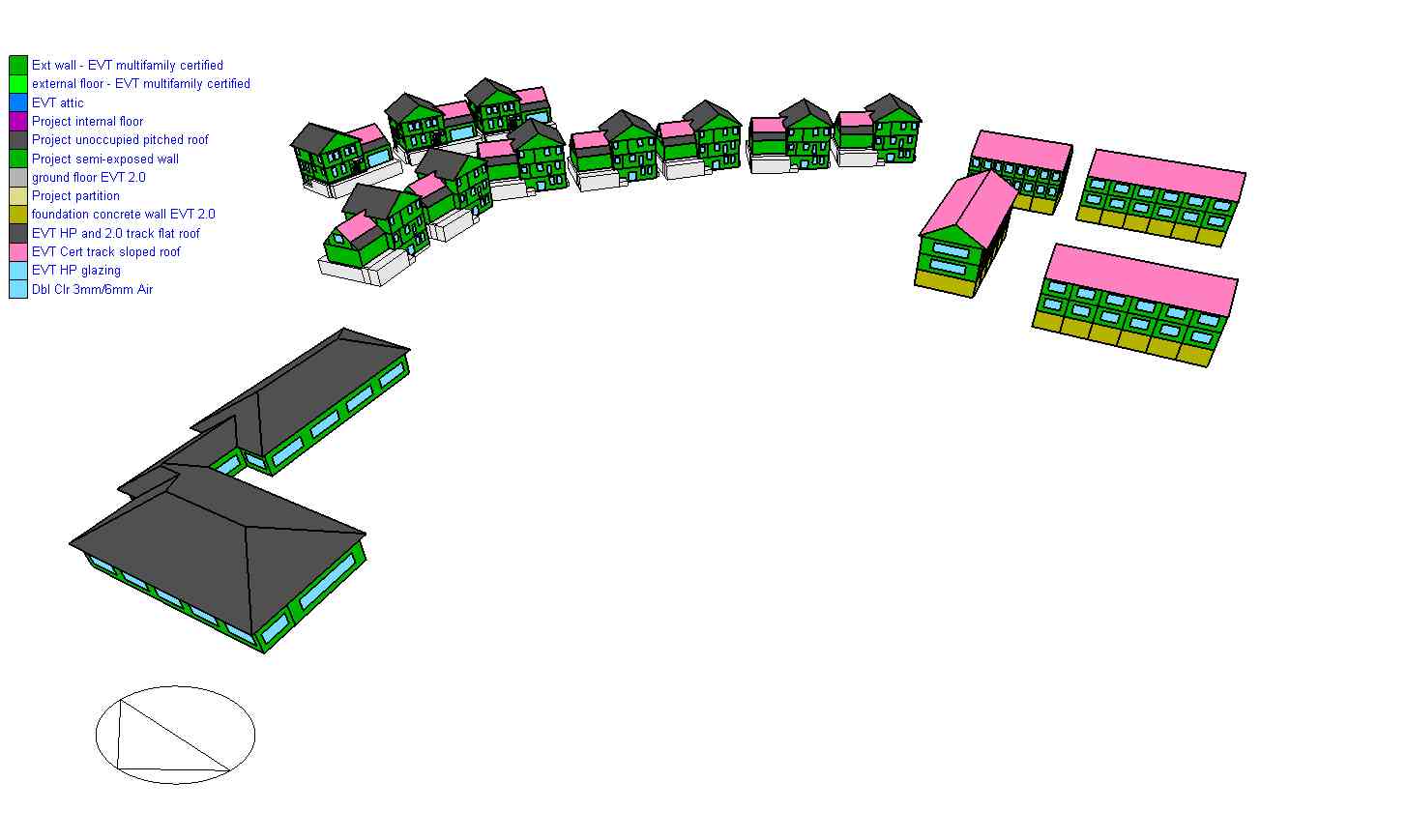
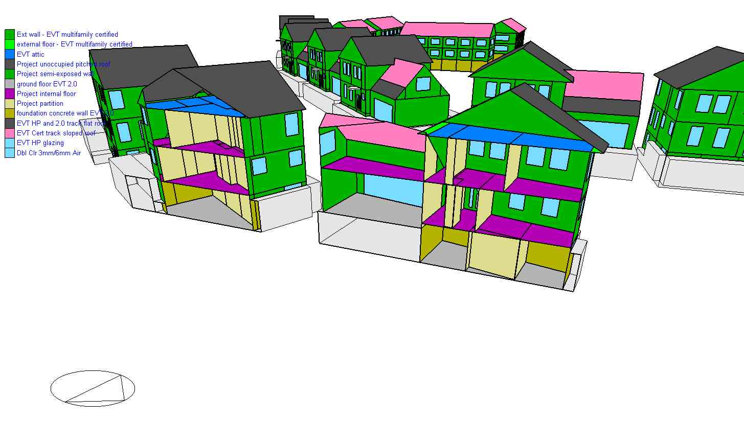
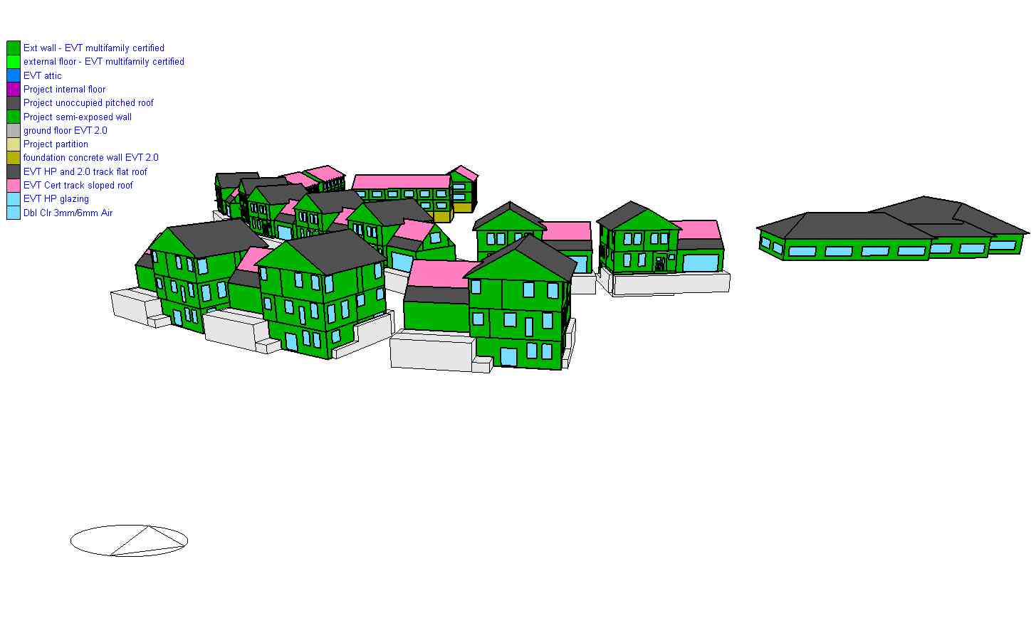
Axonometric View of the Proposed Project Plan.jpgJPEG
This is a rendering image from the design software showing the axonometric...
-
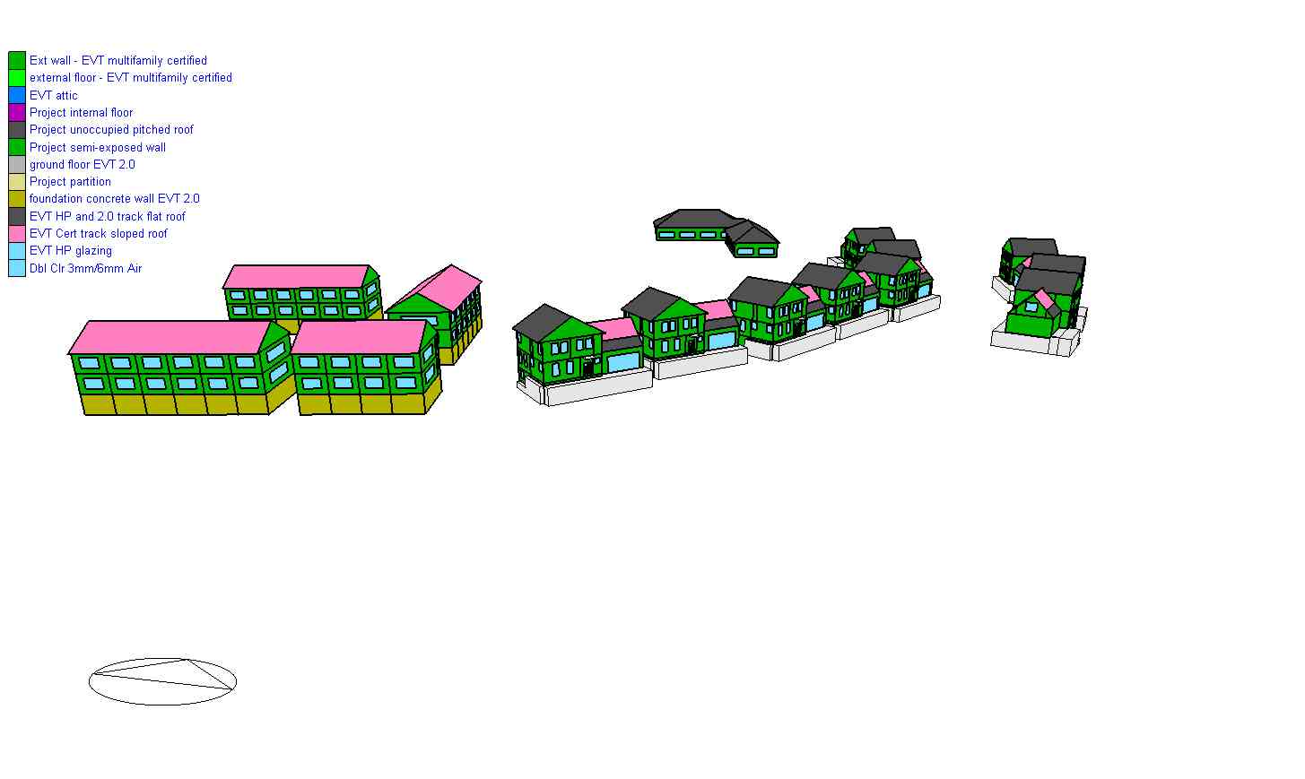
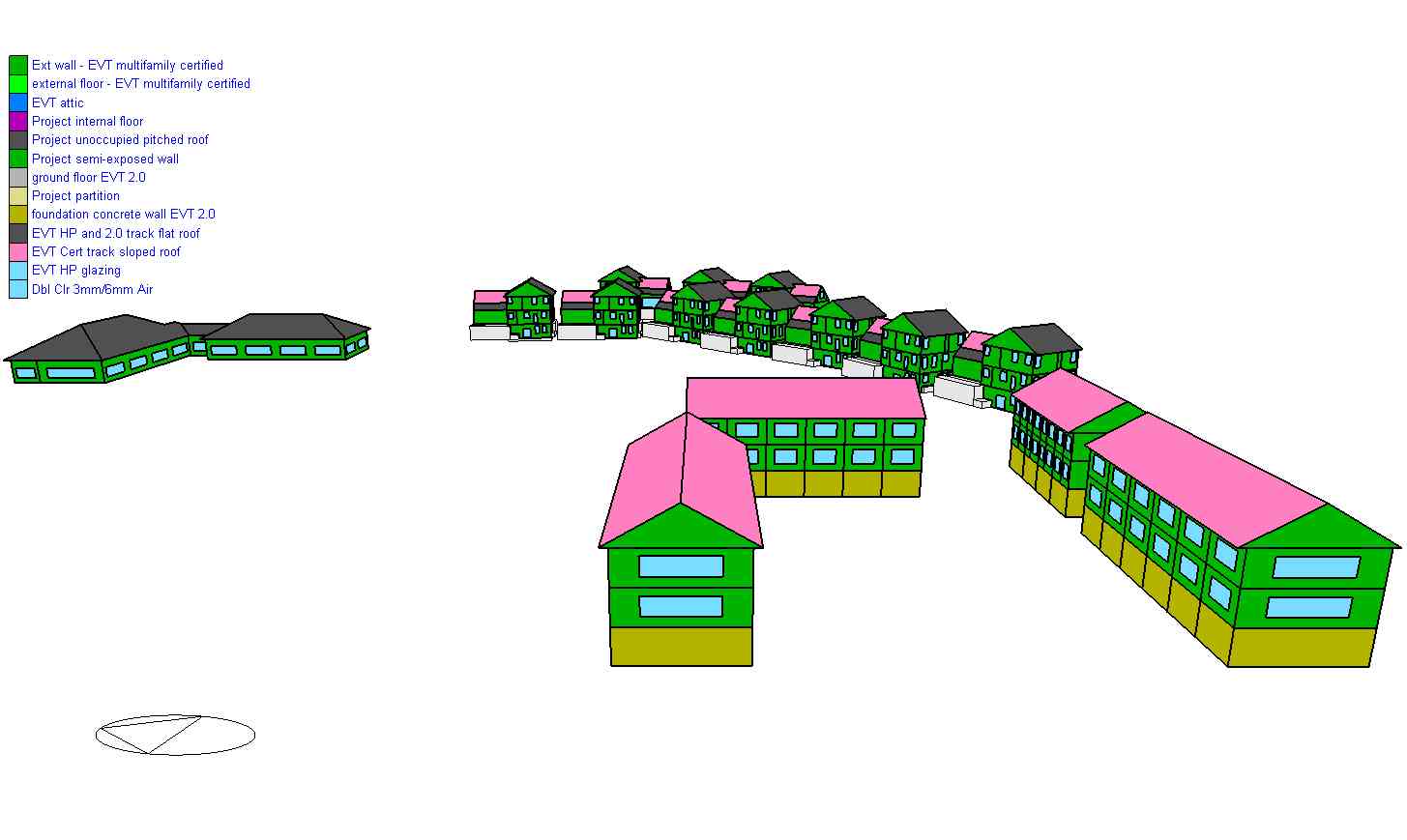
Right View of the Proposed Project Plan.jpgJPEG
This is a rendering image from the design software showing the right side...
-
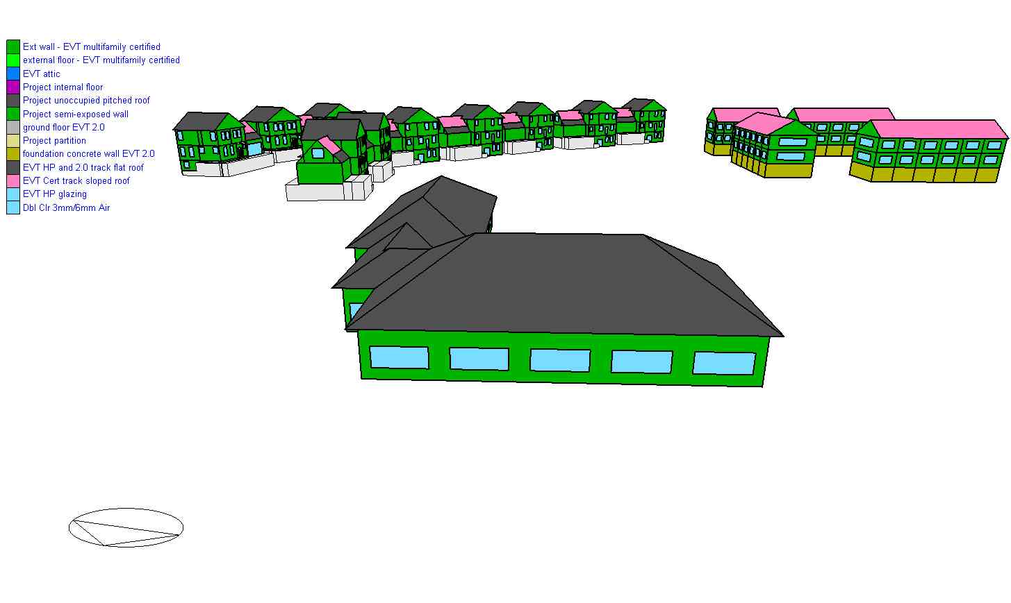
Top View of the Proposed Project Plan.jpgJPEG
This is a rendering image from the design software showing the top view of...
-
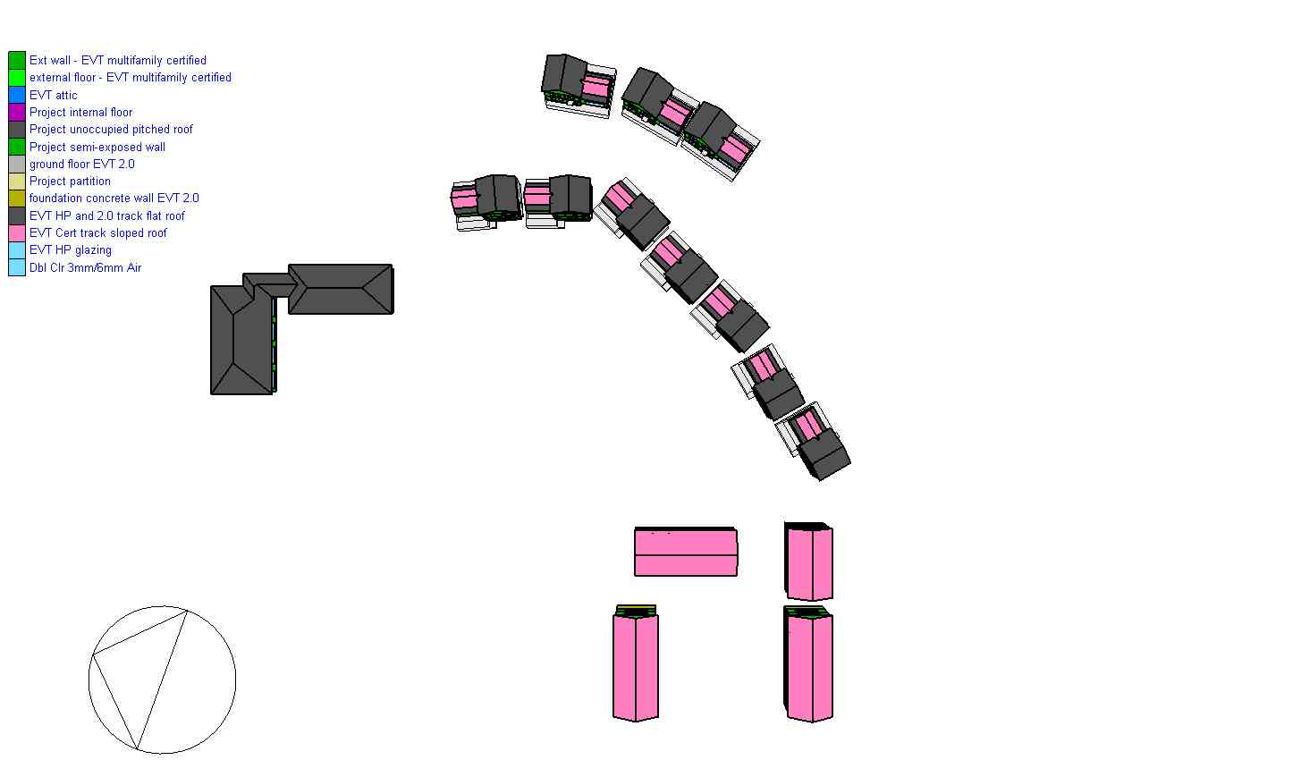
Isometric View of the Sterling Homes.jpgJPEG
This is a rendering image from the design software showing the isometric view...
-
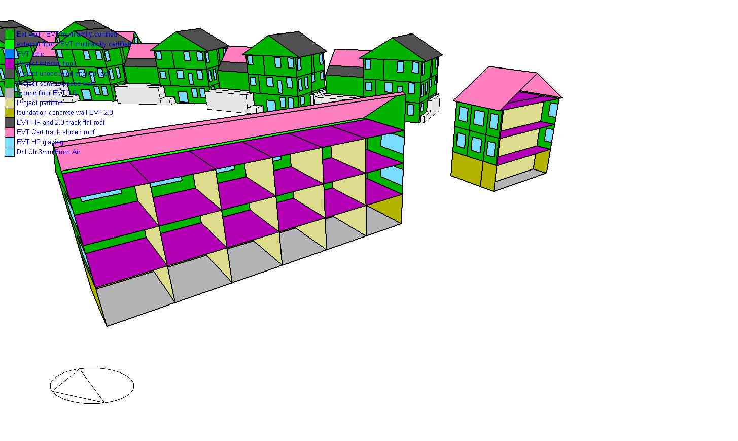
Back View of the Proposed Project Plan.jpgJPEG
This is a rendering image from the design software showing the back side view...
-
Left View of the Proposed Project Plan.jpgJPEG
This is a rendering image from the design software showing the left side view...
-
Front View of the Proposed Project Plan.jpgJPEG
This is a rendering image from the design software showing the front side...
-
Isometric View of the North Meadow Homes.jpgJPEG
This is a rendering image from the design software showing the isometric view...
-
Borehole design report - 30 year monthly method.pdfPDF
This is a borehole design report projecting borehole specifications for a 30...
-
Borehole design report - 1 year hourly method.pdfPDF
This is a borehole design report projecting borehole specifications for a 1...
-
Borehole design report - 15 year hourly method.pdfPDF
This is a borehole design report projecting borehole specifications for a 15...
-
Borehole design report - Summary.pdfPDF
This is a summary of the borehole design process.
-
EnergyPlus Output - Phase 1 Proposed Geothermal.htmHTML
This is an EnergyPlus output defining the hourly loads of the proposed...
-
EnergyPlus Output - Phase 1 Baseline.htmHTML
This is an EnergyPlus output defining the hourly loads of the baseline design...
-
Hourly Space Conditioning Loads - Phase 1 - 6...CSV
This is an EnergyPlus output defining the hourly space conditioning loads of...
-
Hourly Space Conditioning Loads - Phase 1 -...CSV
This is an EnergyPlus output defining the hourly space conditioning loads of...
-
Hourly Space Conditioning Loads - Phase 1 -...CSV
This is an EnergyPlus output defining the hourly space conditioning loads of...
-
Hourly Space Conditioning Loads - Phase 1 -...CSV
This is an EnergyPlus output defining the hourly space conditioning loads of...
-
Hourly Space Conditioning Loads - Phase 1 - 1...CSV
This is an EnergyPlus output defining the hourly space conditioning loads of...
-
Hourly Space Conditioning Loads - Phase 1 - 8...CSV
This is an EnergyPlus output defining the hourly space conditioning loads of...
-
Hourly DHW Loads - Proposed Project.csvCSV
This is an EnergyPlus output defining the hourly DHW loads of the proposed...
-
EnergyPlus Output - Phase 2 Baseline - Gas and...HTML
This is an EnergyPlus output defining the hourly loads of the proposed...
-
EnergyPlus Output - Phase 2 - Proposed...HTML
This is an EnergyPlus output defining the hourly loads of the proposed...
-
EnergyPlus Output - Phase 2 - Proposed...HTML
This is an EnergyPlus output defining the hourly loads of the proposed...
-
EnergyPlus Output - Phase 2 - Baseline - 5...HTML
This is an EnergyPlus output defining the hourly loads of the proposed...
-
Hourly Space Conditioning Loads - Phase 2 -...CSV
This is an EnergyPlus output defining the hourly space conditioning loads of...
-
Hourly Space Conditioning Loads - Proposed...CSV
This is an EnergyPlus output defining the hourly space conditioning loads of...
-
Hourly Space Conditioning Loads - Proposed...CSV
This is an EnergyPlus output defining the hourly space conditioning loads of...
-
Hourly Space Conditioning Loads - Proposed...CSV
This is an EnergyPlus output defining the hourly space conditioning loads of...
-
EnergyPlus File - GHX Sizing - Phase 1.idfidf
This EnergyPlus file helps in simulating the proposed GHX sizing to meet the...
-
EnergyPlus File - GHX Sizing - Phase 2.idfidf
This EnergyPlus file helps in simulating the proposed GHX sizing to meet the...
-
Borehole Loads with and without DHW - Phase 1.xlsxEXCEL
This .csv file contains loads of the proposed borehole with and without DHW...
-
Borehole Temperatures with DHW - Phase 1.xlsxEXCEL
This .csv file contains inlet and outlet temperatures of the proposed...
-
Pipe Layout Combined Phase 1 and 2.xlsxEXCEL
This .csv file gives the proposed pipe layout for both phases of the current...
-
OnePipe Model - Phase 1.zipZIP
This compressed folder contains all the relevant files needed to view the...
-
GHX Network Design - Python Notebooks - Phase 1 2.zipZIP
This compressed folder contains all the necessary files that help in defining...
-
Borehole Temperatures with DHW Phase 2.xlsxEXCEL
This file contains inlet and outlet temperatures of the proposed borehole...
-
Borehole Loads for Phase 1 and Phase 2.xlsxEXCEL
This .csv file contains borehole loads of both the phases in the proposed...
-
Landing PageLanding Page
Dates
| Metadata Created Date | January 11, 2025 |
|---|---|
| Metadata Updated Date | January 20, 2025 |
Metadata Source
- Data.json Data.json Metadata
Harvested from OpenEI data.json
Additional Metadata
| Resource Type | Dataset |
|---|---|
| Metadata Created Date | January 11, 2025 |
| Metadata Updated Date | January 20, 2025 |
| Publisher | GTI Energy |
| Maintainer | |
| Doi | 10.15121/2447627 |
| Identifier | https://data.openei.org/submissions/7732 |
| Data First Published | 2024-08-30T06:00:00Z |
| Data Last Modified | 2024-09-24T22:50:30Z |
| Public Access Level | public |
| Bureau Code | 019:20 |
| Metadata Context | https://openei.org/data.json |
| Metadata Catalog ID | https://openei.org/data.json |
| Schema Version | https://project-open-data.cio.gov/v1.1/schema |
| Catalog Describedby | https://project-open-data.cio.gov/v1.1/schema/catalog.json |
| Data Quality | True |
| Datagov Dedupe Retained | 20250120171954 |
| Harvest Object Id | b529425e-6cc4-448c-982e-d32afaab1066 |
| Harvest Source Id | 7cbf9085-0290-4e9f-bec1-91653baeddfd |
| Harvest Source Title | OpenEI data.json |
| Homepage URL | https://gdr.openei.org/submissions/1667 |
| License | https://creativecommons.org/licenses/by/4.0/ |
| Old Spatial | {"type":"Polygon","coordinates":-73.1973679931641,44.47024150335885,-73.19615672321527,44.47024150335885,-73.19615672321527,44.47234105531944,-73.1973679931641,44.47234105531944,-73.1973679931641,44.47024150335885} |
| Program Code | 019:006 |
| Projectlead | Arlene Anderson |
| Projectnumber | EE0010669 |
| Projecttitle | Community Geothermal Heating and Cooling Design and Deployment |
| Source Datajson Identifier | True |
| Source Hash | f1ec8d3f2c1e71900484bc4e9eab000eb828e3b3195833ff467c7063955e1504 |
| Source Schema Version | 1.1 |
| Spatial | {"type":"Polygon","coordinates":-73.1973679931641,44.47024150335885,-73.19615672321527,44.47024150335885,-73.19615672321527,44.47234105531944,-73.1973679931641,44.47234105531944,-73.1973679931641,44.47024150335885} |
Didn't find what you're looking for? Suggest a dataset here.