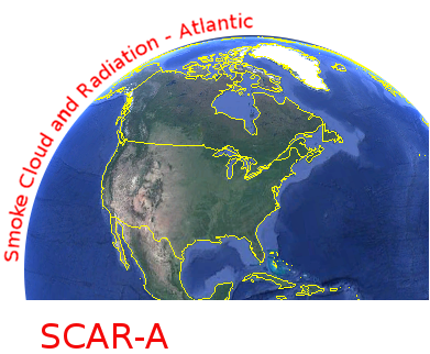
CAR SCAR-A Sulfates, Clouds, and Radiation-Atlantic L1 V1 (CAR_SCARA_L1C) at GES DISC
Access & Use Information
Downloads & Resources
-
Google Scholar search resultsHTML
Search results for publications that cite this dataset by its DOI.
-
Get a related visualizationPNG
CAR_SCAR_L1C_1.png
-
This dataset's landing pageHTML
Access the dataset landing page from the GES DISC website.
-
Download this dataset through a directory mapHTML
Access the data via HTTPS.
-
Use OPeNDAP to access the dataset's dataHTML
Access the data via the OPeNDAP protocol.
-
The dataset's project home pageHTML
CAR Project Home Page
-
View this dataset's read me documentPDF
README Document
-
Landing PageLanding Page
Dates
| Metadata Created Date | November 12, 2020 |
|---|---|
| Metadata Updated Date | December 7, 2023 |
Metadata Source
- Data.json Data.json Metadata
Harvested from NASA Data.json
Graphic Preview

Additional Metadata
| Resource Type | Dataset |
|---|---|
| Metadata Created Date | November 12, 2020 |
| Metadata Updated Date | December 7, 2023 |
| Publisher | NASA/GSFC/SED/ESD/GCDC/GESDISC |
| Maintainer | |
| Identifier | C1442068303-GES_DISC |
| Data First Published | 2017-11-29 |
| Language | en-US |
| Data Last Modified | 2017-11-29 |
| Category | CAR, geospatial |
| Public Access Level | public |
| Bureau Code | 026:00 |
| Metadata Context | https://project-open-data.cio.gov/v1.1/schema/catalog.jsonld |
| Metadata Catalog ID | https://data.nasa.gov/data.json |
| Schema Version | https://project-open-data.cio.gov/v1.1/schema |
| Catalog Describedby | https://project-open-data.cio.gov/v1.1/schema/catalog.json |
| Citation | Charles Gatebe; Michael King; Rajesh Poudyal. 2018-01-10. CAR_SCARA_L1C. Version 1. CAR SCAR-A Sulfates, Clouds, and Radiation-Atlantic L1 V1. Greenbelt, MD, USA. Archived by National Aeronautics and Space Administration, U.S. Government, Goddard Earth Sciences Data and Information Services Center (GES DISC). https://doi.org/10.5067/CAR/DATA112. https://disc.gsfc.nasa.gov/datacollection/CAR_SCARA_L1C_1.html. |
| Creator | Charles Gatebe; Michael King; Rajesh Poudyal |
| Graphic Preview File | https://docserver.gesdisc.eosdis.nasa.gov/public/project/Images/CAR_SCAR_L1C_1.png |
| Harvest Object Id | 5c5ab9ce-e506-4683-a502-1a4d7213c81c |
| Harvest Source Id | 58f92550-7a01-4f00-b1b2-8dc953bd598f |
| Harvest Source Title | NASA Data.json |
| Homepage URL | https://doi.org/10.5067/CAR/DATA112 |
| Metadata Type | geospatial |
| Old Spatial | -77.1809 36.2555 -73.429 39.9294 |
| Program Code | 026:001 |
| Release Place | Greenbelt, MD, USA |
| Series Name | CAR_SCARA_L1C |
| Source Datajson Identifier | True |
| Source Hash | aa2741060111b818b314a7c1f96eefefc4edd249af03fa52a0450c8ec781bf71 |
| Source Schema Version | 1.1 |
| Spatial | |
| Temporal | 1993-07-12T00:00:00Z/1993-07-28T23:59:59.999Z |
Didn't find what you're looking for? Suggest a dataset here.

