AVIRIS-Classic: L2 Calibrated Reflectance, Facility Instrument Collection
Access & Use Information
Downloads & Resources
-
Google Scholar search resultsHTML
Search results for publications that cite this dataset by its DOI.
-
Download this datasetHTML
This link allows direct data access via Earthdata login
-
View documentation related to this datasetHTML
ORNL DAAC Data Set Documentation
-
This dataset's landing pageHTML
Data set Landing Page DOI URL
-
View documentation related to this datasetPDF
AVIRIS-Classic: L2 Calibrated Reflectance, Facility Instrument Collection:...
-
Get a related visualizationJPEG
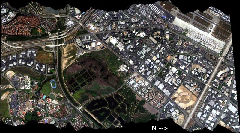
RGB composite image from AVIRIS-Classic flight f060510t01p00r06 on May 10...
-
Landing PageLanding Page
Dates
| Metadata Created Date | June 27, 2023 |
|---|---|
| Metadata Updated Date | December 6, 2023 |
Metadata Source
- Data.json Data.json Metadata
Harvested from NASA Data.json
Graphic Preview

Additional Metadata
| Resource Type | Dataset |
|---|---|
| Metadata Created Date | June 27, 2023 |
| Metadata Updated Date | December 6, 2023 |
| Publisher | ORNL_DAAC |
| Maintainer | |
| Identifier | C2711871294-ORNL_CLOUD |
| Data First Published | 2023-06-15 |
| Language | en-US |
| Data Last Modified | 2023-06-17 |
| Category | AVIRIS, geospatial |
| Public Access Level | public |
| Bureau Code | 026:00 |
| Metadata Context | https://project-open-data.cio.gov/v1.1/schema/catalog.jsonld |
| Metadata Catalog ID | https://data.nasa.gov/data.json |
| Schema Version | https://project-open-data.cio.gov/v1.1/schema |
| Catalog Describedby | https://project-open-data.cio.gov/v1.1/schema/catalog.json |
| Citation | Green, R.O., D.R. Thompson, J.W. Boardman, J.W. Chapman, M. Eastwood, M. Helmlinger, S.R. Lundeen, and W. Olson-Duvall. 2023. AVIRIS-Classic: L2 Calibrated Reflectance, Facility Instrument Collection. ORNL DAAC, Oak Ridge, Tennessee, USA. https://doi.org/10.3334/ORNLDAAC/2154 |
| Graphic Preview Description | RGB composite image from AVIRIS-Classic flight f060510t01p00r06 on May 10 2006 over Irvine, California. Source: f060510t01p00r06_sc01_RGB.jpeg. |
| Graphic Preview File | https://daac.ornl.gov/AVIRIS/guides/AVIRIS-Classic_L2_Reflectance_Fig1.jpg |
| Harvest Object Id | 281c8b8b-cc0e-4e95-8bae-d227ebaa5a2b |
| Harvest Source Id | 58f92550-7a01-4f00-b1b2-8dc953bd598f |
| Harvest Source Title | NASA Data.json |
| Homepage URL | https://doi.org/10.3334/ORNLDAAC/2154 |
| Metadata Type | geospatial |
| Old Spatial | -171.84 18.57 -81.02 48.69 |
| Program Code | 026:001 |
| Source Datajson Identifier | True |
| Source Hash | e3da3aa8171742af6273aa17dbb9fe0dadd35bafae18225ed3194d4f54910b4f |
| Source Schema Version | 1.1 |
| Spatial | |
| Temporal | 2008-06-11T21:38:00Z/2020-10-13T23:03:00Z |
Didn't find what you're looking for? Suggest a dataset here.

