ATom: GEOS-5 Derived Meteorological Conditions and Tagged Tracers Along Flight Tracks
Access & Use Information
Downloads & Resources
-
Google Scholar search resultsHTML
Search results for publications that cite this dataset by its DOI.
-
Download this datasetHTML
This link allows direct data access via Earthdata login
-
View documentation related to this datasetHTML
ORNL DAAC Data Set Documentation
-
This dataset's landing pageHTML
Data set Landing Page DOI URL
-
View documentation related to this datasetPDF
ATom: GEOS-5 Derived Meteorological Conditions and Tagged Tracers Along...
-
Get a related visualizationJPEG
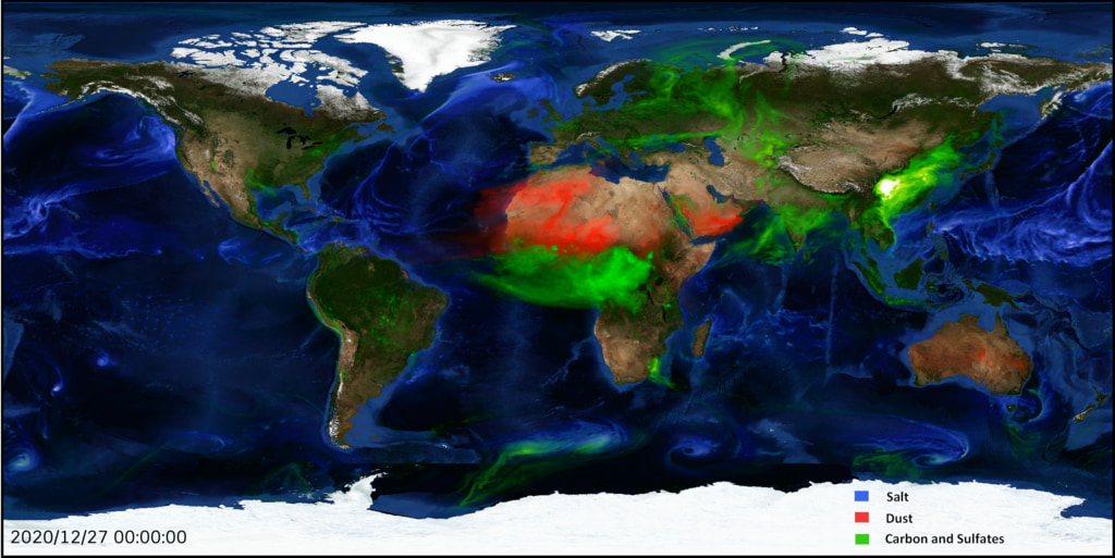
An example of aerosols modeled by GEOS-5. Source: NASA, 2020
-
The dataset's project home pageHTML
ATom campaign page
-
Landing PageLanding Page
Dates
| Metadata Created Date | May 30, 2023 |
|---|---|
| Metadata Updated Date | December 6, 2023 |
Metadata Source
- Data.json Data.json Metadata
Harvested from NASA Data.json
Graphic Preview

Additional Metadata
| Resource Type | Dataset |
|---|---|
| Metadata Created Date | May 30, 2023 |
| Metadata Updated Date | December 6, 2023 |
| Publisher | ORNL_DAAC |
| Maintainer | |
| Identifier | C2677009033-ORNL_CLOUD |
| Data First Published | 2022-01-03 |
| Language | en-US |
| Data Last Modified | 2023-06-12 |
| Category | ATom, geospatial |
| Public Access Level | public |
| Bureau Code | 026:00 |
| Metadata Context | https://project-open-data.cio.gov/v1.1/schema/catalog.jsonld |
| Metadata Catalog ID | https://data.nasa.gov/data.json |
| Schema Version | https://project-open-data.cio.gov/v1.1/schema |
| Catalog Describedby | https://project-open-data.cio.gov/v1.1/schema/catalog.json |
| Citation | Newman, P.A., and S. Pawson. 2021. ATom: GEOS-5 Derived Meteorological Conditions and Tagged Tracers Along Flight Tracks. ORNL DAAC, Oak Ridge, Tennessee, USA. https://doi.org/10.3334/ORNLDAAC/1876 |
| Graphic Preview Description | An example of aerosols modeled by GEOS-5. Source: NASA, 2020 |
| Graphic Preview File | https://daac.ornl.gov/ATOM/guides/Interpolated_Met_Products_Fig1.jpg |
| Harvest Object Id | a32d5c0b-1d6c-4e89-9f5e-d387f64e4402 |
| Harvest Source Id | 58f92550-7a01-4f00-b1b2-8dc953bd598f |
| Harvest Source Title | NASA Data.json |
| Homepage URL | https://doi.org/10.3334/ORNLDAAC/1876 |
| Metadata Type | geospatial |
| Old Spatial | -180.0 -90.0 180.0 90.0 |
| Program Code | 026:001 |
| Source Datajson Identifier | True |
| Source Hash | 540aee38b3ac5c0711bf149aed1abb3ecce80fb967a4ef6ffa1541068b25c8b0 |
| Source Schema Version | 1.1 |
| Spatial | |
| Temporal | 2016-07-29T00:00:00Z/2018-05-21T23:59:59Z |
Didn't find what you're looking for? Suggest a dataset here.

