

ASTER Orthorectified Digital Elevation Model (DEM) V003
Access & Use Information
Public: This dataset is intended for public access and use.
License: No license information was provided. If this work was prepared by an officer or employee of the United States government as part of that person's official duties it is considered a U.S. Government Work.
Downloads & Resources
-
Data Information (Unknown Format)BIN
-
Data Information (Unknown Format)BIN
-
Data Information (HTML)HTML
AST14DMO.003
-
Data Information (Unknown Format)BIN
-
Data Information (PDF)PDF
AST14_ATBD.pdf
-
Data Information (PDF)PDF
AST_L1_User_Guide_V3.pdf
-
Data Information (PDF)PDF
AST14_User_Guide_V3.pdf
-
Data Information (PDF)PDF
ASTER_Earthdata_Search_Order_Instructions.pdf
-
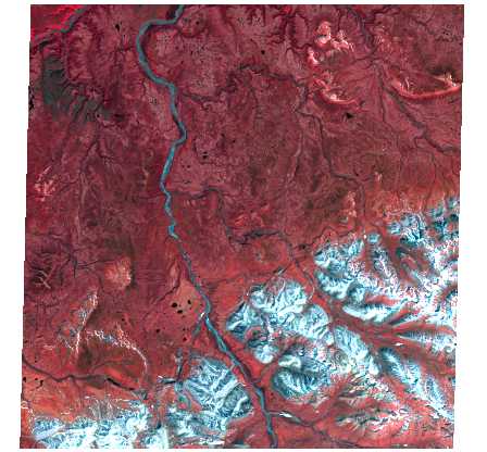
Data Information (JPEG)JPEG
pg-BR1A0000-2021061601_029_047.1.VNIR.jpg
-
Data Information (PDF)PDF
ASTER_User_Handbook_v3.pdf
-
Data Information (PDF)PDF
ASTER_SWIR_User_Advisory_Jan_12_2009.pdf
-
Landing PageLanding Page
Dates
| Metadata Created Date | April 11, 2025 |
|---|---|
| Metadata Updated Date | February 6, 2026 |
Metadata Source
- Data.json Data.json Metadata
Harvested from NASA Data.json
Additional Metadata
| Resource Type | Dataset |
|---|---|
| Metadata Created Date | April 11, 2025 |
| Metadata Updated Date | February 6, 2026 |
| Publisher | LP DAAC;JP/METI/AIST/JSS/GDS |
| Maintainer | |
| Identifier | 10.5067/ASTER/AST14DMO.003 |
| Data Last Modified | 2026-02-03 |
| Category | Earth Science |
| Public Access Level | public |
| Bureau Code | 026:00 |
| Metadata Context | https://project-open-data.cio.gov/v1.1/schema/catalog.jsonld |
| Schema Version | https://project-open-data.cio.gov/v1.1/schema |
| Catalog Describedby | https://project-open-data.cio.gov/v1.1/schema/catalog.json |
| Harvest Object Id | e231e130-f5f4-4313-abda-2d9afaee03ca |
| Harvest Source Id | 58f92550-7a01-4f00-b1b2-8dc953bd598f |
| Harvest Source Title | NASA Data.json |
| Homepage URL | https://www.earthdata.nasa.gov/centers/lp-daac |
| Old Spatial | {"NorthBoundingCoordinate":83,"WestBoundingCoordinate":-180,"EastBoundingCoordinate":180,"SouthBoundingCoordinate":-83},"CARTESIAN" |
| Program Code | 026:000 |
| Source Datajson Identifier | True |
| Source Hash | d75f8b77c17fdea4efa9feed2b64f4c931e7d84411fcfaf88d04386da8180c55 |
| Source Schema Version | 1.1 |
| Spatial | |
| Temporal | 2000-03-06/2000-03-06 |
Didn't find what you're looking for? Suggest a dataset here.