Annual Aboveground Biomass Maps for Forests in the Northwestern USA, 2000-2016
Access & Use Information
Downloads & Resources
-
Google Scholar search resultsHTML
Search results for publications that cite this dataset by its DOI.
-
Download this datasetHTML
This link allows direct data access via Earthdata login
-
View documentation related to this datasetHTML
ORNL DAAC Data Set Documentation
-
This dataset's landing pageHTML
Data set Landing Page DOI URL
-
View documentation related to this datasetPDF
CMS: Aboveground Forest Biomass Maps for Northwestern USA, 2000-2016:...
-
Get a related visualizationPNG
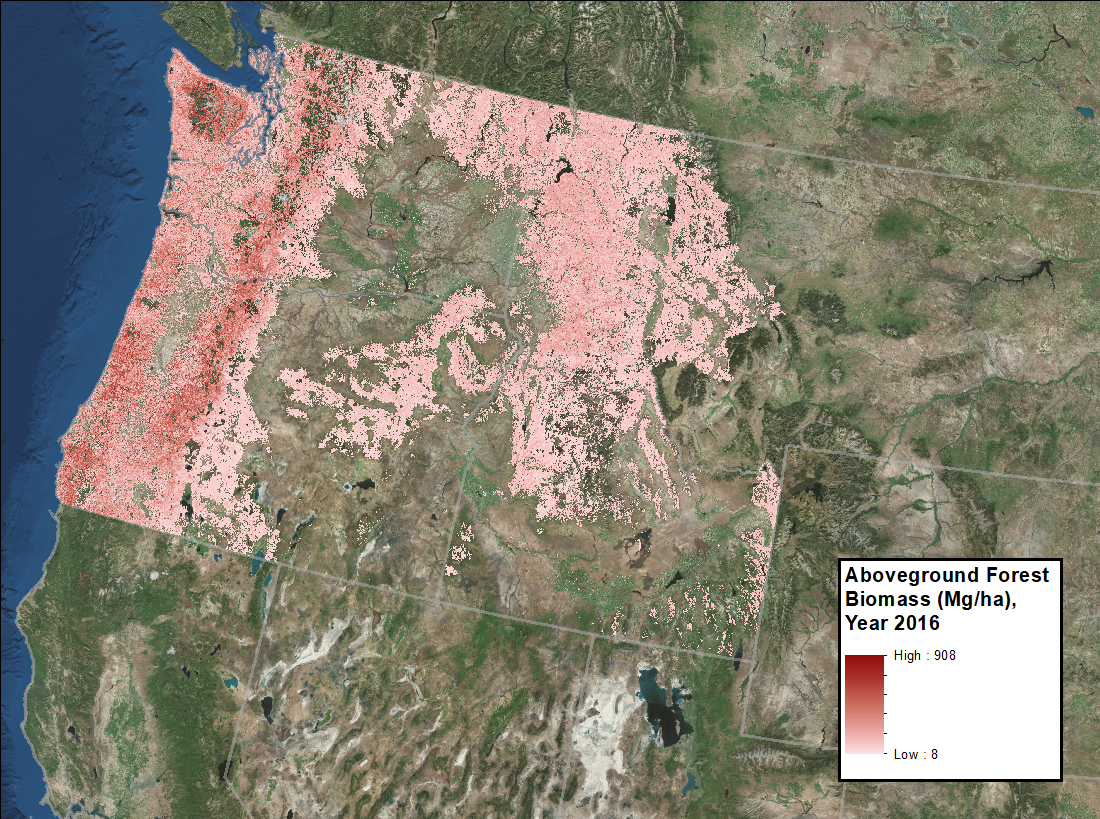
Forest aboveground biomass in megagrams per hectare for the year 2016....
-
Landing PageLanding Page
Dates
| Metadata Created Date | December 1, 2022 |
|---|---|
| Metadata Updated Date | December 3, 2024 |
Metadata Source
- Data.json Data.json Metadata
Harvested from NASA Data.json
Graphic Preview

Additional Metadata
| Resource Type | Dataset |
|---|---|
| Metadata Created Date | December 1, 2022 |
| Metadata Updated Date | December 3, 2024 |
| Publisher | ORNL_DAAC |
| Maintainer | |
| Identifier | C2398119727-ORNL_CLOUD |
| Data First Published | 2019-11-14 |
| Language | en-US |
| Data Last Modified | 2024-11-27 |
| Category | CMS, geospatial |
| Public Access Level | public |
| Bureau Code | 026:00 |
| Metadata Context | https://project-open-data.cio.gov/v1.1/schema/catalog.jsonld |
| Metadata Catalog ID | https://data.nasa.gov/data.json |
| Schema Version | https://project-open-data.cio.gov/v1.1/schema |
| Catalog Describedby | https://project-open-data.cio.gov/v1.1/schema/catalog.json |
| Citation | Fekety, P.A., and A.T. Hudak. 2019. Annual Aboveground Biomass Maps for Forests in the Northwestern USA, 2000-2016. ORNL DAAC, Oak Ridge, Tennessee, USA. https://doi.org/10.3334/ORNLDAAC/1719 |
| Graphic Preview Description | Forest aboveground biomass in megagrams per hectare for the year 2016. Source: AGB_Forest_NW_USA_2016.tif |
| Graphic Preview File | https://daac.ornl.gov/CMS/guides/CMS_AGB_NW_USA_Fig1.png |
| Harvest Object Id | f556e802-11f0-4072-9d88-baea62227548 |
| Harvest Source Id | 58f92550-7a01-4f00-b1b2-8dc953bd598f |
| Harvest Source Title | NASA Data.json |
| Homepage URL | https://doi.org/10.3334/ORNLDAAC/1719 |
| Metadata Type | geospatial |
| Old Spatial | -127.52 39.81 -110.31 50.79 |
| Program Code | 026:001 |
| Source Datajson Identifier | True |
| Source Hash | efef276dc1d28dcb7c316a32e5ed92f53cc04755785de9963bf2e209de26ae67 |
| Source Schema Version | 1.1 |
| Spatial | |
| Temporal | 2000-01-01T00:00:00Z/2016-12-31T23:59:59Z |
Didn't find what you're looking for? Suggest a dataset here.

