ABoVE: Alder Shrub Cover and Soil Properties, Alaska, 2019, V2
Access & Use Information
Downloads & Resources
-
Google Scholar search resultsHTML
Search results for publications that cite this dataset by its DOI.
-
Download this datasetHTML
This link allows direct data access via Earthdata login
-
View documentation related to this datasetHTML
ORNL DAAC Data Set Documentation
-
This dataset's landing pageHTML
Data set Landing Page DOI URL
-
View documentation related to this datasetPDF
ABoVE: Alder Shrub Cover and Soil Properties, Alaska, 2019, V2:...
-
Get a related visualizationJPEG
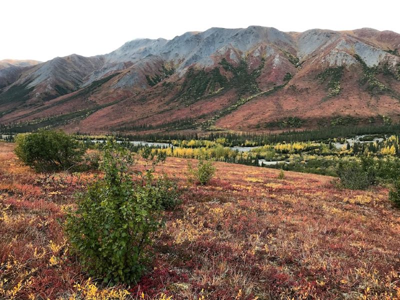
Alder shrubs expanding into graminoid tundra. Coldfoot Valley, Alaska. 2019.
-
The dataset's project home pageHTML
ABoVE project site
-
Landing PageLanding Page
Dates
| Metadata Created Date | January 22, 2024 |
|---|---|
| Metadata Updated Date | January 22, 2024 |
Metadata Source
- Data.json Data.json Metadata
Harvested from NASA Data.json
Graphic Preview

Additional Metadata
| Resource Type | Dataset |
|---|---|
| Metadata Created Date | January 22, 2024 |
| Metadata Updated Date | January 22, 2024 |
| Publisher | ORNL_DAAC |
| Maintainer | |
| Identifier | C2840822238-ORNL_CLOUD |
| Data First Published | 2024-01-18 |
| Language | en-US |
| Data Last Modified | 2024-01-22 |
| Category | ABoVE, geospatial |
| Public Access Level | public |
| Bureau Code | 026:00 |
| Metadata Context | https://project-open-data.cio.gov/v1.1/schema/catalog.jsonld |
| Metadata Catalog ID | https://data.nasa.gov/data.json |
| Schema Version | https://project-open-data.cio.gov/v1.1/schema |
| Catalog Describedby | https://project-open-data.cio.gov/v1.1/schema/catalog.json |
| Citation | Pedron, S., A. Welch, R.G. Jespersen, Xiaomei Xu, B. Martinez, Y. Khazindar, N. Fiore, M.L. Goulden, and C.I. Czimczik. 2023. ABoVE: Alder Shrub Cover and Soil Properties, Alaska, 2019, V2. ORNL DAAC, Oak Ridge, Tennessee, USA. https://doi.org/10.3334/ORNLDAAC/2300 |
| Graphic Preview Description | Alder shrubs expanding into graminoid tundra. Coldfoot Valley, Alaska. 2019. |
| Graphic Preview File | https://daac.ornl.gov/ABOVE/guides/Alder_Shrub_Soil_Alaska_V2_Fig1.jpg |
| Harvest Object Id | 86870a89-9033-4395-bd75-e1484df2d7e7 |
| Harvest Source Id | 58f92550-7a01-4f00-b1b2-8dc953bd598f |
| Harvest Source Title | NASA Data.json |
| Homepage URL | https://doi.org/10.3334/ORNLDAAC/2300 |
| Metadata Type | geospatial |
| Old Spatial | -150.71 66.34 -149.71 68.02 |
| Program Code | 026:001 |
| Source Datajson Identifier | True |
| Source Hash | 5c69d45efda73185ecf4f72698d0ced139cbf2cedb1db72c73e4e1d0220a2f43 |
| Source Schema Version | 1.1 |
| Spatial | |
| Temporal | 2018-08-14T00:00:00Z/2019-08-28T23:59:59Z |
Didn't find what you're looking for? Suggest a dataset here.

