

73 datasets found
-
Federal
SENTINEL-1A_OCN
National Aeronautics and Space Administration —
SENTINEL-1A Level 2 Ocean wind, wave and current data -
Federal
ERS-2_LEVEL1
National Aeronautics and Space Administration —
ERS-2 Standard Beam Data Level 1 -
Federal
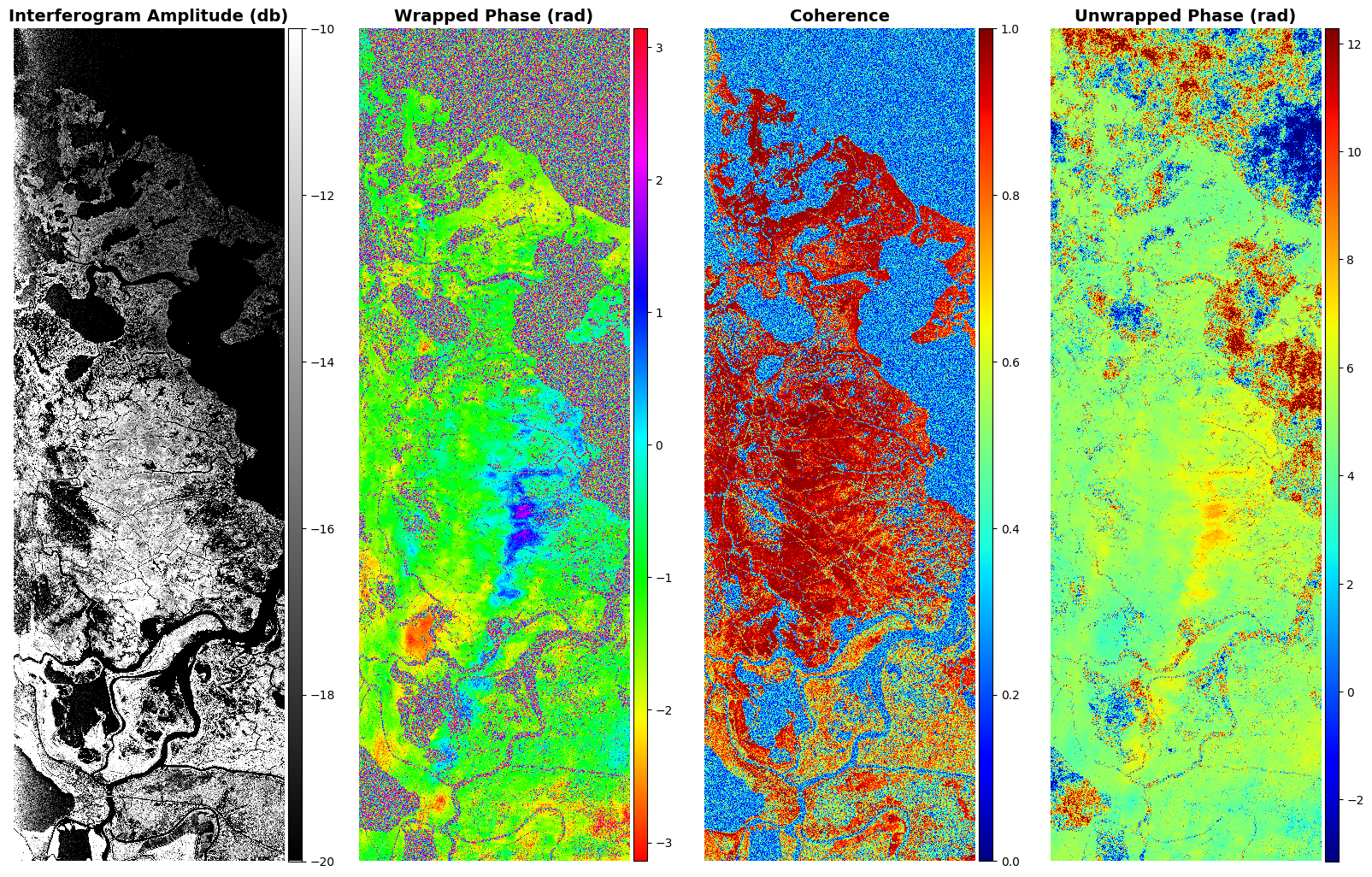
Delta-X: UAVSAR L1B Interferometric Products, MRD, Louisiana, 2021
National Aeronautics and Space Administration —
This dataset contains UAVSAR Level 1B (L1B) interferometric products for Delta-X flight lines acquired during the 2021 Spring (2021-03-27 to 2021-04-18) and Fall... -
Federal
Global Soil Profile Data (ISRIC-WISE)
National Aeronautics and Space Administration —
The ISRIC-WISE International soil profile data set consists of a homogenized, global set of 1,125 soil profiles for use by global modelers. These profiles provided... -
Federal
Space Acquired Photography
National Aeronautics and Space Administration —
Gemini photography was acquired between March 23, 1965 and November 15, 1966. The images were collected as part of the Synoptic Terrain Photography and the Synoptic... -
Federal
SENTINEL-1A_DUAL_POL_GRD_MEDIUM_RES
National Aeronautics and Space Administration —
Sentinel-1A Dual-pol ground projected medium resolution images -
Federal
SENTINEL-1A_DUAL_POL_GRD_HIGH_RES
National Aeronautics and Space Administration —
Sentinel-1A Dual-pol ground projected high and full resolution images -
Federal
SENTINEL-1A_SLC
National Aeronautics and Space Administration —
Sentinel-1A slant-range product -
Federal
MODIS/Terra Water Reservoir Monthly L3 Global V061 NGDA
National Aeronautics and Space Administration —
The Terra Moderate Resolution Imaging Spectroradiometer (MODIS) Water Reservoir Monthly Level 3 (L3) Global (MOD28C3) Version 6.1 product provides current data for... -
Federal
Global Land Cover Characterization Program
National Aeronautics and Space Administration —
The Global Land Cover Characterization Project was established to meet science data requirements identified by the International Geosphere and Biosphere Programme... -
Federal
ALOS_PALSAR_RTC_HIGH_RES
National Aeronautics and Space Administration —
PALSAR_Radiometric_Terrain_Corrected_high_res
73 datasets found