
-
Federal
H01130: NOS Hydrographic Survey , 1871-08-17
National Oceanic and Atmospheric Administration, Department of Commerce —
The National Oceanic and Atmospheric Administration (NOAA) has the statutory mandate to collect hydrographic data in support of nautical chart compilation for safe... -
Federal
H02211: NOS Hydrographic Survey , 1894-12-31
National Oceanic and Atmospheric Administration, Department of Commerce —
The National Oceanic and Atmospheric Administration (NOAA) has the statutory mandate to collect hydrographic data in support of nautical chart compilation for safe... -
Federal
H10555: NOS Hydrographic Survey , Port Angeles, Washington, 1994-11-21
National Oceanic and Atmospheric Administration, Department of Commerce —
The National Oceanic and Atmospheric Administration (NOAA) has the statutory mandate to collect hydrographic data in support of nautical chart compilation for safe... -
Federal
H11086: NOS Hydrographic Survey , Olympic Coast National Marine Sanctuary, Washington, 2001-10-24
National Oceanic and Atmospheric Administration, Department of Commerce —
The National Oceanic and Atmospheric Administration (NOAA) has the statutory mandate to collect hydrographic data in support of nautical chart compilation for safe... -
Federal
H10564: NOS Hydrographic Survey , Port Angeles, Washington, 1995-03-29
National Oceanic and Atmospheric Administration, Department of Commerce —
The National Oceanic and Atmospheric Administration (NOAA) has the statutory mandate to collect hydrographic data in support of nautical chart compilation for safe... -
Federal
Strait of Juan de Fuca 36 arc-second MHW Coastal Digital Elevation Model
National Oceanic and Atmospheric Administration, Department of Commerce —
The 36-second Strait of Juan de Fuca Washington Elevation Grid provides bathymetric data of 36-second resolution in geographic coordinates. This grid is strictly for... -
Federal
British Columbia 3 arc-second Bathymetric Digital Elevation Model
National Oceanic and Atmospheric Administration, Department of Commerce —
The 3 arc-second British Columbia DEM will be used to support NOAA's tsunami forecast system and for tsunami inundation modeling. This DEM covers the coastal area... -
Federal
H12625: NOS Hydrographic Survey , 2014-04-30
National Oceanic and Atmospheric Administration, Department of Commerce —
The National Oceanic and Atmospheric Administration (NOAA) has the statutory mandate to collect hydrographic data in support of nautical chart compilation for safe... -
Federal
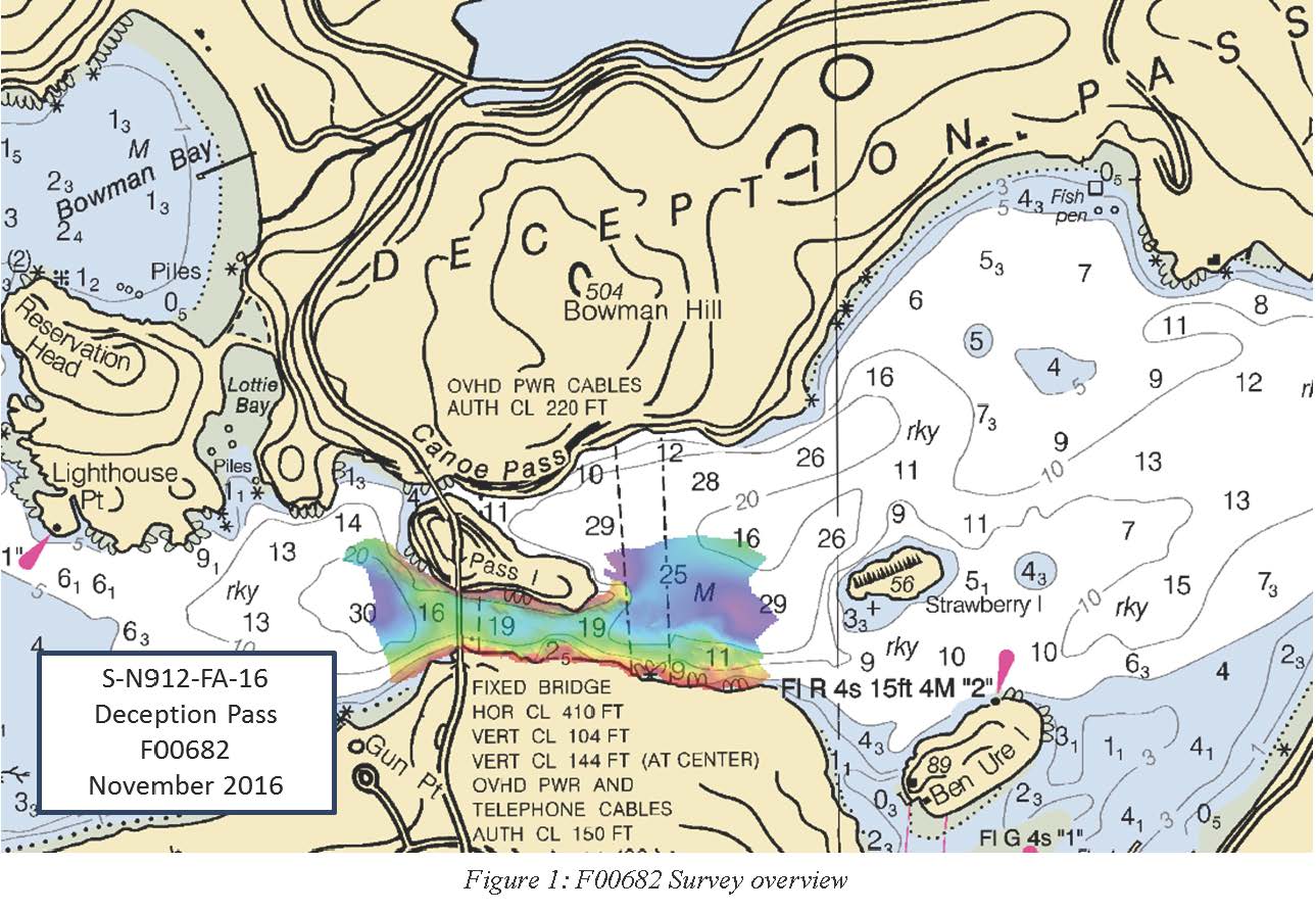
F00682: NOS Hydrographic Survey , 2016-11-21
National Oceanic and Atmospheric Administration, Department of Commerce —
The National Oceanic and Atmospheric Administration (NOAA) has the statutory mandate to collect hydrographic data in support of nautical chart compilation for safe... -
Federal
H12626: NOS Hydrographic Survey , 2014-11-15
National Oceanic and Atmospheric Administration, Department of Commerce —
The National Oceanic and Atmospheric Administration (NOAA) has the statutory mandate to collect hydrographic data in support of nautical chart compilation for safe... -
Federal
H12623: NOS Hydrographic Survey , 2014-11-16
National Oceanic and Atmospheric Administration, Department of Commerce —
The National Oceanic and Atmospheric Administration (NOAA) has the statutory mandate to collect hydrographic data in support of nautical chart compilation for safe... -
Federal
H04573: NOS Hydrographic Survey
National Oceanic and Atmospheric Administration, Department of Commerce —
The National Oceanic and Atmospheric Administration (NOAA) has the statutory mandate to collect hydrographic data in support of nautical chart compilation for safe... -
Federal
H10583: NOS Hydrographic Survey , Port Angeles, Washington, 1995-01-26
National Oceanic and Atmospheric Administration, Department of Commerce —
The National Oceanic and Atmospheric Administration (NOAA) has the statutory mandate to collect hydrographic data in support of nautical chart compilation for safe... -
Federal
Port Angeles, Washington Tsunami Forecast Grids for MOST Model
National Oceanic and Atmospheric Administration, Department of Commerce —
The Port Angeles, Washington Forecast Model Grids provides bathymetric data strictly for tsunami inundation modeling with the Method of Splitting Tsunami (MOST)... -
Federal
Strait of Juan de Fuca 1/3 arc-second NAVD 88 Coastal Digital Elevation Model
National Oceanic and Atmospheric Administration, Department of Commerce —
NOAA's National Centers for Environmental Information (NCEI) is building high-resolution digital elevation models (DEMs) for select U.S. coastal regions. These... -
Federal
British Columbia, Canada Tsunami Forecast Grids for MOST Model
National Oceanic and Atmospheric Administration, Department of Commerce —
The British Columbia, Canada Forecast Model Grids provides bathymetric data strictly for tsunami inundation modeling with the Method of Splitting Tsunami (MOST)... -
Federal
Neah Bay, Washington Tsunami Forecast Grids for MOST Model
National Oceanic and Atmospheric Administration, Department of Commerce —
The Neah Bay, Washington Forecast Model Grids provides bathymetric data strictly for tsunami inundation modeling with the Method of Splitting Tsunami (MOST) model.... -
Federal
Archival and Discovery of April 1, 1946 Tsunami Event on Marigrams
National Oceanic and Atmospheric Administration, Department of Commerce —
NOAA National Centers for Environmental Information have more than 3,000 tsunami marigram (tide gauge) records in both image and paper format. The majority of these... -
Federal
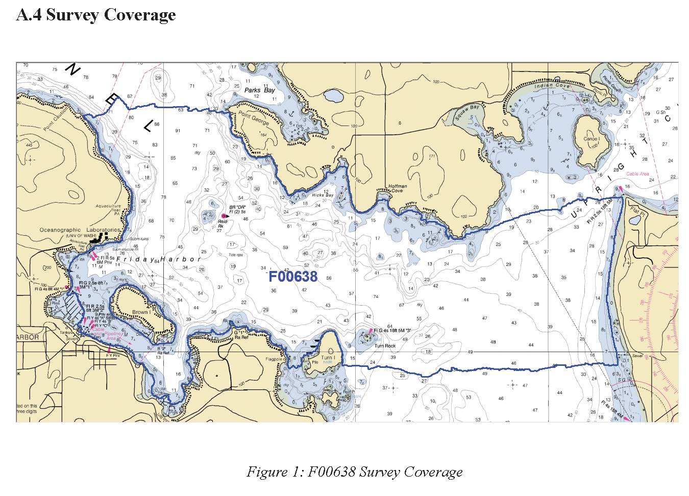
F00638: NOS Hydrographic Survey , 2014-04-21
National Oceanic and Atmospheric Administration, Department of Commerce —
The National Oceanic and Atmospheric Administration (NOAA) has the statutory mandate to collect hydrographic data in support of nautical chart compilation for safe...

Official websites use .gov
A
.gov website belongs to an official government
organization in the United States.
Secure .gov websites use HTTPS
A
lock (
) or https:// means you’ve safely connected to
the .gov website. Share sensitive information only on official,
secure websites.
.jpg)
.jpg)