
-
Federal
Landsat 8 35 recent views
National Aeronautics and Space Administration —
The Operational Land Imager (OLI) and Thermal Infrared Sensor (TIRS) are onboard the Landsat 8 satellite, have acquired images of the Earth since February 2013. The... -
Federal
SMEX04 Airborne Visible/Infrared Imaging Spectrometer (AVIRIS) Data: Arizona, Version 1
National Aeronautics and Space Administration —
Notice to Data Users: The documentation for this data set was provided solely by the Principal Investigator(s) and was not further developed, thoroughly reviewed, or... -
Federal
EO-1 Hyperion
National Aeronautics and Space Administration —
The Earth-Observing One (EO-1) satellite was decommissioned March 2017. The EO-1 satellite was launched on November 21, 2000 with the NASA's New Millennium Program... -
Federal
MASTER: HyspIRI Airborne Campaign, California, Spring 2015
National Aeronautics and Space Administration —
This dataset includes Level 1B (L1B) and Level 2 (L2) data products from the MODIS/ASTER Airborne Simulator (MASTER) instrument. The spectral data were collected as... -
Federal
CERES Single Scanner Footprint (SSF) TOA/Surface Fluxes, Clouds and Aerosols NPP-FM5 Edition2A
National Aeronautics and Space Administration —
CER_SSF_NPP-FM5_Edition2A data are CERES observed TOA fluxes, MODIS clouds and aerosols, and parameterized surface fluxes.The Single Scanner Footprint TOA/Surface... -
Federal
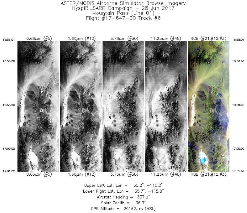
MASTER: HyspIRI Airborne Campaign, California, Summer 2017
National Aeronautics and Space Administration —
This dataset includes Level 1B (L1B) and Level 2 (L2) data products from the MODIS/ASTER Airborne Simulator (MASTER) instrument. The spectral data were collected as... -
Federal
CERES Clouds and Radiative Swath Terra FM1 MODIS Edition2G
National Aeronautics and Space Administration —
CER_CRS_Terra-FM1-MODIS_Edition2G is the Clouds and the Earth's Radiant Energy System (CERES) Clouds and Radiative Swath (CRS) Terra Flight Model 1 (FM1) Moderate-... -
Federal
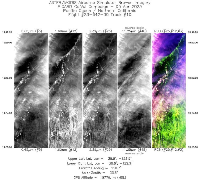
MASTER: Western Diversity Time Series Campaign, WDTS, Spring 2023
National Aeronautics and Space Administration —
This dataset includes Level 1B (L1B) and Level 2 (L2) data products from the MODIS/ASTER Airborne Simulator (MASTER) instrument. The spectral data were collected as... -
Federal
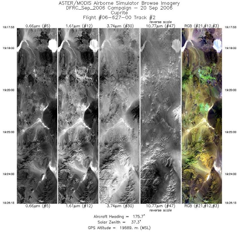
MASTER: Airborne Science, Western US, September, 2006
National Aeronautics and Space Administration —
This dataset includes Level 1B (L1B) and Level 2 (L2) data products from the MODIS/ASTER Airborne Simulator (MASTER) instrument. The spectral data were collected... -
Federal
MASTER: HyspIRI Airborne Campaign, California and Nevada, Summer 2016
National Aeronautics and Space Administration —
This dataset includes Level 1B (L1B) and Level 2 (L2) data products from the MODIS/ASTER Airborne Simulator (MASTER) instrument. The data were collected as part of... -
Federal
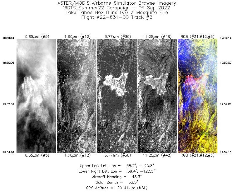
MASTER: Western Diversity Time Series Campaign, WDTS, September 2022
National Aeronautics and Space Administration —
This dataset includes Level 1B (L1B) and Level 2 (L2) data products from the MODIS/ASTER Airborne Simulator (MASTER) instrument. The spectral data were collected as... -
Federal
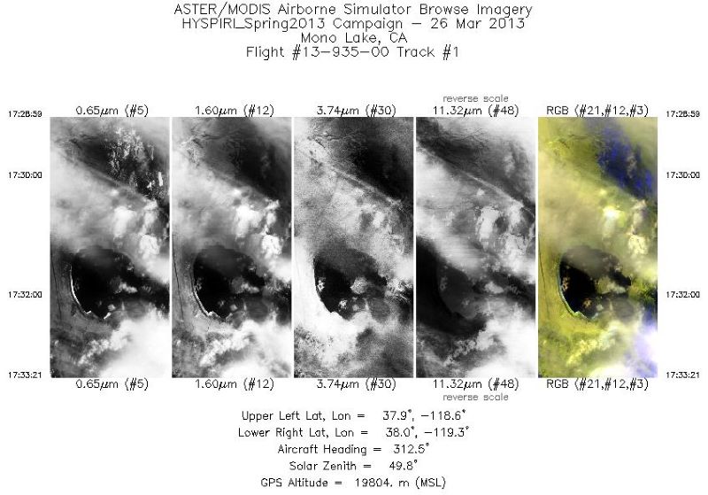
MASTER: HyspIRI Airborne Campaign, California, Early Spring 2013, V2
National Aeronautics and Space Administration —
This dataset includes Level 1B (L1B) and Level 2 (L2) data products from the MODIS/ASTER Airborne Simulator (MASTER) instrument. The spectral data were collected as... -
Federal
MASTER: BP Oil Spill Mapping, Louisiana-Gulf of Mexico-Wisconsin, Fall, 2010
National Aeronautics and Space Administration —
This dataset includes Level 1B (L1B) and Level 2 (L2) data products from the MODIS/ASTER Airborne Simulator (MASTER) instrument. The raw data were collected during 9... -
Federal
MASTER: Cloud And Land Surface Interaction Campaign, California-Oklahoma, 2007
National Aeronautics and Space Administration —
This dataset includes Level 1B (L1B) and Level 2 (L2) data products from the MODIS/ASTER Airborne Simulator (MASTER) instrument. The spectral data were collected... -
Federal
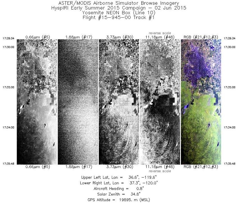
MASTER: HyspIRI Airborne Campaign, California, Summer 2015
National Aeronautics and Space Administration —
This dataset includes Level 1B (L1B) and Level 2 (L2) data products from the MODIS/ASTER Airborne Simulator (MASTER) instrument. The spectral data were collected as... -
Federal
Advanced Solid-state Array Spectroradiometer (ASAS)
National Aeronautics and Space Administration —
The Advanced Solid-state Array Spectroradiometer (ASAS) data collection contains data collected by the ASAS sensor flown aboard NASA aircraft. A fundamental use of... -
Federal
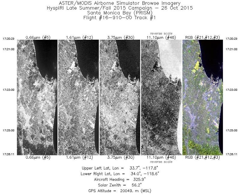
MASTER: HyspIRI Airborne Campaign, California, Fall 2015
National Aeronautics and Space Administration —
This dataset includes Level 1B (L1B) and Level 2 (L2) data products from the MODIS/ASTER Airborne Simulator (MASTER) instrument. The spectral data were collected as... -
Federal
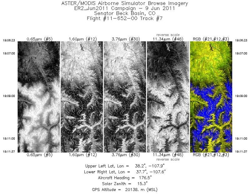
MASTER: Airborne Science, Southwest US, June, 2011
National Aeronautics and Space Administration —
This dataset includes Level 1B (L1B) and Level 2 (L2) data products from the MODIS/ASTER Airborne Simulator (MASTER) instrument. The spectral data were collected... -
Federal
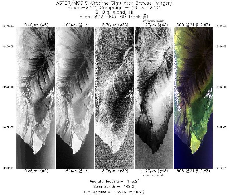
MASTER: Airborne Science, Hawaii-Pacific Ocean-western US, Fall, 2001, V2
National Aeronautics and Space Administration —
This dataset includes Level 1B (L1B) and Level 2 (L2) data products from the MODIS/ASTER Airborne Simulator (MASTER) instrument. The spectral data were collected...

Official websites use .gov
A
.gov website belongs to an official government
organization in the United States.
Secure .gov websites use HTTPS
A
lock (
) or https:// means you’ve safely connected to
the .gov website. Share sensitive information only on official,
secure websites.